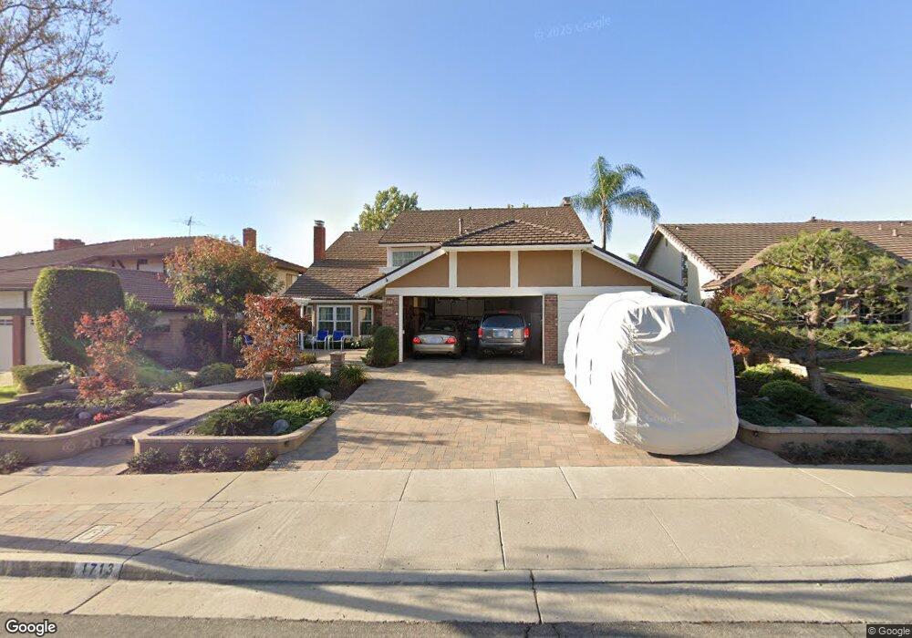
1713 Burning Tree Rd Fullerton, CA 92833
Sunny Hills NeighborhoodEstimated Value: $1,483,432 - $1,708,000
4
Beds
3
Baths
2,857
Sq Ft
$557/Sq Ft
Est. Value
About This Home
This home is located at 1713 Burning Tree Rd, Fullerton, CA 92833 and is currently estimated at $1,591,358, approximately $557 per square foot. 1713 Burning Tree Rd is a home located in Orange County with nearby schools including Sunset Lane Elementary School, D. Russell Parks Junior High School, and Sunny Hills High School.
Ownership History
Date
Name
Owned For
Owner Type
Purchase Details
Closed on
Apr 29, 2014
Sold by
Clavio Paul D and Clavio Rita T
Bought by
The Clavio Living Trust
Current Estimated Value
Home Financials for this Owner
Home Financials are based on the most recent Mortgage that was taken out on this home.
Original Mortgage
$240,000
Interest Rate
4.38%
Mortgage Type
New Conventional
Purchase Details
Closed on
Apr 15, 2003
Sold by
Clavio Paul D and Clavio Rita T
Bought by
Clavio Paul D and Clavio Rita T
Create a Home Valuation Report for This Property
The Home Valuation Report is an in-depth analysis detailing your home's value as well as a comparison with similar homes in the area
Home Values in the Area
Average Home Value in this Area
Purchase History
| Date | Buyer | Sale Price | Title Company |
|---|---|---|---|
| The Clavio Living Trust | -- | First American Title Company | |
| Clavio Paul D | -- | -- |
Source: Public Records
Mortgage History
| Date | Status | Borrower | Loan Amount |
|---|---|---|---|
| Closed | The Clavio Living Trust | $240,000 |
Source: Public Records
Tax History
| Year | Tax Paid | Tax Assessment Tax Assessment Total Assessment is a certain percentage of the fair market value that is determined by local assessors to be the total taxable value of land and additions on the property. | Land | Improvement |
|---|---|---|---|---|
| 2025 | $4,390 | $389,396 | $155,558 | $233,838 |
| 2024 | $4,390 | $381,761 | $152,508 | $229,253 |
| 2023 | $4,281 | $374,276 | $149,518 | $224,758 |
| 2022 | $4,249 | $366,938 | $146,587 | $220,351 |
| 2021 | $4,174 | $359,744 | $143,713 | $216,031 |
| 2020 | $4,150 | $356,056 | $142,240 | $213,816 |
| 2019 | $4,044 | $349,075 | $139,451 | $209,624 |
| 2018 | $3,982 | $342,231 | $136,717 | $205,514 |
| 2017 | $3,915 | $335,521 | $134,036 | $201,485 |
| 2016 | $3,834 | $328,943 | $131,408 | $197,535 |
| 2015 | $3,727 | $324,002 | $129,434 | $194,568 |
| 2014 | $3,620 | $317,656 | $126,899 | $190,757 |
Source: Public Records
Map
Nearby Homes
- 1715 Fairford Dr
- 1605 Avenida Selva Unit 217
- 1590 Avenida Selva
- 5471 Jonesboro Way
- 2505 Regency Cir
- 8641 Buena Tierra Place
- 4840 Sunnybrook Ave
- 2426 Plaza de Vista
- 921 Creekside Dr Unit 131
- 2523 Cypress Point Dr
- 2230 Andrews Dr Unit 239
- 926 Whitewater Dr Unit 96
- 1216 Mcfadden Dr
- 913 Whitewater Dr
- 904 Whitewater Dr Unit 6
- 804 Creekside Dr Unit 56
- 6 Tidewater Cove
- 2886 Muir Trail Dr
- 4935 Somerset St
- 0 Rosecrans Ave
- 1707 Burning Tree Rd
- 1719 Burning Tree Rd
- 1606 Clear Creek Dr
- 1701 Burning Tree Rd
- 1725 Burning Tree Rd
- 1612 Clear Creek Dr
- 1700 Redwillow Rd
- 1600 Clear Creek Dr
- 1701 Island Dr
- 1650 Clear Creek Dr
- 1656 Clear Creek Dr
- 1644 Clear Creek Dr
- 1706 Redwillow Rd
- 1701 Redwillow Rd
- 1662 Clear Creek Dr
- 1638 Clear Creek Dr
- 1709 Island Dr
- 1664 N Island Dr
- 1637 Island Dr
- 1712 Redwillow Rd
Your Personal Tour Guide
Ask me questions while you tour the home.