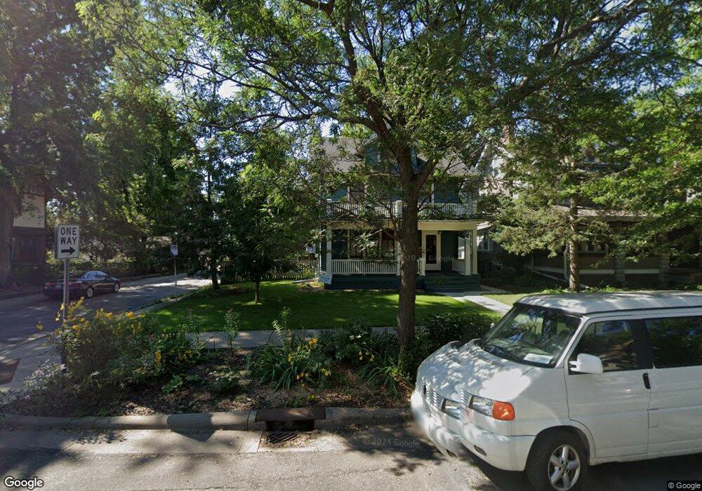
1728 Laurel Ave Saint Paul, MN 55104
Union Park NeighborhoodEstimated Value: $410,000 - $583,000
5
Beds
2
Baths
1,496
Sq Ft
$325/Sq Ft
Est. Value
About This Home
This home is located at 1728 Laurel Ave, Saint Paul, MN 55104 and is currently estimated at $485,503, approximately $324 per square foot. 1728 Laurel Ave is a home located in Ramsey County with nearby schools including Groveland Park Elementary School, Hidden River Middle School, and Central Senior High School.
Ownership History
Date
Name
Owned For
Owner Type
Purchase Details
Closed on
Jul 30, 2014
Sold by
Frederick Cecilia A
Bought by
Jordan Bennett M and Puryear Gillian
Current Estimated Value
Home Financials for this Owner
Home Financials are based on the most recent Mortgage that was taken out on this home.
Original Mortgage
$296,600
Outstanding Balance
$226,072
Interest Rate
4.1%
Mortgage Type
New Conventional
Estimated Equity
$259,431
Create a Home Valuation Report for This Property
The Home Valuation Report is an in-depth analysis detailing your home's value as well as a comparison with similar homes in the area
Home Values in the Area
Average Home Value in this Area
Purchase History
| Date | Buyer | Sale Price | Title Company |
|---|---|---|---|
| Jordan Bennett M | $308,075 | Titlesmart Inc |
Source: Public Records
Mortgage History
| Date | Status | Borrower | Loan Amount |
|---|---|---|---|
| Open | Jordan Bennett M | $296,600 |
Source: Public Records
Tax History Compared to Growth
Tax History
| Year | Tax Paid | Tax Assessment Tax Assessment Total Assessment is a certain percentage of the fair market value that is determined by local assessors to be the total taxable value of land and additions on the property. | Land | Improvement |
|---|---|---|---|---|
| 2025 | $6,760 | $443,000 | $121,000 | $322,000 |
| 2023 | $6,760 | $424,700 | $121,000 | $303,700 |
| 2022 | $6,054 | $420,400 | $121,000 | $299,400 |
| 2021 | $5,882 | $359,900 | $121,000 | $238,900 |
| 2020 | $6,310 | $362,400 | $121,000 | $241,400 |
| 2019 | $5,726 | $361,400 | $121,000 | $240,400 |
| 2018 | $4,998 | $335,700 | $121,000 | $214,700 |
| 2017 | $5,046 | $291,600 | $121,000 | $170,600 |
| 2016 | $5,188 | $0 | $0 | $0 |
| 2015 | $5,000 | $291,600 | $121,000 | $170,600 |
| 2014 | $4,346 | $0 | $0 | $0 |
Source: Public Records
Map
Nearby Homes
- 1670 Ashland Ave
- 1821 Selby Ave
- 1671 Marshall Ave
- 1798 Marshall Ave
- 1836 Marshall Ave
- 266 Fry St
- 1796 Iglehart Ave
- 1540 Ashland Ave Unit 12
- 1510 Laurel Ave
- 1920 Laurel Ave
- 184 Saratoga St N
- 1787 Carroll Ave
- 1611 Carroll Ave
- 1917 Summit Ave Unit 2
- 142 Cambridge St
- 1826 Goodrich Ave
- 1447 Hague Ave
- 750 Summit Ave
- 1935 Iglehart Ave
- 382 Fry St
- 1732 Laurel Ave
- 1724 Laurel Ave
- 1736 Laurel Ave
- 1740 Laurel Ave
- 1720 Laurel Ave
- 1744 Laurel Ave
- 1716 Laurel Ave
- 1716 1716 Laurel Ave
- 1729 Ashland Ave
- 1733 Ashland Ave
- 1725 Ashland Ave
- 1737 Ashland Ave
- 1727 Laurel Ave
- 1727 Laurel Ave Unit lower
- 1731 Laurel Ave
- 1737 Laurel Ave
- 1746 Laurel Ave
- 1725 Laurel Ave
- 1712 Laurel Ave
- 1741 Ashland Ave