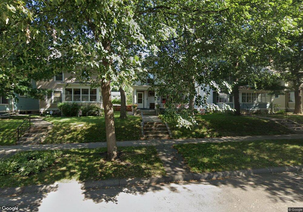
1779 Ashland Ave Saint Paul, MN 55104
Union Park NeighborhoodEstimated Value: $605,000 - $692,063
5
Beds
2
Baths
2,600
Sq Ft
$244/Sq Ft
Est. Value
About This Home
This home is located at 1779 Ashland Ave, Saint Paul, MN 55104 and is currently estimated at $635,016, approximately $244 per square foot. 1779 Ashland Ave is a home located in Ramsey County with nearby schools including Groveland Park Elementary School, Hidden River Middle School, and Central Senior High School.
Ownership History
Date
Name
Owned For
Owner Type
Purchase Details
Closed on
Oct 29, 2013
Sold by
Gaylord Robert G and Gaylor Kathryn B
Bought by
Poduska Gregory D and Matykowski Anna W
Current Estimated Value
Home Financials for this Owner
Home Financials are based on the most recent Mortgage that was taken out on this home.
Original Mortgage
$367,920
Outstanding Balance
$274,485
Interest Rate
4.24%
Mortgage Type
New Conventional
Estimated Equity
$360,531
Create a Home Valuation Report for This Property
The Home Valuation Report is an in-depth analysis detailing your home's value as well as a comparison with similar homes in the area
Home Values in the Area
Average Home Value in this Area
Purchase History
| Date | Buyer | Sale Price | Title Company |
|---|---|---|---|
| Poduska Gregory D | $473,836 | None Available |
Source: Public Records
Mortgage History
| Date | Status | Borrower | Loan Amount |
|---|---|---|---|
| Open | Poduska Gregory D | $367,920 |
Source: Public Records
Tax History Compared to Growth
Tax History
| Year | Tax Paid | Tax Assessment Tax Assessment Total Assessment is a certain percentage of the fair market value that is determined by local assessors to be the total taxable value of land and additions on the property. | Land | Improvement |
|---|---|---|---|---|
| 2025 | $10,118 | $638,600 | $105,600 | $533,000 |
| 2023 | $10,118 | $625,200 | $105,600 | $519,600 |
| 2022 | $8,020 | $562,900 | $105,600 | $457,300 |
| 2021 | $7,744 | $496,600 | $105,600 | $391,000 |
| 2020 | $8,084 | $497,400 | $105,600 | $391,800 |
| 2019 | $7,830 | $482,100 | $105,600 | $376,500 |
| 2018 | $7,590 | $460,900 | $105,600 | $355,300 |
| 2017 | $6,804 | $459,700 | $105,600 | $354,100 |
| 2016 | $7,026 | $0 | $0 | $0 |
| 2015 | $7,080 | $423,700 | $105,600 | $318,100 |
| 2014 | $5,294 | $0 | $0 | $0 |
Source: Public Records
Map
Nearby Homes
- 1821 Selby Ave
- 1670 Ashland Ave
- 1920 Laurel Ave
- 1798 Marshall Ave
- 1917 Summit Ave Unit 2
- 1836 Marshall Ave
- 1796 Iglehart Ave
- 1671 Marshall Ave
- 1826 Goodrich Ave
- 1926 Lincoln Ave
- 266 Fry St
- 1787 Carroll Ave
- 1540 Ashland Ave Unit 12
- 142 Cambridge St
- 1935 Iglehart Ave
- 2034 Ashland Ave
- 2009 Grand Ave
- 2023 Selby Ave
- 1510 Laurel Ave
- 1611 Carroll Ave
- 1773 Ashland Ave
- 1783 Ashland Ave
- 1769 Ashland Ave
- 1787 Ashland Ave
- 1765 Ashland Ave
- 1791 Ashland Ave
- 1793 Ashland Ave
- 1759 Ashland Ave
- 1778 Laurel Ave
- 1772 Laurel Ave
- 1782 Laurel Ave
- 1766 Laurel Ave
- 1784 Laurel Ave
- 1784 1784 Laurel Ave
- 1799 Ashland Ave
- 1764 Laurel Ave
- 1790 Laurel Ave
- 1776 1776 Ashland Ave
- 1776 Ashland Ave
- 1772 Ashland Ave