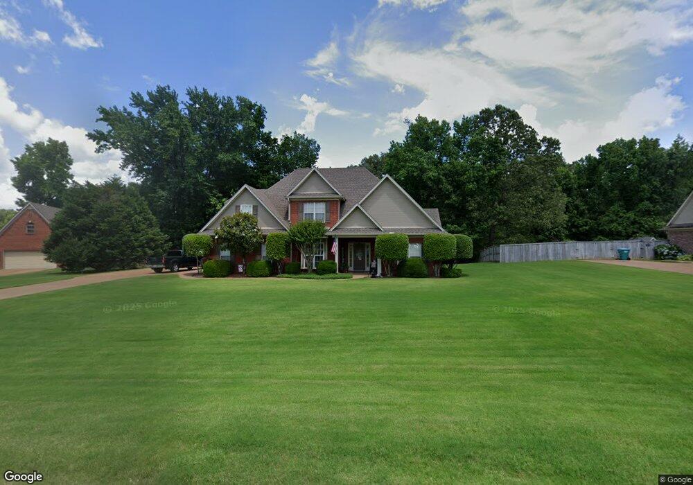
1850 Westwind Dr Nesbit, MS 38651
Pleasant Hill NeighborhoodEstimated Value: $335,000 - $388,000
5
Beds
3
Baths
2,150
Sq Ft
$168/Sq Ft
Est. Value
About This Home
This home is located at 1850 Westwind Dr, Nesbit, MS 38651 and is currently estimated at $361,128, approximately $167 per square foot. 1850 Westwind Dr is a home located in DeSoto County with nearby schools including DeSoto Central Primary School, DeSoto Central Elementary School, and DeSoto Central Middle School.
Ownership History
Date
Name
Owned For
Owner Type
Purchase Details
Closed on
Mar 1, 2014
Sold by
Carpenter John Lewis and Carpenter Tammy Lambert
Bought by
Carpenter John Lewis
Current Estimated Value
Create a Home Valuation Report for This Property
The Home Valuation Report is an in-depth analysis detailing your home's value as well as a comparison with similar homes in the area
Home Values in the Area
Average Home Value in this Area
Purchase History
| Date | Buyer | Sale Price | Title Company |
|---|---|---|---|
| Carpenter John Lewis | -- | None Available |
Source: Public Records
Tax History
| Year | Tax Paid | Tax Assessment Tax Assessment Total Assessment is a certain percentage of the fair market value that is determined by local assessors to be the total taxable value of land and additions on the property. | Land | Improvement |
|---|---|---|---|---|
| 2025 | $1,369 | $20,227 | $4,000 | $16,227 |
| 2024 | $1,226 | $15,262 | $4,000 | $11,262 |
| 2023 | $1,226 | $15,262 | $0 | $0 |
| 2022 | $1,226 | $15,262 | $4,000 | $11,262 |
| 2021 | $1,226 | $15,262 | $4,000 | $11,262 |
| 2020 | $1,134 | $14,340 | $4,000 | $10,340 |
| 2019 | $1,134 | $14,340 | $4,000 | $10,340 |
| 2017 | $1,111 | $24,024 | $14,012 | $10,012 |
| 2016 | $1,111 | $14,012 | $4,000 | $10,012 |
| 2015 | $1,411 | $24,024 | $14,012 | $10,012 |
| 2014 | $1,090 | $13,805 | $0 | $0 |
| 2013 | $1,178 | $13,805 | $0 | $0 |
Source: Public Records
Map
Nearby Homes
- 3456 Susie Cir
- 4055 Bakersfield Dr
- 1835 Baisley Dr
- 1811 Baisley Dr
- 1721 Baisley Dr
- Lot 99 Baisley Dr
- 1722 Baisley Dr
- Lot 107 Brooke Dr
- 4232 Brooke Dr
- 4209 Edison Dr
- 4276 Brooke Dr
- 4020 Maryan Ct
- 1755 Bakersfield Way
- 1735 Bakersfield Way
- 1762 Bakersfield Way
- 1694 Bakersfield Way
- 1789 Caribe Dr
- 1817 Caribe Dr
- 2147 Chancellor Cove
- 3770 Malone Rd
- 1824 Westwind Dr
- 3610 Westwind Dr
- 3645 Meadow Trace Cove
- 1802 Westwind Dr
- 3601 Westwind Dr
- 1835 Westwind Dr
- 3661 Meadow Trace Cove
- 3660 Pleasant Hill Rd
- 1811 Westwind Dr
- 3683 Meadow Trace Cove
- 3572 Meadow Trace Cove
- 96 Meadow Trace Cove
- 2021 W Erwin
- 3630 Meadow Trace Cove
- 3559 Westwind Dr
- 3715 Meadow Trace Cove
- 3559 Westwind Dr
- 1941 Laurel Stone Ln
- 3577 Westwind Dr
- 1770 Pleasant View Cove
Your Personal Tour Guide
Ask me questions while you tour the home.