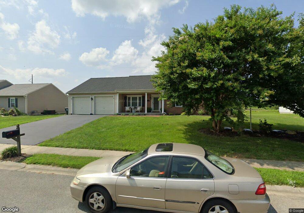
19 Mailly Dr Townsend, DE 19734
Estimated Value: $453,954 - $523,000
3
Beds
2
Baths
2,175
Sq Ft
$226/Sq Ft
Est. Value
About This Home
This home is located at 19 Mailly Dr, Townsend, DE 19734 and is currently estimated at $490,489, approximately $225 per square foot. 19 Mailly Dr is a home located in New Castle County with nearby schools including Old State Elementary School, Cantwell's Bridge Middle School, and Odessa High School.
Ownership History
Date
Name
Owned For
Owner Type
Purchase Details
Closed on
Jan 7, 2025
Sold by
Mccraw Megan E and Mccraw Kevin J
Bought by
Mccraw Kevin J and Mccraw Megan E
Current Estimated Value
Home Financials for this Owner
Home Financials are based on the most recent Mortgage that was taken out on this home.
Original Mortgage
$325,600
Outstanding Balance
$321,175
Interest Rate
6.69%
Mortgage Type
FHA
Estimated Equity
$169,314
Purchase Details
Closed on
Jan 29, 2016
Sold by
Wright James H and Wright Margaret E
Bought by
Mccraw Kevin J and Palmer Megan
Purchase Details
Closed on
Nov 16, 2001
Sold by
Cantwell Development Llc
Bought by
Wright James H and Wright Margaret E
Home Financials for this Owner
Home Financials are based on the most recent Mortgage that was taken out on this home.
Original Mortgage
$170,246
Interest Rate
6.7%
Create a Home Valuation Report for This Property
The Home Valuation Report is an in-depth analysis detailing your home's value as well as a comparison with similar homes in the area
Home Values in the Area
Average Home Value in this Area
Purchase History
We collect this data history from publicly available records. To have your information removed, we recommend requesting removal directly through your county’s website.
| Date | Buyer | Sale Price | Title Company |
|---|---|---|---|
| Mccraw Kevin J | -- | None Listed On Document | |
| Mccraw Kevin J | -- | Attorney | |
| Wright James H | $212,807 | Atlantic Title & Abstract Co |
Source: Public Records
Mortgage History
We collect this data history from publicly available records. To have your information removed, we recommend requesting removal directly through your county’s website.
| Date | Status | Borrower | Loan Amount |
|---|---|---|---|
| Open | Mccraw Kevin J | $325,600 | |
| Previous Owner | Wright James H | $170,246 |
Source: Public Records
Tax History
| Year | Tax Paid | Tax Assessment Tax Assessment Total Assessment is a certain percentage of the fair market value that is determined by local assessors to be the total taxable value of land and additions on the property. | Land | Improvement |
|---|---|---|---|---|
| 2025 | $3,997 | $495,100 | $100,300 | $394,800 |
| 2024 | $3,640 | $84,100 | $9,100 | $75,000 |
| 2023 | $3,121 | $84,100 | $9,100 | $75,000 |
| 2022 | $3,130 | $84,100 | $9,100 | $75,000 |
| 2021 | $3,092 | $84,100 | $9,100 | $75,000 |
| 2020 | $3,057 | $84,100 | $9,100 | $75,000 |
| 2019 | $3,058 | $84,100 | $9,100 | $75,000 |
| 2018 | $2,747 | $84,100 | $9,100 | $75,000 |
| 2017 | $2,636 | $84,100 | $9,100 | $75,000 |
| 2016 | $2,400 | $84,100 | $9,100 | $75,000 |
| 2015 | $1,604 | $84,100 | $9,100 | $75,000 |
| 2014 | $1,610 | $84,100 | $9,100 | $75,000 |
Source: Public Records
Map
Nearby Homes
- 528 Silverhill Crossing
- 137 Tweedsmere Dr
- 338 Canvasback Rd
- 101 Spaniel Ct
- 332 Canvasback Rd
- 27 Basalt St
- 5 Basalt St
- 2 Mica St
- 604 Ravenglass Dr
- 220 Abbigail Crossing
- 207 Olivine Cir
- 239 Abbigail Crossing
- 60 Spring Creek Dr
- 145 Abbigail Crossing
- 227 Avonbridge Dr
- 213 Loft St
- 929 Robinson Rd
- 1003 Robinson Rd
- 413 Janets Way
- 643 Southerness Dr
Your Personal Tour Guide
Ask me questions while you tour the home.