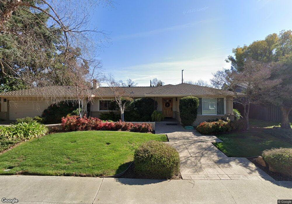
1918 Rolls Way Carmichael, CA 95608
Carmichael Town Center NeighborhoodEstimated Value: $611,000 - $744,000
4
Beds
3
Baths
1,851
Sq Ft
$371/Sq Ft
Est. Value
About This Home
This home is located at 1918 Rolls Way, Carmichael, CA 95608 and is currently estimated at $686,057, approximately $370 per square foot. 1918 Rolls Way is a home located in Sacramento County with nearby schools including Del Dayo Elementary School, Arden Middle School, and Rio Americano High School.
Ownership History
Date
Name
Owned For
Owner Type
Purchase Details
Closed on
Feb 22, 2013
Sold by
Dawson William D and Dawson Linda A
Bought by
Dawson William D and Dawson Linda A
Current Estimated Value
Home Financials for this Owner
Home Financials are based on the most recent Mortgage that was taken out on this home.
Original Mortgage
$267,612
Interest Rate
3.54%
Mortgage Type
New Conventional
Purchase Details
Closed on
Aug 6, 2007
Sold by
Dawson William D and Dawson Linda A
Bought by
Dawson William D and Dawson Linda A
Home Financials for this Owner
Home Financials are based on the most recent Mortgage that was taken out on this home.
Original Mortgage
$246,000
Interest Rate
6.65%
Mortgage Type
New Conventional
Purchase Details
Closed on
May 24, 2000
Sold by
Dawson William D and Dawson Linda A
Bought by
Dawson William D and Dawson Linda A
Create a Home Valuation Report for This Property
The Home Valuation Report is an in-depth analysis detailing your home's value as well as a comparison with similar homes in the area
Home Values in the Area
Average Home Value in this Area
Purchase History
| Date | Buyer | Sale Price | Title Company |
|---|---|---|---|
| Dawson William D | -- | Servicelink | |
| Dawson William D | -- | Alliance Title Company | |
| Dawson William D | -- | Alliance Title Company | |
| Dawson William D | -- | -- |
Source: Public Records
Mortgage History
| Date | Status | Borrower | Loan Amount |
|---|---|---|---|
| Closed | Dawson William D | $267,612 | |
| Closed | Dawson William D | $246,000 |
Source: Public Records
Tax History
| Year | Tax Paid | Tax Assessment Tax Assessment Total Assessment is a certain percentage of the fair market value that is determined by local assessors to be the total taxable value of land and additions on the property. | Land | Improvement |
|---|---|---|---|---|
| 2025 | $2,181 | $178,834 | $37,186 | $141,648 |
| 2024 | $2,181 | $175,328 | $36,457 | $138,871 |
| 2023 | $2,146 | $171,892 | $35,743 | $136,149 |
| 2022 | $2,104 | $168,523 | $35,043 | $133,480 |
| 2021 | $2,069 | $165,219 | $34,356 | $130,863 |
| 2020 | $2,031 | $163,526 | $34,004 | $129,522 |
| 2019 | $1,990 | $160,321 | $33,338 | $126,983 |
| 2018 | $1,911 | $157,179 | $32,685 | $124,494 |
| 2017 | $1,947 | $154,098 | $32,045 | $122,053 |
| 2016 | $1,812 | $151,077 | $31,417 | $119,660 |
| 2015 | $1,826 | $148,809 | $30,946 | $117,863 |
| 2014 | $1,790 | $145,895 | $30,340 | $115,555 |
Source: Public Records
Map
Nearby Homes
- 2051 Lambeth Way
- 5424 Fair Oaks Blvd
- 1744 Danielson Ct
- 5312 Retreat Way
- 1749 Haggin Grove Way
- 1625 Gary Way
- 1700 McClaren Dr
- 1744 Haggin Grove Way
- 1620 Gary Way
- 2239 Seabler Place
- 1835 Westminster Ct
- 5216 Marione Dr
- 5910 River Glen Ct
- 1626 Arden Bluffs Ln
- 5911 Sarah Ct
- 2240 Boyer Dr
- 5902 Oak Ave
- 23 Riverbank Place
- 2232 Boyer Dr
- 1431 McClaren Dr
- 1912 Rolls Way
- 1924 Rolls Way
- 1955 Wingfield Way
- 1945 Wingfield Way
- 1923 Rolls Way
- 1965 Wingfield Way
- 1917 Rolls Way
- 1906 Rolls Way
- 1930 Rolls Way
- 1935 Wingfield Way
- 1911 Rolls Way
- 1920 Lambeth Way
- 2001 Wingfield Way
- 2000 Lambeth Way
- 2008 Lambeth Way
- 1946 Wingfield Way
- 1914 Lambeth Way
- 1900 Rolls Way
- 1956 Wingfield Way
- 1925 Wingfield Way
Your Personal Tour Guide
Ask me questions while you tour the home.