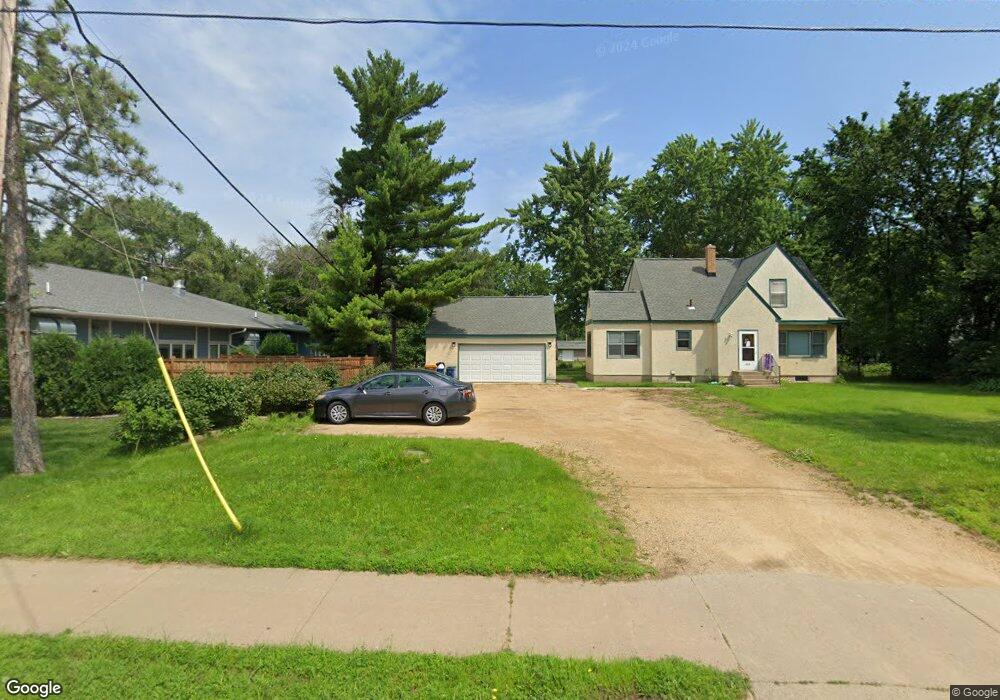
1925 County Road E E Saint Paul, MN 55110
Estimated Value: $288,228 - $342,000
2
Beds
2
Baths
845
Sq Ft
$366/Sq Ft
Est. Value
About This Home
This home is located at 1925 County Road E E, Saint Paul, MN 55110 and is currently estimated at $309,307, approximately $366 per square foot. 1925 County Road E E is a home located in Ramsey County with nearby schools including Willow Lane Elementary School, Sunrise Park Middle School, and Gentry Academy High.
Ownership History
Date
Name
Owned For
Owner Type
Purchase Details
Closed on
Jan 25, 2021
Sold by
Schmidt David A
Bought by
Aanenson Shelli A and Isakson Donna L
Current Estimated Value
Home Financials for this Owner
Home Financials are based on the most recent Mortgage that was taken out on this home.
Original Mortgage
$245,471
Outstanding Balance
$219,433
Interest Rate
2.67%
Mortgage Type
FHA
Estimated Equity
$89,874
Create a Home Valuation Report for This Property
The Home Valuation Report is an in-depth analysis detailing your home's value as well as a comparison with similar homes in the area
Home Values in the Area
Average Home Value in this Area
Purchase History
| Date | Buyer | Sale Price | Title Company |
|---|---|---|---|
| Aanenson Shelli A | $250,000 | Attorneys Title Group Llc | |
| Aanenson Shelli Shelli | $250,000 | -- |
Source: Public Records
Mortgage History
| Date | Status | Borrower | Loan Amount |
|---|---|---|---|
| Open | Aanenson Shelli A | $245,471 | |
| Closed | Aanenson Shelli Shelli | $245,471 |
Source: Public Records
Tax History
| Year | Tax Paid | Tax Assessment Tax Assessment Total Assessment is a certain percentage of the fair market value that is determined by local assessors to be the total taxable value of land and additions on the property. | Land | Improvement |
|---|---|---|---|---|
| 2025 | $3,596 | $332,100 | $95,000 | $237,100 |
| 2023 | $3,596 | $280,500 | $95,000 | $185,500 |
| 2022 | $3,750 | $262,800 | $95,000 | $167,800 |
| 2021 | $3,770 | $286,700 | $95,000 | $191,700 |
| 2020 | $3,870 | $294,500 | $95,000 | $199,500 |
| 2019 | $3,152 | $283,100 | $95,000 | $188,100 |
| 2018 | $2,600 | $250,600 | $95,000 | $155,600 |
| 2017 | $2,448 | $216,100 | $95,000 | $121,100 |
| 2016 | $2,460 | $0 | $0 | $0 |
| 2015 | $2,262 | $192,900 | $89,300 | $103,600 |
| 2014 | $2,036 | $0 | $0 | $0 |
Source: Public Records
Map
Nearby Homes
- 3584 Midland Ave
- 3675 White Bear Ave N
- 1807 1/2 County Road E E Unit 34
- 3781 Auger Ave
- 1778 Linden Cove
- 1787 Cheri Ct
- 1782 Cedar Cove
- 3834 Linden Ave
- 1893 Roth St
- 2041 Orchard Ln
- 3886 Hill Ave
- 3920 White Bear Ave N
- 1943 Oak Knoll Dr
- 3512 Mcknight Rd N
- 3407 Emerald Dr
- 2174 County Road F E
- 3084 Chisholm Ct N
- 1613 County Road D E Unit L
- 1579 County Road D E Unit K
- 2501 Jansen Ave
- 1925 County Rd E Unit 1
- 1917 County Road E E
- 1937 County Road E E
- 1941 County Road E E
- 3618 Highland Ave
- 1928 County Road E E
- 1918 County Road E E
- 1938 County Road E E
- 1955 County Road E E
- 1930 Spruce Place
- 1924 Spruce Place
- 1916 Spruce Place
- 1910 Spruce Place
- 1948 Spruce Place
- 1908 & 191 County Rd E
- 1908 & 1910 County Rd E
- 1946 County Road E E
- 1950 County Road E E
- 1908 County Road E E
- 1959 County Road E E
Your Personal Tour Guide
Ask me questions while you tour the home.