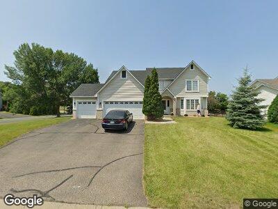
1980 Hazen St Shakopee, MN 55379
Estimated Value: $484,000 - $550,000
5
Beds
4
Baths
3,242
Sq Ft
$161/Sq Ft
Est. Value
About This Home
This home is located at 1980 Hazen St, Shakopee, MN 55379 and is currently estimated at $521,763, approximately $160 per square foot. 1980 Hazen St is a home located in Scott County with nearby schools including Sun Path Elementary School, Shakopee West Middle School, and Shakopee Senior High School.
Ownership History
Date
Name
Owned For
Owner Type
Purchase Details
Closed on
Jul 22, 2019
Sold by
Anderson Susan M and Andreson Daniel F
Bought by
Stackhouse Dwayne M and Bagley Katherine S
Current Estimated Value
Home Financials for this Owner
Home Financials are based on the most recent Mortgage that was taken out on this home.
Original Mortgage
$368,029
Outstanding Balance
$329,186
Interest Rate
4.37%
Mortgage Type
FHA
Estimated Equity
$192,577
Purchase Details
Closed on
Aug 31, 2001
Sold by
U S Home Corp
Bought by
Anderson Susan M and Anderson Daniel F
Create a Home Valuation Report for This Property
The Home Valuation Report is an in-depth analysis detailing your home's value as well as a comparison with similar homes in the area
Home Values in the Area
Average Home Value in this Area
Purchase History
| Date | Buyer | Sale Price | Title Company |
|---|---|---|---|
| Stackhouse Dwayne M | $375,000 | Edina Realty Title Inc | |
| Anderson Susan M | $256,515 | -- |
Source: Public Records
Mortgage History
| Date | Status | Borrower | Loan Amount |
|---|---|---|---|
| Open | Stackhouse Dwayne M | $368,029 | |
| Closed | Anderson Daniel Fletcher | $282,500 |
Source: Public Records
Tax History Compared to Growth
Tax History
| Year | Tax Paid | Tax Assessment Tax Assessment Total Assessment is a certain percentage of the fair market value that is determined by local assessors to be the total taxable value of land and additions on the property. | Land | Improvement |
|---|---|---|---|---|
| 2025 | $4,900 | $467,400 | $136,900 | $330,500 |
| 2024 | $4,900 | $472,100 | $136,900 | $335,200 |
| 2023 | $5,142 | $457,500 | $131,700 | $325,800 |
| 2022 | $4,820 | $471,300 | $149,600 | $321,700 |
| 2021 | $4,378 | $380,500 | $115,700 | $264,800 |
| 2020 | $4,820 | $377,200 | $110,900 | $266,300 |
| 2019 | $5,030 | $365,000 | $98,600 | $266,400 |
| 2018 | $5,198 | $0 | $0 | $0 |
| 2016 | $5,016 | $0 | $0 | $0 |
| 2014 | -- | $0 | $0 | $0 |
Source: Public Records
Map
Nearby Homes
- 1815 Mooers Ave
- 1986 Mathias Rd
- 2052 Wilhelm Ct
- 2179 Ponds Way
- 2374 Thrush St
- 2330 Ponds Way
- 1780 Quail Dr
- 1971 Evergreen Ln
- 1874 Pintail Ave
- 1938 Ormond Dr
- 2011 Downing Ave
- 2127 Ormond Dr
- 2726 Green Ash Ave
- 2734 Green Ash Ave
- 2749 Green Ash Ave
- 2718 Green Ash Ave
- 2704 Aspen Dr
- 2606 Green Ash Ave
- 2405 Jennifer Ln
- 2230 Downing Ave
- 1980 Hazen St
- 1972 Hazen St
- 1964 Hazen St
- 1760 Alden Ave
- 1784 Alden Ave
- 1823 Alden Ave
- 1808 Alden Ave
- 1956 Hazen St
- 1967 Hazen St
- 1832 Alden Ave
- 1847 Alden Ave
- 1959 Hazen St
- 1823 Wilhelm Place
- 1948 Hazen St
- 1801 Wilhelm Place
- 1856 Alden Ave
- 1951 Hazen St
- 1845 Wilhelm Place
- 1823 Mathias Rd
- 1871 Alden Ave