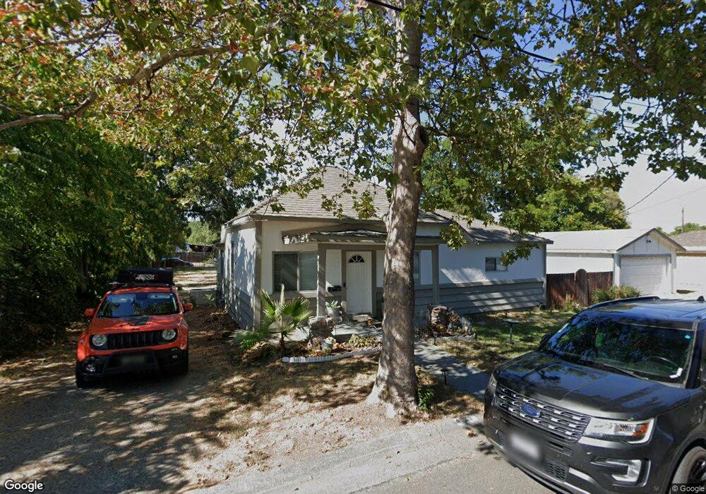
1982 Taft Ave Unit 1 Corning, CA 96021
Estimated Value: $214,573 - $249,000
2
Beds
2
Baths
1,160
Sq Ft
$197/Sq Ft
Est. Value
About This Home
This home is located at 1982 Taft Ave Unit 1, Corning, CA 96021 and is currently estimated at $228,893, approximately $197 per square foot. 1982 Taft Ave Unit 1 is a home located in Tehama County with nearby schools including West Street Elementary School, Maywood Middle School, and Corning High School.
Ownership History
Date
Name
Owned For
Owner Type
Purchase Details
Closed on
Jan 23, 2013
Sold by
Wells Fargo Bank Na
Bought by
Abel Jason and Abel Anna
Current Estimated Value
Purchase Details
Closed on
Aug 10, 2012
Sold by
Farias Raquel S
Bought by
Wells Fargo Bank Na
Purchase Details
Closed on
Oct 20, 2008
Sold by
Federal Home Loan Mortgage Corporation
Bought by
Farias Raquel S
Home Financials for this Owner
Home Financials are based on the most recent Mortgage that was taken out on this home.
Original Mortgage
$123,600
Interest Rate
6.31%
Mortgage Type
Purchase Money Mortgage
Purchase Details
Closed on
Oct 10, 2008
Sold by
Farias Jose
Bought by
Farias Raquel S
Home Financials for this Owner
Home Financials are based on the most recent Mortgage that was taken out on this home.
Original Mortgage
$123,600
Interest Rate
6.31%
Mortgage Type
Purchase Money Mortgage
Purchase Details
Closed on
Jul 1, 2008
Sold by
Engel Gus A and Enge Tena G
Bought by
Federal Home Loan Mortgage Corporation
Purchase Details
Closed on
Sep 14, 2004
Sold by
Engel Carl and Engel Kathy
Bought by
Engel Gus A and Engel Tena G
Home Financials for this Owner
Home Financials are based on the most recent Mortgage that was taken out on this home.
Original Mortgage
$108,750
Interest Rate
5.8%
Mortgage Type
New Conventional
Purchase Details
Closed on
Feb 6, 2002
Sold by
Engel Carl and Engel Kathy
Bought by
Engel Carl and Engel Kathy
Home Financials for this Owner
Home Financials are based on the most recent Mortgage that was taken out on this home.
Original Mortgage
$77,850
Interest Rate
7.17%
Purchase Details
Closed on
Jan 30, 2002
Sold by
Worsham Kenneth Douglas
Bought by
Engel Carl and Engel Kathy
Home Financials for this Owner
Home Financials are based on the most recent Mortgage that was taken out on this home.
Original Mortgage
$77,850
Interest Rate
7.17%
Create a Home Valuation Report for This Property
The Home Valuation Report is an in-depth analysis detailing your home's value as well as a comparison with similar homes in the area
Purchase History
| Date | Buyer | Sale Price | Title Company |
|---|---|---|---|
| Abel Jason | $68,000 | Servicelink | |
| Wells Fargo Bank Na | $84,824 | Accommodation | |
| Farias Raquel S | $120,000 | First American Title Ins Co | |
| Farias Raquel S | -- | First American Title Ins Co | |
| Federal Home Loan Mortgage Corporation | $113,445 | First American Title Ins Co | |
| Engel Gus A | -- | Chicago Title Co | |
| Engel Carl | -- | -- | |
| Engel Carl | $86,500 | Northern California Title Co |
Source: Public Records
Mortgage History
| Date | Status | Borrower | Loan Amount |
|---|---|---|---|
| Previous Owner | Farias Raquel S | $123,600 | |
| Previous Owner | Engel Gus A | $108,750 | |
| Previous Owner | Engel Carl | $77,850 |
Source: Public Records
Tax History
| Year | Tax Paid | Tax Assessment Tax Assessment Total Assessment is a certain percentage of the fair market value that is determined by local assessors to be the total taxable value of land and additions on the property. | Land | Improvement |
|---|---|---|---|---|
| 2025 | $868 | $83,722 | $24,622 | $59,100 |
| 2023 | $852 | $80,473 | $23,667 | $56,806 |
| 2022 | $840 | $78,896 | $23,203 | $55,693 |
| 2021 | $809 | $77,350 | $22,749 | $54,601 |
| 2020 | $817 | $76,558 | $22,516 | $54,042 |
| 2019 | $784 | $75,058 | $22,075 | $52,983 |
| 2018 | $785 | $73,588 | $21,643 | $51,945 |
| 2017 | $780 | $72,146 | $21,219 | $50,927 |
| 2016 | $727 | $70,732 | $20,803 | $49,929 |
| 2015 | -- | $69,671 | $20,491 | $49,180 |
| 2014 | $711 | $68,307 | $20,090 | $48,217 |
Source: Public Records
Map
Nearby Homes
- 1001 Toomes Ave
- 2018 Donnovan Ave
- 0 Toomes Ave Unit SN25272183
- 0 Toomes Ave Unit SN24222817
- 0 Toomes Ave Unit SN25176211
- 2067 Blossom Ave
- 611 Hoag St
- 611 Hoag St Unit 250
- 1419 Yolo St
- 1517 Tehama St
- 1890 North St
- 1311 6th Ave
- 1162 5th Ave
- 1568 Link St
- 1075 99w
- 233 Rio Verde Ct
- 243 Edith Ave
- 1409 North St
- 1121 Marin St
- 311 6th St
- 1982 Taft Ave
- 1948 Taft Ave
- 1958 Taft Ave
- 909 Toomes Ave
- XXX Toomes Ave
- 4178 Toomes Ave
- 1983 Taft Ave
- 1973 Taft Ave
- 1928 Grant Ave
- 907 Toomes Ave
- 1045 Toomes Ave
- 1916 Grant Ave
- 1014 Toomes Ave
- 1914 Grant Ave
- 982 Toomes Ave
- 1910 Grant Ave
- 1042 Toomes Ave
- 1931 Mckinley Ave
- 1927 Mckinley Ave
- 1940 Taft Ave
Your Personal Tour Guide
Ask me questions while you tour the home.