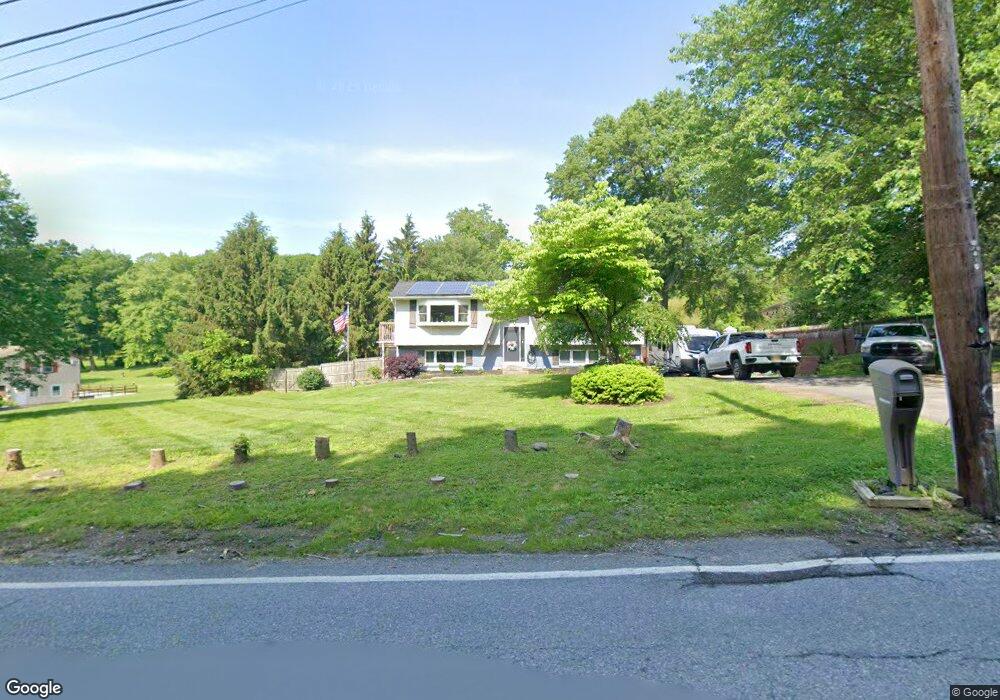
2 Daley Rd Poughkeepsie, NY 12603
Estimated Value: $450,000 - $517,000
4
Beds
2
Baths
1,212
Sq Ft
$398/Sq Ft
Est. Value
About This Home
This home is located at 2 Daley Rd, Poughkeepsie, NY 12603 and is currently estimated at $482,661, approximately $398 per square foot. 2 Daley Rd is a home located in Dutchess County with nearby schools including Vassar Road Elementary School, Kinry Road Elementary School, and Wappingers Junior High School.
Ownership History
Date
Name
Owned For
Owner Type
Purchase Details
Closed on
Feb 21, 2018
Sold by
Kimberly Franzese
Bought by
Cole David and Cole Kimberly
Current Estimated Value
Home Financials for this Owner
Home Financials are based on the most recent Mortgage that was taken out on this home.
Original Mortgage
$269,871
Outstanding Balance
$230,754
Interest Rate
4.38%
Estimated Equity
$251,907
Purchase Details
Closed on
Dec 7, 2001
Sold by
Gieseler Robert W
Bought by
Franzese Kimberly
Create a Home Valuation Report for This Property
The Home Valuation Report is an in-depth analysis detailing your home's value as well as a comparison with similar homes in the area
Home Values in the Area
Average Home Value in this Area
Purchase History
| Date | Buyer | Sale Price | Title Company |
|---|---|---|---|
| Cole David | -- | -- | |
| Franzese Kimberly | $206,000 | Joseph Sayegh |
Source: Public Records
Mortgage History
| Date | Status | Borrower | Loan Amount |
|---|---|---|---|
| Open | Cole David | $269,871 | |
| Closed | Cole David | -- |
Source: Public Records
Tax History Compared to Growth
Tax History
| Year | Tax Paid | Tax Assessment Tax Assessment Total Assessment is a certain percentage of the fair market value that is determined by local assessors to be the total taxable value of land and additions on the property. | Land | Improvement |
|---|---|---|---|---|
| 2024 | $7,736 | $254,100 | $56,200 | $197,900 |
| 2023 | $11,243 | $254,100 | $56,200 | $197,900 |
| 2022 | $10,011 | $254,100 | $56,200 | $197,900 |
| 2021 | $9,174 | $254,100 | $56,200 | $197,900 |
| 2020 | $6,299 | $254,100 | $56,200 | $197,900 |
| 2019 | $6,099 | $254,100 | $56,200 | $197,900 |
| 2018 | $6,225 | $254,100 | $56,200 | $197,900 |
| 2017 | $6,101 | $254,100 | $56,200 | $197,900 |
| 2016 | $6,130 | $254,100 | $56,200 | $197,900 |
| 2015 | -- | $254,100 | $56,200 | $197,900 |
| 2014 | -- | $254,100 | $56,200 | $197,900 |
Source: Public Records
Map
Nearby Homes
- 1 Four Winds Dr
- 322 Noxon Rd
- 42 Feller Ct
- 56 Daley Rd
- 321 Titusville Rd Unit D12
- 321 Titusville Rd - 128
- 122 King Dr
- 102 Simone Dr
- 8 Walker Rd
- 20 Greenfield St
- 6 North Dr
- 3 Mark Vincent Dr
- 22 Old Mill Rd
- 6 Frederick Dr
- 66 High Acres Dr
- 96 Daley Rd
- 2123 New Hackensack Rd
- 152 Bart Dr
- 156 Bart Dr
- 31 Pine Tree Dr
- 246 Titusville Rd
- 4 Daley Rd
- 254 Titusville Rd
- 245 Titusville Rd
- 6 Daley Rd
- 27 Partners Trace
- 251 Titusville Rd
- 25 Partners Trace
- 2 Partners Trace
- 2 Partners Trace
- 4 Partners Trace
- 8 Daley Rd
- 23 Partners Trace
- 23 Partners Trace
- 14 Partners Trace
- 14 Partners Trace
- 3 Partners Trace
- 10 Daley Rd
- 3 Partners Trace
- 21 Partners Trace