Estimated Value: $462,000 - $576,000
3
Beds
3
Baths
1,504
Sq Ft
$338/Sq Ft
Est. Value
About This Home
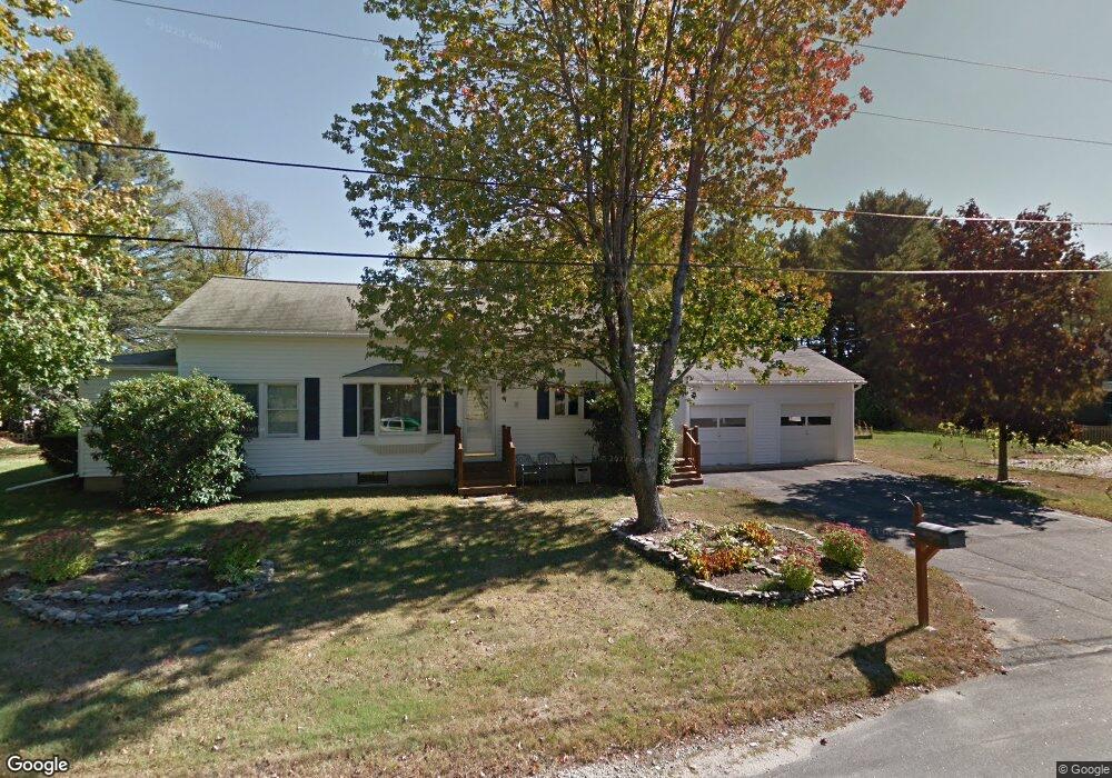
This home is located at 2 Willard Rd, Dover, NH 03820 and is currently estimated at $508,601, approximately $338 per square foot. 2 Willard Rd is a home located in Strafford County with nearby schools including Horne Street School, Dover Middle School, and Dover Senior High School.
Ownership History
Date
Name
Owned For
Owner Type
Purchase Details
Closed on
Sep 30, 1996
Sold by
Futerrer David C and Futerrer Susan A
Bought by
Taylor Bernard C
Current Estimated Value
Home Financials for this Owner
Home Financials are based on the most recent Mortgage that was taken out on this home.
Original Mortgage
$72,000
Outstanding Balance
$4,529
Interest Rate
7.83%
Estimated Equity
$504,072
Create a Home Valuation Report for This Property
The Home Valuation Report is an in-depth analysis detailing your home's value as well as a comparison with similar homes in the area
Home Values in the Area
Average Home Value in this Area
Purchase History
| Date | Buyer | Sale Price | Title Company |
|---|---|---|---|
| Taylor Bernard C | $80,000 | -- |
Source: Public Records
Mortgage History
| Date | Status | Borrower | Loan Amount |
|---|---|---|---|
| Open | Taylor Bernard C | $72,000 |
Source: Public Records
Tax History
| Year | Tax Paid | Tax Assessment Tax Assessment Total Assessment is a certain percentage of the fair market value that is determined by local assessors to be the total taxable value of land and additions on the property. | Land | Improvement |
|---|---|---|---|---|
| 2024 | $8,594 | $473,000 | $153,700 | $319,300 |
| 2023 | $7,813 | $417,800 | $137,500 | $280,300 |
| 2022 | $7,579 | $382,000 | $129,400 | $252,600 |
| 2021 | $7,317 | $337,200 | $121,300 | $215,900 |
| 2020 | $7,192 | $289,400 | $113,200 | $176,200 |
| 2019 | $6,897 | $273,800 | $101,100 | $172,700 |
| 2018 | $6,325 | $253,800 | $89,000 | $164,800 |
| 2017 | $5,989 | $231,500 | $80,900 | $150,600 |
| 2016 | $5,497 | $209,100 | $72,000 | $137,100 |
| 2015 | $5,112 | $192,100 | $67,800 | $124,300 |
| 2014 | $4,929 | $189,500 | $67,800 | $121,700 |
| 2011 | $4,265 | $169,800 | $68,400 | $101,400 |
Source: Public Records
Map
Nearby Homes
- 0 Indian Brook Rd Unit C
- 472 High St
- 2 Wolf Ln
- 80 Glenwood Ave
- Lot 0 Page Ave
- 9 Lowell Ave
- 187 Old Rochester Rd
- 454 Sixth St
- 725 Central Ave Unit 203
- 725 Central Ave Unit LL03
- 725 Central Ave Unit 301
- 725 Central Ave Unit 302
- 725 Central Ave Unit LL01
- 725 Central Ave Unit 304
- Lot 4 Charlotte Dr Unit 4
- 34 Floral Ave Unit 5
- 12 Charlotte Dr Unit 5
- 63 Sixth St
- 43 Sixth St Unit A and B
- 108 Colonial Village
- 40 New Rochester Rd
- 42 New Rochester Rd
- 9 Copper Dr
- 4 Willard Rd
- 1 Willard Rd
- 5 Copper Dr
- 15 Copper Dr
- 10 Copper Dr
- 14 Copper Dr
- 6 Willard Rd
- 44 New Rochester Rd
- 38 New Rochester Rd
- 36 New Rochester Rd
- 8 Willard Rd
- 3 Willard Rd
- 7 Oxbow Ln
- 6 Copper Dr
- 6 Copper Dr
- 48 New Rochester Rd
- 27 New Rochester Rd
Your Personal Tour Guide
Ask me questions while you tour the home.