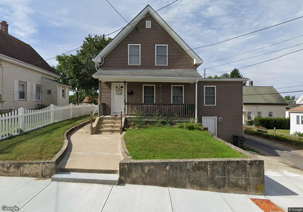
20 Howard St Franklin, MA 02038
Downtown Franklin NeighborhoodEstimated Value: $440,000 - $533,000
About This Home
This home is located at 20 Howard St, Franklin, MA 02038 and is currently estimated at $502,992, approximately $363 per square foot. 20 Howard St is a home located in Norfolk County with nearby schools including Gerald M. Parmenter Elementary School, Remington Middle School, and Franklin High School.
Ownership History
We collect this data history from publicly available records. To have your information removed, we recommend requesting removal directly through your county’s website.
Purchase Details
Purchase Details
Purchase Details
Purchase Details
Purchase Details
Purchase Details
Purchase Details
Home Values in the Area
Average Home Value in this Area
Purchase History
We collect this data history from publicly available records. To have your information removed, we recommend requesting removal directly through your county’s website.
| Date | Buyer | Sale Price | Title Company |
|---|---|---|---|
| $12,500 | -- | ||
| $12,500 | -- | ||
| $4,167 | -- | ||
| $2,500 | -- | ||
| $2,500 | -- | ||
| $2,500 | -- | ||
| $2,500 | -- | ||
| $4,167 | -- | ||
| $12,500 | -- | ||
| $12,500 | -- | ||
| $4,167 | -- | ||
| -- | -- | ||
| $3,125 | -- | ||
| -- | -- | ||
| $3,125 | -- | ||
| $6,250 | -- | ||
| $12,500 | -- | ||
| $2,500 | -- | ||
| $12,500 | -- | ||
| $4,167 | -- | ||
| $3,125 | -- | ||
| $3,125 | -- | ||
| $6,250 | -- |
Tax History
We collect this data history from publicly available records. To have your information removed, we recommend requesting removal directly through your county’s website.
| Year | Tax Paid | Tax Assessment Tax Assessment Total Assessment is a certain percentage of the fair market value that is determined by local assessors to be the total taxable value of land and additions on the property. | Land | Improvement |
|---|---|---|---|---|
| 2025 | $5,375 | $462,600 | $231,700 | $230,900 |
| 2024 | $5,177 | $439,100 | $231,700 | $207,400 |
| 2023 | $5,451 | $433,300 | $252,900 | $180,400 |
| 2022 | $4,925 | $350,500 | $193,100 | $157,400 |
| 2021 | $4,773 | $325,800 | $201,000 | $124,800 |
| 2020 | $4,656 | $320,900 | $202,800 | $118,100 |
| 2019 | $4,339 | $296,000 | $177,900 | $118,100 |
| 2018 | $4,190 | $286,000 | $181,400 | $104,600 |
| 2017 | $4,119 | $282,500 | $177,900 | $104,600 |
| 2016 | $4,014 | $276,800 | $185,100 | $91,700 |
| 2015 | $3,842 | $258,900 | $167,200 | $91,700 |
| 2014 | $3,682 | $254,800 | $162,400 | $92,400 |
Map
- 1 Washington St
- 3 Washington St
- 44 Winter St
- 32 Dale St
- 33 Winter St Unit 2
- 59 Cottage St
- 26 Mccarthy St
- 57 A St Unit 57
- 127 King St Unit 304
- 20 Anna Rd
- 90 E Central St Unit 304
- 74 Uncas Ave Unit 1
- 72 Uncas Ave Unit 1
- 55 Dean Ave
- 40 Hill Ave Unit 40
- 87 Alpine Place Unit 87
- 349 Summer St
- 4 Shawkemo Path
- 55 Quince Landing
- 360 W Central St
- 17 Howard St
- 21 Howard St
- 11 Howard St
- 1 Wachusett Place
- 27 Howard St
- 16 Howard St
- 17 Arlington St
- 23 Arlington St
- 65 Wachusett St
- 11 Arlington St
- 31 Howard St
- 73 Wachusett St
- 26 Howard St
- 75 Wachusett St
- 75 Wachusett St Unit 1
- 18 Hutchinson St
- 31 Arlington St
- 31 Arlington St Unit 1
- 31 Arlington St Unit 2
- 14 Hutchinson St
Ask me questions while you tour the home.