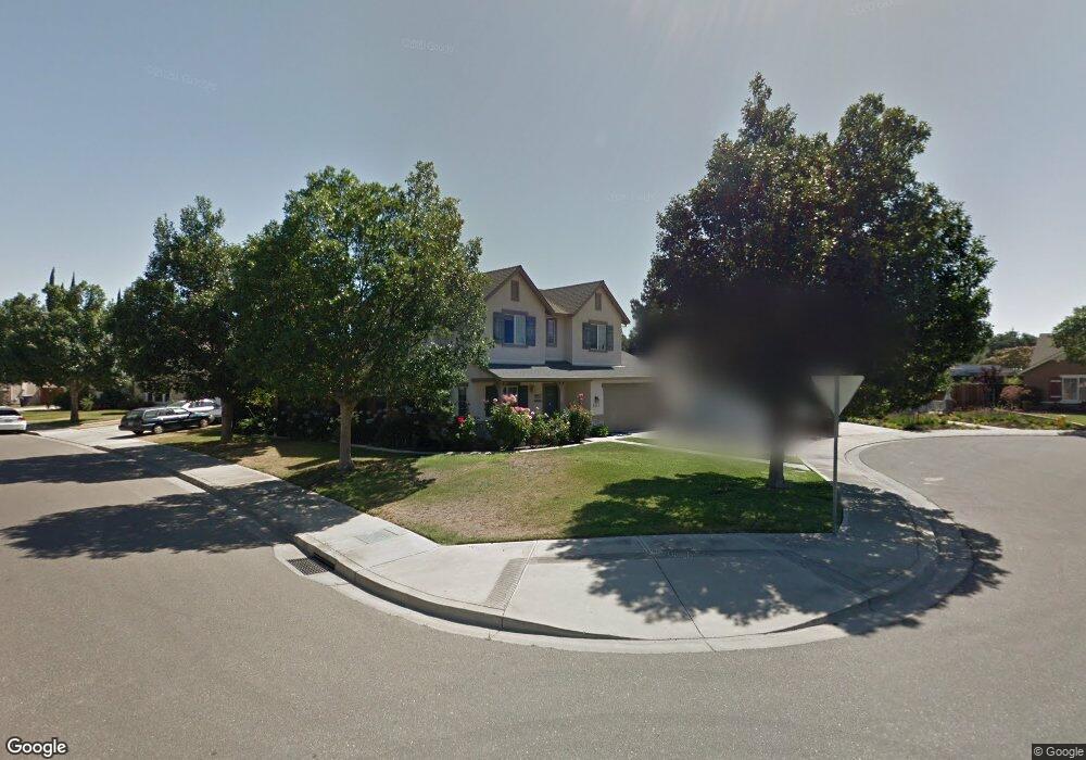
2001 Damask Ct Modesto, CA 95355
Northeast Modesto NeighborhoodEstimated Value: $456,000 - $510,000
3
Beds
3
Baths
1,642
Sq Ft
$298/Sq Ft
Est. Value
About This Home
This home is located at 2001 Damask Ct, Modesto, CA 95355 and is currently estimated at $489,498, approximately $298 per square foot. 2001 Damask Ct is a home located in Stanislaus County with nearby schools including Coleman F. Brown Elementary School, Daniel J. Savage Middle School, and Fred C. Beyer High School.
Ownership History
Date
Name
Owned For
Owner Type
Purchase Details
Closed on
Apr 16, 2021
Sold by
Letsinger Derrick A and Letsinger Sunshine D
Bought by
Le Phong Tony Thanh and Sze Hwa Lau
Current Estimated Value
Home Financials for this Owner
Home Financials are based on the most recent Mortgage that was taken out on this home.
Original Mortgage
$373,500
Outstanding Balance
$337,495
Interest Rate
3.05%
Mortgage Type
New Conventional
Estimated Equity
$152,003
Purchase Details
Closed on
Dec 17, 2001
Sold by
Florsheim Bros
Bought by
Letsinger Derrick A and Letsinger Sunshine D
Home Financials for this Owner
Home Financials are based on the most recent Mortgage that was taken out on this home.
Original Mortgage
$204,953
Interest Rate
6.39%
Create a Home Valuation Report for This Property
The Home Valuation Report is an in-depth analysis detailing your home's value as well as a comparison with similar homes in the area
Home Values in the Area
Average Home Value in this Area
Purchase History
| Date | Buyer | Sale Price | Title Company |
|---|---|---|---|
| Le Phong Tony Thanh | $415,000 | First American Title Company | |
| Letsinger Derrick A | $216,000 | Alliance Title Company |
Source: Public Records
Mortgage History
| Date | Status | Borrower | Loan Amount |
|---|---|---|---|
| Open | Le Phong Tony Thanh | $373,500 | |
| Previous Owner | Letsinger Derrick A | $204,953 |
Source: Public Records
Tax History
| Year | Tax Paid | Tax Assessment Tax Assessment Total Assessment is a certain percentage of the fair market value that is determined by local assessors to be the total taxable value of land and additions on the property. | Land | Improvement |
|---|---|---|---|---|
| 2025 | $4,964 | $449,207 | $189,425 | $259,782 |
| 2024 | $4,874 | $440,400 | $185,711 | $254,689 |
| 2023 | $4,782 | $431,766 | $182,070 | $249,696 |
| 2022 | $4,588 | $423,300 | $178,500 | $244,800 |
| 2021 | $3,388 | $318,854 | $68,233 | $250,621 |
| 2020 | $3,338 | $315,586 | $67,534 | $248,052 |
| 2019 | $3,275 | $309,399 | $66,210 | $243,189 |
| 2018 | $3,209 | $303,333 | $64,912 | $238,421 |
| 2017 | $3,131 | $297,387 | $63,640 | $233,747 |
| 2016 | $3,112 | $291,557 | $62,393 | $229,164 |
| 2015 | $2,593 | $244,000 | $44,000 | $200,000 |
| 2014 | $2,390 | $222,000 | $40,000 | $182,000 |
Source: Public Records
Map
Nearby Homes
- 2307 Oakdale Rd Unit 13
- 2101 Milford Ln
- 1837 Celeste Dr
- 2113 Milford Ln
- 1900 Ellison Dr
- 1909 Devin Dr
- 2313 San Rafael Ave
- 2209 Perth Dr
- 1813 Rose Ave
- 2204 Orchard Park Way
- 2210 San Blas Ct
- 2413 Ventana View Way
- 1904 Kendall Ave
- 1313 Floyd Ave Unit 176
- 1313 Floyd Ave Unit 119
- 1313 Floyd Ave Unit 122
- 1509 Duportail Ave
- 2429 Woodvale Dr
- 3205 Pleasant Bay Cir
- 2808 Espana Ln
- 2005 Damask Ct
- 2208 Ellison Dr
- 2212 Ellison Dr
- 2205 Ellison Dr
- 2201 Ellison Dr
- 2213 Ellison Dr
- 2008 Damask Ct
- 2000 Damask Ct
- 2129 Ellison Dr
- 2004 Damask Ct
- 2216 Ellison Dr
- 1932 Lifetime Dr
- 2125 Ellison Dr
- 2220 Ellison Dr
- 1928 Lifetime Dr
- 2212 Rose Walk Ct
- 2121 Ellison Dr
- 2208 Rose Walk Ct
- 2216 Rose Walk Ct
- 1924 Lifetime Dr
Your Personal Tour Guide
Ask me questions while you tour the home.