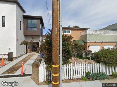
2003 Graham Ave Redondo Beach, CA 90278
North Redondo Beach NeighborhoodEstimated Value: $1,452,000 - $2,161,000
5
Beds
3
Baths
2,804
Sq Ft
$645/Sq Ft
Est. Value
About This Home
This home is located at 2003 Graham Ave, Redondo Beach, CA 90278 and is currently estimated at $1,809,707, approximately $645 per square foot. 2003 Graham Ave is a home located in Los Angeles County with nearby schools including Lincoln Elementary School, Adams Middle School, and Redondo Union High School.
Ownership History
Date
Name
Owned For
Owner Type
Purchase Details
Closed on
Sep 11, 2024
Sold by
Milke Karen Gail
Bought by
Karen G Milke 2010 Trust and Mitchell
Current Estimated Value
Purchase Details
Closed on
Apr 28, 2010
Sold by
Milke Karen G
Bought by
Milke Karen G and Karen G Milke 2010 Trust
Purchase Details
Closed on
Apr 26, 2010
Sold by
Milke Raymond F
Bought by
Milke Karen G
Create a Home Valuation Report for This Property
The Home Valuation Report is an in-depth analysis detailing your home's value as well as a comparison with similar homes in the area
Home Values in the Area
Average Home Value in this Area
Purchase History
| Date | Buyer | Sale Price | Title Company |
|---|---|---|---|
| Milke Karen G | -- | None Available | |
| Milke Karen G | -- | None Available |
Source: Public Records
Mortgage History
| Date | Status | Borrower | Loan Amount |
|---|---|---|---|
| Previous Owner | Milke Raymond Fred | $196,000 | |
| Previous Owner | Milke Karen Gail | $202,400 |
Source: Public Records
Tax History Compared to Growth
Tax History
| Year | Tax Paid | Tax Assessment Tax Assessment Total Assessment is a certain percentage of the fair market value that is determined by local assessors to be the total taxable value of land and additions on the property. | Land | Improvement |
|---|---|---|---|---|
| 2024 | $5,832 | $389,489 | $158,348 | $231,141 |
| 2023 | $5,740 | $381,853 | $155,244 | $226,609 |
| 2022 | $5,581 | $374,366 | $152,200 | $222,166 |
| 2021 | $5,394 | $367,026 | $149,216 | $217,810 |
| 2020 | $5,349 | $363,263 | $147,686 | $215,577 |
| 2019 | $5,210 | $356,141 | $144,791 | $211,350 |
| 2018 | $4,991 | $349,158 | $141,952 | $207,206 |
| 2016 | $4,801 | $335,602 | $136,441 | $199,161 |
| 2015 | $4,725 | $330,562 | $134,392 | $196,170 |
| 2014 | $4,657 | $324,088 | $131,760 | $192,328 |
Source: Public Records
Map
Nearby Homes
- 2020 Graham Ave
- 2929 Green Ln
- 1922 Gates Ave Unit A
- 2700 Aviation Blvd
- 2021 Curtis Ave
- 1852 6th St
- 1907 Ernest Ave Unit B
- 3202 Green Ln
- 2205 Gates Ave Unit A
- 2117 Voorhees Ave Unit A
- 1926 Ruhland Ave Unit B
- 2018 Bataan Rd Unit A
- 1756 Voorhees Ave
- 1820 9th St
- 1827 9th St
- 1756 Ruhland Ave
- 1643 3rd St
- 2008 Mathews Ave Unit C
- 1924 Mathews Ave Unit B
- 1612 Gates Ave
- 2003 Graham Ave
- 2005 Graham Ave
- 2001 Graham Ave
- 2706 Green Ln
- 2007 Graham Ave
- 2002 Robinson St
- 2000 Robinson St
- 2004 Robinson St
- 1935 Graham Ave
- 2006 Robinson St
- 2000 Graham Ave
- 2009 Graham Ave
- 2006 Graham Ave Unit A
- 2006 Graham Ave Unit B
- 2002 Graham Ave Unit B
- 2002 Graham Ave Unit A
- 2004 Graham Ave
- 1934 Robinson St
- 2008 Robinson St
- 1933 Graham Ave