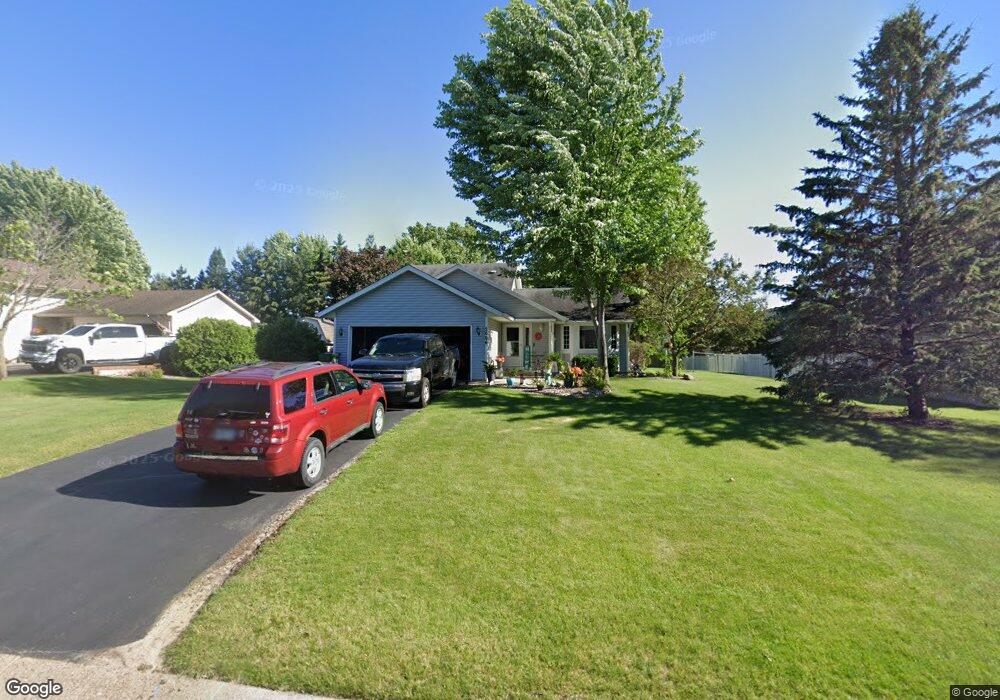
2006 134th Ln NW Andover, MN 55304
Estimated Value: $363,000 - $407,000
3
Beds
2
Baths
1,022
Sq Ft
$377/Sq Ft
Est. Value
About This Home
This home is located at 2006 134th Ln NW, Andover, MN 55304 and is currently estimated at $385,586, approximately $377 per square foot. 2006 134th Ln NW is a home located in Anoka County with nearby schools including Morris Bye Elementary School, Coon Rapids Middle School, and Coon Rapids Senior High School.
Ownership History
Date
Name
Owned For
Owner Type
Purchase Details
Closed on
Jan 18, 2002
Sold by
Ailabouni Eli A and Ailabouni Tonjia M
Bought by
Buecksler Christopher M and Buecksler Eva M
Current Estimated Value
Purchase Details
Closed on
Feb 25, 1999
Sold by
Grosz Peter G
Bought by
Ailsbouni Eli and Ailsbouni Tonja
Create a Home Valuation Report for This Property
The Home Valuation Report is an in-depth analysis detailing your home's value as well as a comparison with similar homes in the area
Home Values in the Area
Average Home Value in this Area
Purchase History
| Date | Buyer | Sale Price | Title Company |
|---|---|---|---|
| Buecksler Christopher M | $173,000 | -- | |
| Ailsbouni Eli | $135,000 | -- |
Source: Public Records
Tax History Compared to Growth
Tax History
| Year | Tax Paid | Tax Assessment Tax Assessment Total Assessment is a certain percentage of the fair market value that is determined by local assessors to be the total taxable value of land and additions on the property. | Land | Improvement |
|---|---|---|---|---|
| 2025 | $3,285 | $352,500 | $121,500 | $231,000 |
| 2024 | $3,285 | $330,300 | $105,300 | $225,000 |
| 2023 | $3,007 | $331,900 | $102,200 | $229,700 |
| 2022 | $2,787 | $328,100 | $97,800 | $230,300 |
| 2021 | $2,628 | $267,600 | $82,000 | $185,600 |
| 2020 | $2,679 | $248,200 | $71,300 | $176,900 |
| 2019 | $2,481 | $245,300 | $71,300 | $174,000 |
| 2018 | $2,391 | $224,600 | $0 | $0 |
| 2017 | $2,114 | $213,300 | $0 | $0 |
| 2016 | $2,214 | $190,600 | $0 | $0 |
| 2015 | $2,102 | $190,600 | $63,100 | $127,500 |
| 2014 | -- | $160,900 | $45,000 | $115,900 |
Source: Public Records
Map
Nearby Homes
- 2115 134th Ave NW
- 13519 Partridge Cir NW
- 13624 Partridge Cir NW
- 13416 Swallow St NW
- 1776 133rd Ave NW
- 1687 131st Ln NW
- 2315 131st Ave NW
- 1879 128th Ave NW
- 12979 Killdeer St NW
- 1920 128th Ave NW
- 13182 Crane St NW
- 13208 Zion St NW
- 13078 Crane St NW
- 12759 Ibis St NW
- 12720 Ibis St NW
- 2536 131st Ave NW
- 1520 129th Ave NW
- 2743 134th Ln NW
- 1568 140th Ln NW
- 12597 Thrush St NW
- 2020 134th Ln NW
- 1994 134th Ln NW
- 13409 Nightingale St NW
- 1982 134th Ln NW
- 2005 134th Ln NW
- 13389 Nightingale St NW
- 2031 134th Ln NW
- 1993 134th Ln NW
- 1983 134th Ave NW
- 13398 Martin St NW
- 1970 134th Ln NW
- 13440 Nightingale St NW
- 1981 134th Ln NW
- 1971 134th Ave NW
- 13426 Nightingale St NW
- 13410 Nightingale St NW
- 13369 Nightingale St NW
- 13382 Martin St NW
- 13390 Nightingale St NW
- 1958 134th Ln NW