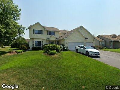
2027 Chester St Shakopee, MN 55379
Estimated Value: $477,000 - $538,000
4
Beds
3
Baths
2,327
Sq Ft
$213/Sq Ft
Est. Value
About This Home
This home is located at 2027 Chester St, Shakopee, MN 55379 and is currently estimated at $495,294, approximately $212 per square foot. 2027 Chester St is a home located in Scott County with nearby schools including Sun Path Elementary School, Shakopee West Middle School, and Shakopee Senior High School.
Ownership History
Date
Name
Owned For
Owner Type
Purchase Details
Closed on
Feb 29, 2000
Sold by
First Residential Homes Inc
Bought by
Dussik David P and Dussik Cathy L
Current Estimated Value
Purchase Details
Closed on
May 27, 1999
Sold by
Pheasant Run Of Shakopee L L P
Bought by
First Residential Homes Inc
Create a Home Valuation Report for This Property
The Home Valuation Report is an in-depth analysis detailing your home's value as well as a comparison with similar homes in the area
Home Values in the Area
Average Home Value in this Area
Purchase History
| Date | Buyer | Sale Price | Title Company |
|---|---|---|---|
| Dussik David P | $240,000 | -- | |
| First Residential Homes Inc | $45,400 | -- |
Source: Public Records
Mortgage History
| Date | Status | Borrower | Loan Amount |
|---|---|---|---|
| Open | Dussik David P | $284,000 | |
| Closed | Dussik Cathy L | $33,500 | |
| Closed | Dussik David P | $268,000 | |
| Closed | Dussik Cathy L | $314,827 | |
| Closed | Dussik David P | $81,500 | |
| Closed | First Residential Homes Inc | -- |
Source: Public Records
Tax History Compared to Growth
Tax History
| Year | Tax Paid | Tax Assessment Tax Assessment Total Assessment is a certain percentage of the fair market value that is determined by local assessors to be the total taxable value of land and additions on the property. | Land | Improvement |
|---|---|---|---|---|
| 2025 | $4,400 | $445,700 | $144,100 | $301,600 |
| 2024 | $4,400 | $450,100 | $144,100 | $306,000 |
| 2023 | $4,654 | $410,800 | $138,500 | $272,300 |
| 2022 | $4,238 | $426,400 | $157,400 | $269,000 |
| 2021 | $3,834 | $337,800 | $121,700 | $216,100 |
| 2020 | $4,180 | $334,000 | $116,700 | $217,300 |
| 2019 | $4,274 | $320,700 | $103,700 | $217,000 |
| 2018 | $4,788 | $0 | $0 | $0 |
| 2016 | $4,632 | $0 | $0 | $0 |
| 2014 | -- | $0 | $0 | $0 |
Source: Public Records
Map
Nearby Homes
- 2179 Ponds Way
- 2330 Ponds Way
- 2052 Wilhelm Ct
- 2374 Thrush St
- 1986 Mathias Rd
- 1815 Mooers Ave
- 1938 Ormond Dr
- 1780 Quail Dr
- 2127 Ormond Dr
- 2726 Green Ash Ave
- 2734 Green Ash Ave
- 2749 Green Ash Ave
- 2718 Green Ash Ave
- 2704 Aspen Dr
- 2606 Green Ash Ave
- 2940 Tiflawn Ct
- 2907 Asarum Ct
- 2909 Molina St
- 1874 Pintail Ave
- 2230 Downing Ave
- 2027 Chester St
- 2041 Chester St
- 2028 Pheasant Run St
- 2020 Pheasant Run St
- 2032 Pheasant Run St
- 2049 Chester St
- 2022 Chester St
- 2030 Chester St
- 2038 Pheasant Run St
- 2011 Chester Ct
- 2038 Chester St
- 2014 Chester Ct
- 2057 Chester St
- 2016 Pheasant Run St
- 2046 Chester St
- 2044 Pheasant Run St
- 2003 Chester Ct
- 2065 Chester St
- 2054 Chester St
- 2025 Pheasant Run St