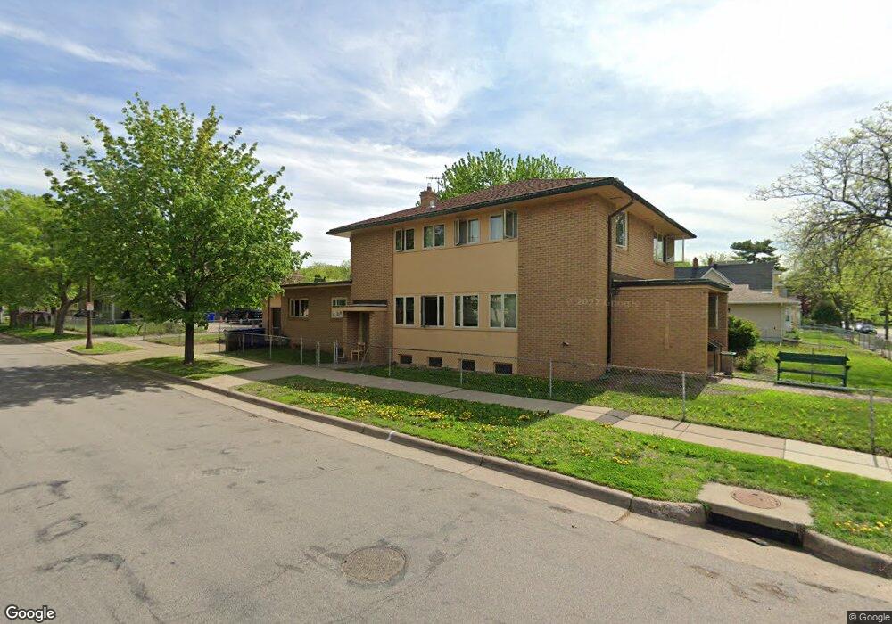
203 Robie St E St. Paul, MN 55107
West Side NeighborhoodEstimated Value: $378,000 - $484,000
6
Beds
3
Baths
3,258
Sq Ft
$129/Sq Ft
Est. Value
About This Home
This home is located at 203 Robie St E, St. Paul, MN 55107 and is currently estimated at $420,667, approximately $129 per square foot. 203 Robie St E is a home located in Ramsey County with nearby schools including Riverview West Side School of Excellence, Cherokee Heights Elementary School, and Humboldt Secondary School.
Ownership History
Date
Name
Owned For
Owner Type
Purchase Details
Closed on
Mar 1, 2016
Sold by
Younes George George
Current Estimated Value
Purchase Details
Closed on
Feb 27, 2016
Sold by
Younes George B and Younes Susan K
Bought by
A & M Rentals Llc
Purchase Details
Closed on
May 27, 2014
Sold by
Zaidan Bishop A Elias
Bought by
Younes George
Create a Home Valuation Report for This Property
The Home Valuation Report is an in-depth analysis detailing your home's value as well as a comparison with similar homes in the area
Home Values in the Area
Average Home Value in this Area
Purchase History
| Date | Buyer | Sale Price | Title Company |
|---|---|---|---|
| -- | -- | -- | |
| A & M Rentals Llc | -- | None Available | |
| Younes George | $231,818 | Dca Title |
Source: Public Records
Tax History Compared to Growth
Tax History
| Year | Tax Paid | Tax Assessment Tax Assessment Total Assessment is a certain percentage of the fair market value that is determined by local assessors to be the total taxable value of land and additions on the property. | Land | Improvement |
|---|---|---|---|---|
| 2025 | $5,124 | $399,900 | $45,000 | $354,900 |
| 2023 | $5,124 | $335,200 | $27,900 | $307,300 |
| 2022 | $4,868 | $316,100 | $27,900 | $288,200 |
| 2021 | $4,038 | $304,500 | $27,900 | $276,600 |
| 2020 | $4,282 | $261,000 | $27,900 | $233,100 |
| 2019 | $4,320 | $257,600 | $27,900 | $229,700 |
| 2018 | $3,864 | $256,000 | $27,900 | $228,100 |
| 2017 | $3,588 | $235,400 | $27,900 | $207,500 |
| 2016 | $3,896 | $0 | $0 | $0 |
| 2015 | $3,608 | $236,400 | $27,900 | $208,500 |
| 2014 | $52 | $0 | $0 | $0 |
Source: Public Records
Map
Nearby Homes
- 260 Winifred St E
- 568 State St Unit A
- 273 Winifred St E
- 435 Greenwood Ave
- 303 Cesar Chavez St
- 439 Clinton Ave
- 196 Baker St E
- 131 Delos St E
- 277 Morton St E
- 300 Baker St E
- 383 Clinton Ave
- 66 Stevens St E
- 182 Morton St E
- 332 Morton St E
- 234 Sidney St E
- 751 Woodbury St
- 293 Curtice St E
- 767 Robert St S
- 452 Page St E
- 369 Belvidere St E Unit 369B
- 203 Robie St E
- 213 Robie St E
- 492 Ada St
- 210 Winifred St E
- 219 Robie St E
- 214 Winifred St E
- 210 210 Winifred St E
- 210 210 Winifred-Street-e
- 206 Robie St E
- 210 Robie St E
- 216 Winifred St E
- 223 Robie St E
- 214 Robie St E
- 222 222 Robie St E
- 222 222 Robie-Street-e
- 222 Winifred St E
- 222 Winifred St E
- 218 Robie St E
- 225 Robie St E
- 214 214 Winifred St E