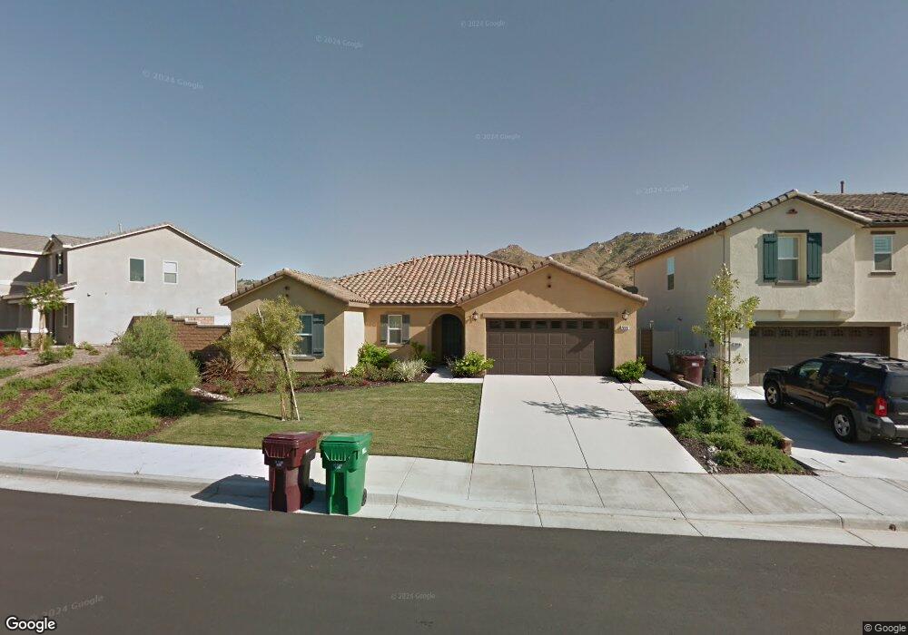
20597 Pitchfork Dr Riverside, CA 92507
Highgrove NeighborhoodEstimated Value: $635,073 - $734,000
3
Beds
2
Baths
1,854
Sq Ft
$374/Sq Ft
Est. Value
About This Home
This home is located at 20597 Pitchfork Dr, Riverside, CA 92507 and is currently estimated at $693,518, approximately $374 per square foot. 20597 Pitchfork Dr is a home with nearby schools including Highgrove Elementary School, University Heights Middle School, and John W. North High School.
Ownership History
Date
Name
Owned For
Owner Type
Purchase Details
Closed on
Feb 10, 2015
Sold by
Kb Home Coastal Inc
Bought by
Artuz Christel Marie
Current Estimated Value
Home Financials for this Owner
Home Financials are based on the most recent Mortgage that was taken out on this home.
Original Mortgage
$336,093
Outstanding Balance
$255,893
Interest Rate
3.6%
Mortgage Type
New Conventional
Estimated Equity
$437,625
Create a Home Valuation Report for This Property
The Home Valuation Report is an in-depth analysis detailing your home's value as well as a comparison with similar homes in the area
Home Values in the Area
Average Home Value in this Area
Purchase History
| Date | Buyer | Sale Price | Title Company |
|---|---|---|---|
| Artuz Christel Marie | $354,000 | First American Title |
Source: Public Records
Mortgage History
| Date | Status | Borrower | Loan Amount |
|---|---|---|---|
| Open | Artuz Christel Marie | $336,093 |
Source: Public Records
Tax History Compared to Growth
Tax History
| Year | Tax Paid | Tax Assessment Tax Assessment Total Assessment is a certain percentage of the fair market value that is determined by local assessors to be the total taxable value of land and additions on the property. | Land | Improvement |
|---|---|---|---|---|
| 2025 | $7,482 | $425,448 | $144,218 | $281,230 |
| 2023 | $7,482 | $408,929 | $138,619 | $270,310 |
| 2022 | $7,178 | $400,911 | $135,901 | $265,010 |
| 2021 | $7,148 | $393,051 | $133,237 | $259,814 |
| 2020 | $7,052 | $389,021 | $131,871 | $257,150 |
| 2019 | $6,967 | $381,394 | $129,286 | $252,108 |
| 2018 | $6,828 | $373,916 | $126,751 | $247,165 |
| 2017 | $6,818 | $366,585 | $124,266 | $242,319 |
| 2016 | $6,498 | $359,398 | $121,830 | $237,568 |
| 2015 | $3,497 | $74,998 | $74,998 | $0 |
Source: Public Records
Map
Nearby Homes
- 20692 Pitchfork Dr
- 20813 Spring St
- 7404 Blue Oak Rd
- 20349 Barrel Rd
- 7075 Laban Ln
- 20107 Curaco Ct
- 7736 Citron Cir
- 22740 Main St
- 7584 Citrusmoon Ct
- 20046 Red Rock Ave
- 7864 Raincross Ct
- 145 Carlota Way
- 22710 Robin Way
- 19872 Season Grove Dr
- 196 Owetzal Ln
- 7576 Wagon Trail Rd
- 19919 Sunkissed Ridge Dr
- 340 Pelican Dr
- 125 Brian Way
- 21152 Mill Valley Ct
- 20581 Pitchfork Dr
- 20605 Pitchfork Dr
- 20600 Pronghorn Ct
- 20569 Pitchfork Dr
- 20629 Pitchfork Dr
- 20584 Pitchfork Dr
- 20572 Pitchfork Dr
- 20596 Pitchfork Dr
- 20624 Pronghorn Ct
- 20597 Pronghorn Ct
- 20604 Pitchfork Dr
- 20545 Pitchfork Dr
- 20608 Pitchfork Dr
- 20653 Pitchfork Dr
- 20620 Pitchfork Dr
- 20560 Pitchfork Dr
- 20609 Pronghorn Ct
- 20636 Pronghorn Ct
- 20665 Pitchfork Dr
- 20621 Pronghorn Ct