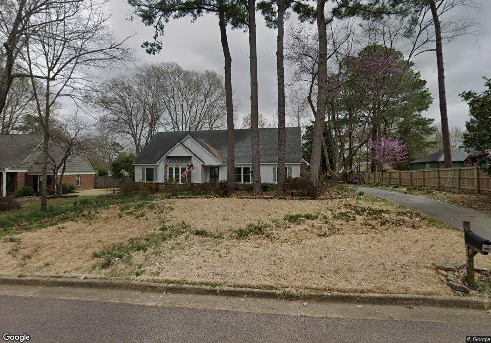
2082 Cranbrook Dr Germantown, TN 38138
Estimated Value: $335,000 - $392,000
4
Beds
2
Baths
3,646
Sq Ft
$101/Sq Ft
Est. Value
About This Home
This home is located at 2082 Cranbrook Dr, Germantown, TN 38138 and is currently estimated at $368,300, approximately $101 per square foot. 2082 Cranbrook Dr is a home located in Shelby County with nearby schools including Farmington Elementary School, Houston Middle School, and Houston High School.
Ownership History
Date
Name
Owned For
Owner Type
Purchase Details
Closed on
Apr 24, 2023
Sold by
Losier Paul W and Losier Sue T
Bought by
Mcguire Myles
Current Estimated Value
Home Financials for this Owner
Home Financials are based on the most recent Mortgage that was taken out on this home.
Original Mortgage
$363,298
Outstanding Balance
$353,201
Interest Rate
6.6%
Mortgage Type
Construction
Estimated Equity
$15,099
Purchase Details
Closed on
Mar 31, 1999
Sold by
Kennedy William A and Kennedy Mary E
Bought by
Losier Paul W and Losier Sue T
Home Financials for this Owner
Home Financials are based on the most recent Mortgage that was taken out on this home.
Original Mortgage
$149,800
Interest Rate
6.82%
Purchase Details
Closed on
Jul 27, 1994
Bought by
Kennedy William A and Kennedy Mary E
Create a Home Valuation Report for This Property
The Home Valuation Report is an in-depth analysis detailing your home's value as well as a comparison with similar homes in the area
Home Values in the Area
Average Home Value in this Area
Purchase History
| Date | Buyer | Sale Price | Title Company |
|---|---|---|---|
| Mcguire Myles | $370,000 | Tri State Title | |
| Losier Paul W | $187,300 | Security Title Company | |
| Kennedy William A | $126,500 | -- |
Source: Public Records
Mortgage History
| Date | Status | Borrower | Loan Amount |
|---|---|---|---|
| Open | Mcguire Myles | $363,298 | |
| Previous Owner | Losier Paul W | $149,800 | |
| Closed | Losier Paul W | $18,700 |
Source: Public Records
Tax History Compared to Growth
Tax History
| Year | Tax Paid | Tax Assessment Tax Assessment Total Assessment is a certain percentage of the fair market value that is determined by local assessors to be the total taxable value of land and additions on the property. | Land | Improvement |
|---|---|---|---|---|
| 2025 | $2,608 | $87,625 | $19,700 | $67,925 |
| 2024 | $2,608 | $76,925 | $12,100 | $64,825 |
| 2023 | $4,022 | $76,925 | $12,100 | $64,825 |
| 2022 | $3,895 | $76,925 | $12,100 | $64,825 |
| 2021 | $3,945 | $76,925 | $12,100 | $64,825 |
| 2020 | $3,515 | $58,575 | $12,100 | $46,475 |
| 2019 | $2,372 | $58,575 | $12,100 | $46,475 |
| 2018 | $2,372 | $58,575 | $12,100 | $46,475 |
| 2017 | $2,407 | $58,575 | $12,100 | $46,475 |
| 2016 | $2,387 | $54,625 | $0 | $0 |
| 2014 | $2,387 | $54,625 | $0 | $0 |
Source: Public Records
Map
Nearby Homes
- 2062 Bensonwood Dr
- 2133 Cranbrook Dr
- 8043 Farmington Blvd
- 7956 Woodford Ln
- 2057 Sonning Dr
- 1914 Malabar Dr
- 2155 Wickersham Ln
- 1847 Gray Ridge Cove Unit 2
- 1899 River Valley Dr
- 1911 Brierbrook Rd
- 1838 Fernspring Cove Unit 36
- 2211 Wickersham Ln
- 1841 Eagle Branch Cove Unit 1
- 1843 Eagle Branch Cove Unit 50
- 2279 Pinnacle Creek Dr
- 1822 Dragonfly Cove Unit 79
- 7924 Signature Cove
- 2129 Gorham Place
- 1824 Crossflower Cove Unit 94
- 1836 Kimbrough Rd
- 2064 Cranbrook Dr
- 8034 Cavershamwood Ln
- 2085 Thorncroft Dr
- 2075 Thorncroft Dr
- 8060 Cavershamwood Ln
- 2079 Cranbrook Dr
- 2054 Cranbrook Dr
- 2065 Thorncroft Dr
- 2091 Cranbrook Dr
- 2052 Cranbrook Dr
- 8033 Cavershamwood Ln
- 2057 Cranbrook Dr
- 8043 Cavershamwood Ln
- 2055 Thorncroft Dr
- 8053 Cavershamwood Ln
- 2072 Bensonwood Dr
- 2084 Thorncroft Dr
- 2084 Bensonwood Dr
- 2072 Thorncroft Dr
- 8076 Cavershamwood Ln