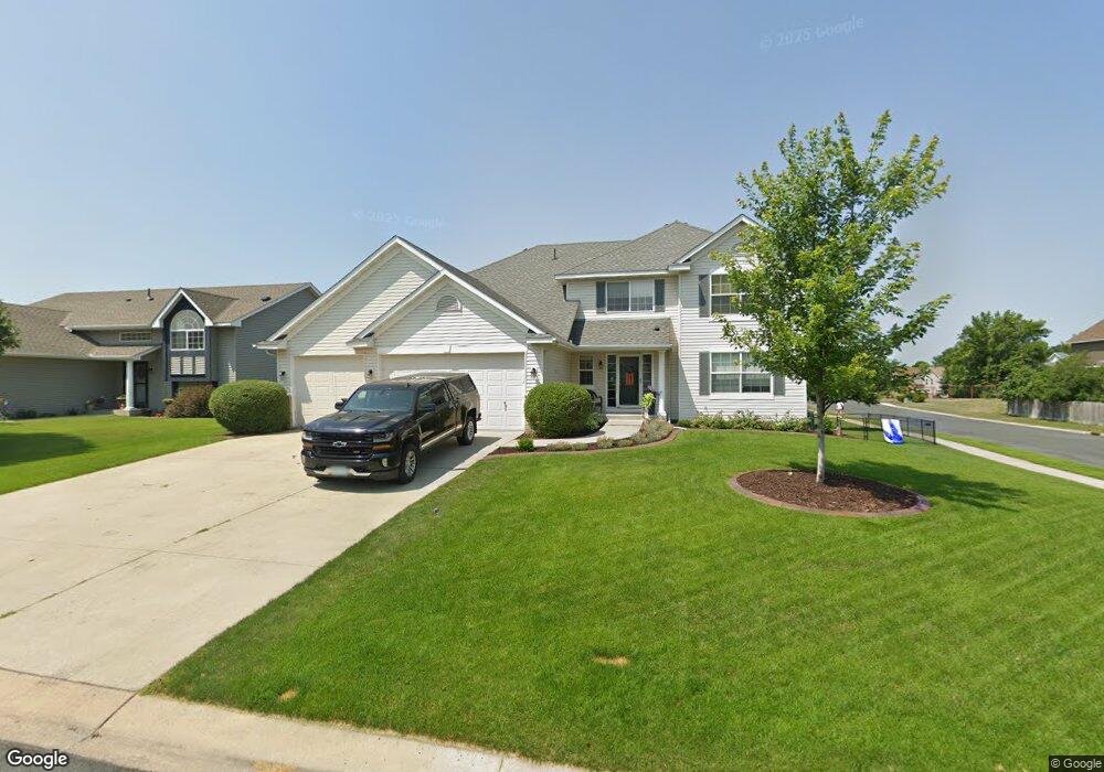
2082 Ormond Dr Shakopee, MN 55379
Estimated Value: $497,192 - $593,000
3
Beds
3
Baths
2,844
Sq Ft
$184/Sq Ft
Est. Value
About This Home
This home is located at 2082 Ormond Dr, Shakopee, MN 55379 and is currently estimated at $523,548, approximately $184 per square foot. 2082 Ormond Dr is a home located in Scott County with nearby schools including Sun Path Elementary School, Shakopee West Middle School, and Shakopee Senior High School.
Ownership History
Date
Name
Owned For
Owner Type
Purchase Details
Closed on
Jun 30, 2020
Sold by
Hanowski Sreven and Hanowski Jennifer
Bought by
Henstein Aubrey and Henstein Paul
Current Estimated Value
Home Financials for this Owner
Home Financials are based on the most recent Mortgage that was taken out on this home.
Original Mortgage
$251,940
Outstanding Balance
$223,404
Interest Rate
3.1%
Mortgage Type
New Conventional
Estimated Equity
$300,144
Purchase Details
Closed on
Jun 16, 2003
Sold by
Key-Land Homes
Bought by
Hanowski Steven and Sorenson Jennifer Ann
Create a Home Valuation Report for This Property
The Home Valuation Report is an in-depth analysis detailing your home's value as well as a comparison with similar homes in the area
Home Values in the Area
Average Home Value in this Area
Purchase History
| Date | Buyer | Sale Price | Title Company |
|---|---|---|---|
| Henstein Aubrey | $419,900 | Trademark Title Services Inc | |
| Hanowski Steven | $380,484 | -- | |
| Key-Land Homes | $81,861 | -- |
Source: Public Records
Mortgage History
| Date | Status | Borrower | Loan Amount |
|---|---|---|---|
| Open | Henstein Aubrey | $251,940 |
Source: Public Records
Tax History
| Year | Tax Paid | Tax Assessment Tax Assessment Total Assessment is a certain percentage of the fair market value that is determined by local assessors to be the total taxable value of land and additions on the property. | Land | Improvement |
|---|---|---|---|---|
| 2025 | $4,988 | $471,300 | $130,000 | $341,300 |
| 2024 | $5,270 | $476,100 | $130,000 | $346,100 |
| 2023 | $5,528 | $492,200 | $131,500 | $360,700 |
| 2022 | $5,046 | $505,700 | $149,500 | $356,200 |
| 2021 | $4,592 | $397,200 | $115,900 | $281,300 |
| 2020 | $5,060 | $394,100 | $111,200 | $282,900 |
| 2019 | $5,218 | $381,600 | $98,800 | $282,800 |
| 2018 | $4,576 | $0 | $0 | $0 |
| 2016 | $4,498 | $0 | $0 | $0 |
| 2014 | -- | $0 | $0 | $0 |
Source: Public Records
Map
Nearby Homes
- 2577 Green Ash Ave
- 2354 Ponds Way
- 2554 Green Ash Ave
- 2578 Green Ash Ave
- 2566 Green Ash Ave
- 2542 Green Ash Ave
- 2468 Valley View Rd
- 2530 Green Ash Ave
- 2584 Aspen Ct
- 2697 Aspen Dr
- 2624 Aspen Dr
- 2642 Aspen Dr
- 2660 Aspen Dr
- 2542 Mathias Rd
- 2694 Aspen Dr
- 2397 Rock Elm Rd
- 3432 Baneberry Cir
- 1976 Alden Ave
- 2113 Sandhill Dr
- 1832 Alden Ave
- 2090 Ormond Dr
- 2081 Williams St
- 2089 Williams St
- 2098 Ormond Dr
- 2087 Ormond Dr
- 2097 Williams St
- 2073 Williams St
- 2095 Ormond Dr
- 2079 Ormond Dr
- 2106 Ormond Dr
- 2066 Ormond Dr
- 2103 Ormond Dr
- 2105 Williams St
- 2065 Williams St
- 2071 Ormond Dr
- 2111 Ormond Dr
- 2086 Williams St
- 2078 Williams St
- 2058 Ormond Dr
- 2114 Ormond Dr
Your Personal Tour Guide
Ask me questions while you tour the home.