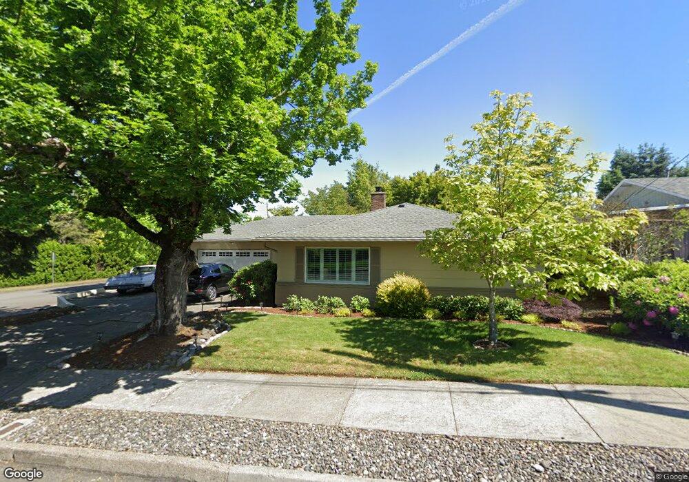
20903 SE Burnside Ct Gresham, OR 97030
Northwest Gresham NeighborhoodEstimated Value: $437,000 - $461,000
3
Beds
2
Baths
1,677
Sq Ft
$269/Sq Ft
Est. Value
About This Home
This home is located at 20903 SE Burnside Ct, Gresham, OR 97030 and is currently estimated at $451,712, approximately $269 per square foot. 20903 SE Burnside Ct is a home located in Multnomah County with nearby schools including North Gresham Elementary School, Clear Creek Middle School, and Gresham High School.
Ownership History
Date
Name
Owned For
Owner Type
Purchase Details
Closed on
Apr 19, 2005
Sold by
Bush Teresa J
Bought by
Rebollo James F and Rebollo Linda N
Current Estimated Value
Home Financials for this Owner
Home Financials are based on the most recent Mortgage that was taken out on this home.
Original Mortgage
$153,200
Outstanding Balance
$78,849
Interest Rate
5.84%
Mortgage Type
Purchase Money Mortgage
Estimated Equity
$372,863
Purchase Details
Closed on
Feb 29, 1996
Sold by
Bush Gary Michael
Bought by
Bush Teresa J
Create a Home Valuation Report for This Property
The Home Valuation Report is an in-depth analysis detailing your home's value as well as a comparison with similar homes in the area
Home Values in the Area
Average Home Value in this Area
Purchase History
| Date | Buyer | Sale Price | Title Company |
|---|---|---|---|
| Rebollo James F | $191,500 | Transnation Title Agency Or | |
| Bush Teresa J | -- | -- |
Source: Public Records
Mortgage History
| Date | Status | Borrower | Loan Amount |
|---|---|---|---|
| Open | Rebollo James F | $153,200 | |
| Closed | Rebollo James F | $38,300 |
Source: Public Records
Tax History
| Year | Tax Paid | Tax Assessment Tax Assessment Total Assessment is a certain percentage of the fair market value that is determined by local assessors to be the total taxable value of land and additions on the property. | Land | Improvement |
|---|---|---|---|---|
| 2025 | $4,724 | $232,140 | -- | -- |
| 2024 | $4,522 | $225,380 | -- | -- |
| 2023 | $4,120 | $218,820 | $0 | $0 |
| 2022 | $4,005 | $212,450 | $0 | $0 |
| 2021 | $3,904 | $206,270 | $0 | $0 |
| 2020 | $3,673 | $200,270 | $0 | $0 |
| 2019 | $3,577 | $194,440 | $0 | $0 |
| 2018 | $3,411 | $188,780 | $0 | $0 |
| 2017 | $3,273 | $183,290 | $0 | $0 |
| 2016 | $2,885 | $177,960 | $0 | $0 |
Source: Public Records
Map
Nearby Homes
- 21033 SE Clay Ct
- 2013 NW Bella Vista Dr
- 1811 NW 19th St
- 1861 NW Wonderview Ave
- 21016 SE Stark St Unit 71
- 21016 SE Stark St Unit 69
- 1596 NW Riverview Ave
- 21532 SE Alder St
- 21260 SE Stark St
- 21400 SE Stark St Unit 2
- 1387 NW Riverview Ave Unit 14B
- 209 SE 214th Ave
- 70 NW Birdsdale Ave
- 21525 SE Oak St
- 1325 NW 9th St
- 132 SE 214th Ave
- 21553 SE Ankeny Terrace
- 0 SE Burnside St
- 970 NW Wonderview Ct Unit 980
- 19776 SE Stark St Unit 147
- 20915 SE Burnside Ct
- 20841 SE Burnside Ct
- 1350 SE 209th Ave
- 20929 SE Burnside Ct
- 1401 SE 210th Ave
- 1343 SE 209th Ave
- 1404 SE 209th Ave
- 20817 SE Burnside Ct
- 21007 SE Burnside Ct
- 21018 SE Main Dr
- 21010 SE Main Dr
- 1401 SE 209th Ave
- 1415 SE 210th Ave
- 21030 SE Main Dr
- 1342 SE 208th Ave
- 20948 SE Main Dr
- 1325 SE 211th Ave
- 1402 SE 210th Ave
- 20805 SE Burnside Ct
- 21021 SE Burnside Ct
Your Personal Tour Guide
Ask me questions while you tour the home.