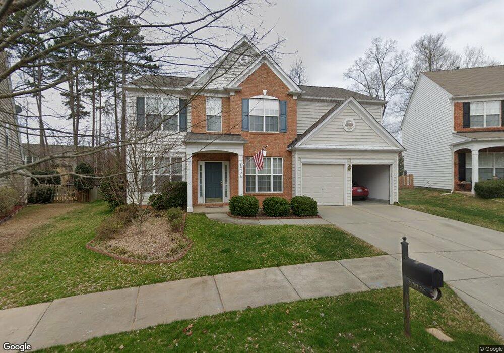
20926 Windshore Ave Cornelius, NC 28031
Estimated Value: $452,000 - $559,000
4
Beds
3
Baths
2,240
Sq Ft
$229/Sq Ft
Est. Value
About This Home
This home is located at 20926 Windshore Ave, Cornelius, NC 28031 and is currently estimated at $513,515, approximately $229 per square foot. 20926 Windshore Ave is a home located in Mecklenburg County with nearby schools including Cornelius Elementary School, Bailey Middle School, and William Amos Hough High School.
Ownership History
Date
Name
Owned For
Owner Type
Purchase Details
Closed on
May 13, 2005
Sold by
Cassanelli Frank and Cassanelli Lisa M
Bought by
Berry Derryl G and Berry Jacqueline
Current Estimated Value
Home Financials for this Owner
Home Financials are based on the most recent Mortgage that was taken out on this home.
Original Mortgage
$153,600
Interest Rate
5.98%
Mortgage Type
Fannie Mae Freddie Mac
Purchase Details
Closed on
Dec 5, 2003
Sold by
Pulte Home Corp
Bought by
Cassanelli Frank and Cassanelli Lisa M
Home Financials for this Owner
Home Financials are based on the most recent Mortgage that was taken out on this home.
Original Mortgage
$167,382
Interest Rate
6.07%
Mortgage Type
Purchase Money Mortgage
Create a Home Valuation Report for This Property
The Home Valuation Report is an in-depth analysis detailing your home's value as well as a comparison with similar homes in the area
Home Values in the Area
Average Home Value in this Area
Purchase History
| Date | Buyer | Sale Price | Title Company |
|---|---|---|---|
| Berry Derryl G | $192,000 | -- | |
| Cassanelli Frank | $186,000 | -- |
Source: Public Records
Mortgage History
| Date | Status | Borrower | Loan Amount |
|---|---|---|---|
| Closed | Berry Derryl G | $153,600 | |
| Previous Owner | Cassanelli Frank | $167,382 |
Source: Public Records
Tax History
| Year | Tax Paid | Tax Assessment Tax Assessment Total Assessment is a certain percentage of the fair market value that is determined by local assessors to be the total taxable value of land and additions on the property. | Land | Improvement |
|---|---|---|---|---|
| 2025 | -- | $442,700 | $95,000 | $347,700 |
| 2024 | -- | $442,700 | $95,000 | $347,700 |
| 2023 | $2,282 | $442,700 | $95,000 | $347,700 |
| 2022 | $2,282 | $272,000 | $85,000 | $187,000 |
| 2021 | $2,282 | $272,000 | $85,000 | $187,000 |
| 2020 | $2,279 | $271,700 | $85,000 | $186,700 |
| 2019 | $2,313 | $271,700 | $85,000 | $186,700 |
| 2018 | $2,167 | $198,400 | $40,000 | $158,400 |
| 2017 | $2,148 | $198,400 | $40,000 | $158,400 |
| 2016 | $2,145 | $198,400 | $40,000 | $158,400 |
| 2015 | $2,112 | $198,400 | $40,000 | $158,400 |
| 2014 | $2,110 | $0 | $0 | $0 |
Source: Public Records
Map
Nearby Homes
- 20127 Beard St
- 20397 Queens St
- 20396 Queens St
- 20392 Queens St
- 21024 Cornelius St Unit 103
- 21024 Cornelius St Unit 303
- 21024 Cornelius St Unit 203
- 21024 Cornelius St Unit 301
- 21024 Cornelius St Unit 404
- 21233 Cornelius St
- 20230 N Main St
- 20724 Catawba Ave Unit 11
- 19901 Burton Ln
- 20232 Zion Ave
- 20128 Zion Ave
- 19512 Meridian St
- 335 Catawba Ave
- 19449 Smith Cir
- 520 Catawba Ave
- Lot 9 Meridian St Unit 9
- 20922 Windshore Ave
- 20930 Windshore Ave
- 18207 Harbor Mist Rd
- 18201 Harbor Mist Rd
- 18213 Harbor Mist Rd
- 18127 Harbor Mist Rd
- 20934 Windshore Ave
- 20916 Windshore Ave
- 18121 Harbor Mist Rd
- 18219 Harbor Mist Rd
- 18113 Harbor Mist Rd
- 20912 Windshore Ave
- 18109 Harbor Mist Rd
- 18204 Harbor Mist Rd
- 18200 Harbor Mist Rd
- 18208 Harbor Mist Rd
- 20906 Windshore Ave
- 18128 Harbor Mist Rd
- 20102 Beard St
- 18101 Harbor Mist Rd
Your Personal Tour Guide
Ask me questions while you tour the home.