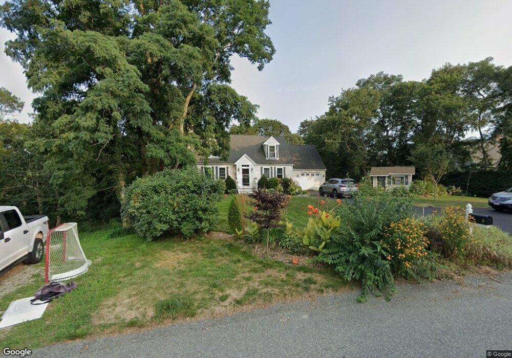
21 Meadow Haven Dr Mashpee, MA 02649
Estimated Value: $626,192 - $692,000
3
Beds
2
Baths
1,566
Sq Ft
$423/Sq Ft
Est. Value
About This Home
This home is located at 21 Meadow Haven Dr, Mashpee, MA 02649 and is currently estimated at $662,298, approximately $422 per square foot. 21 Meadow Haven Dr is a home located in Barnstable County with nearby schools including Kenneth C. Coombs School, Quashnet School, and Mashpee Middle School.
Ownership History
Date
Name
Owned For
Owner Type
Purchase Details
Closed on
Dec 30, 2004
Sold by
Swanson David A and Swanson Lorraine C
Bought by
Lucich Krista M and Lucich Michael R
Current Estimated Value
Home Financials for this Owner
Home Financials are based on the most recent Mortgage that was taken out on this home.
Original Mortgage
$57,000
Interest Rate
5.73%
Mortgage Type
Purchase Money Mortgage
Purchase Details
Closed on
May 7, 1993
Sold by
Keene Ellsworth G and Keene Cynthia
Bought by
Swanson David A and Swanson Lorraine C
Purchase Details
Closed on
Jun 26, 1992
Sold by
Rockland Trust Co
Bought by
Keene Ellsworth G and Keene Cynthia
Purchase Details
Closed on
Jan 13, 1992
Sold by
Pomeroy Tr James F
Bought by
Rockland Trust Co
Create a Home Valuation Report for This Property
The Home Valuation Report is an in-depth analysis detailing your home's value as well as a comparison with similar homes in the area
Purchase History
| Date | Buyer | Sale Price | Title Company |
|---|---|---|---|
| Lucich Krista M | $320,000 | -- | |
| Swanson David A | $111,900 | -- | |
| Keene Ellsworth G | $25,000 | -- | |
| Rockland Trust Co | $30,000 | -- |
Source: Public Records
Mortgage History
| Date | Status | Borrower | Loan Amount |
|---|---|---|---|
| Open | Rockland Trust Co | $277,000 | |
| Closed | Lucich Krista M | $57,000 | |
| Previous Owner | Rockland Trust Co | $111,005 | |
| Previous Owner | Rockland Trust Co | $95,000 |
Source: Public Records
Tax History
| Year | Tax Paid | Tax Assessment Tax Assessment Total Assessment is a certain percentage of the fair market value that is determined by local assessors to be the total taxable value of land and additions on the property. | Land | Improvement |
|---|---|---|---|---|
| 2025 | $3,610 | $545,300 | $215,400 | $329,900 |
| 2024 | $3,281 | $510,200 | $195,800 | $314,400 |
| 2023 | $3,090 | $440,800 | $186,400 | $254,400 |
| 2022 | $2,958 | $362,100 | $151,600 | $210,500 |
| 2021 | $2,886 | $318,200 | $136,500 | $181,700 |
| 2020 | $2,458 | $306,100 | $131,300 | $174,800 |
| 2019 | $2,673 | $295,400 | $131,300 | $164,100 |
| 2018 | $2,524 | $283,000 | $131,300 | $151,700 |
| 2017 | $2,470 | $268,800 | $131,300 | $137,500 |
| 2016 | $2,407 | $260,500 | $131,300 | $129,200 |
| 2015 | $2,323 | $255,000 | $131,300 | $123,700 |
| 2014 | $2,363 | $251,600 | $129,700 | $121,900 |
Source: Public Records
Map
Nearby Homes
- 75 Bob White Run
- 4 Bishops Park
- 226 Dunrobin Rd
- 16 Spring Brook Ln
- 22 Stratford Ridge Unit 22
- 1456 Santuit-Newtown Rd
- 173 Main St
- 70 Cape Dr Unit 14D
- 70 Cape Dr Unit 11D
- 70 Cape Dr Unit 11D
- 35 Claulise Ln
- 235 Main St
- 195 Falmouth Rd Unit 19F
- 195 Falmouth Rd Unit 9D
- 195 Falmouth Rd Unit 19F
- 78 Brittany Dr
- 70 Simons Rd Unit E
- 70 Simons Rd
- 15 Geraldine Rd
- 602 Putnam Ave
- 17 Meadow Haven Dr
- 25 Meadow Haven Dr
- 22 Meadow Haven Dr
- 11 Meadow Haven Dr
- 16 Meadow Haven Dr
- 29 Meadow Haven Dr
- 32 Meadow Haven Dr
- 12 Meadow Haven Dr
- 17 Main St
- 36 Meadow Haven Dr
- 13 Main St
- 5 Meadow Haven Dr
- 15 Elmwood Cir
- 23 Main St
- 4 Meadow Haven Dr
- 41 Meadow Haven Dr
- 1 Main St
- 5 Main St
- 28-=55 Main St Unit 9
- 42 Meadow Haven Dr
Your Personal Tour Guide
Ask me questions while you tour the home.