Estimated Value: $456,108 - $576,000
3
Beds
2
Baths
1,178
Sq Ft
$424/Sq Ft
Est. Value
About This Home
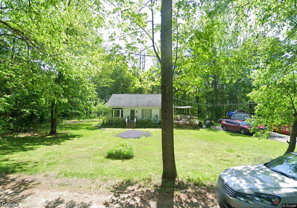
This home is located at 21 Upper Factory Rd, Dover, NH 03820 and is currently estimated at $500,027, approximately $424 per square foot. 21 Upper Factory Rd is a home located in Strafford County with nearby schools including Woodman Park School, Dover Middle School, and Dover Senior High School.
Ownership History
Date
Name
Owned For
Owner Type
Purchase Details
Closed on
Jun 2, 2006
Sold by
Donnelly Mary S
Bought by
Joyce Lisa
Current Estimated Value
Home Financials for this Owner
Home Financials are based on the most recent Mortgage that was taken out on this home.
Original Mortgage
$188,800
Interest Rate
7%
Mortgage Type
Adjustable Rate Mortgage/ARM
Create a Home Valuation Report for This Property
The Home Valuation Report is an in-depth analysis detailing your home's value as well as a comparison with similar homes in the area
Home Values in the Area
Average Home Value in this Area
Purchase History
| Date | Buyer | Sale Price | Title Company |
|---|---|---|---|
| Joyce Lisa | $236,000 | -- | |
| Joyce Lisa | $236,000 | -- |
Source: Public Records
Mortgage History
| Date | Status | Borrower | Loan Amount |
|---|---|---|---|
| Open | Joyce Lisa | $223,850 | |
| Closed | Joyce Lisa | $188,800 |
Source: Public Records
Tax History
| Year | Tax Paid | Tax Assessment Tax Assessment Total Assessment is a certain percentage of the fair market value that is determined by local assessors to be the total taxable value of land and additions on the property. | Land | Improvement |
|---|---|---|---|---|
| 2024 | $6,965 | $383,300 | $162,600 | $220,700 |
| 2023 | $6,753 | $361,100 | $149,400 | $211,700 |
| 2022 | $6,621 | $333,700 | $140,600 | $193,100 |
| 2021 | $6,310 | $290,800 | $123,000 | $167,800 |
| 2020 | $6,061 | $243,900 | $105,500 | $138,400 |
| 2019 | $5,965 | $236,800 | $101,100 | $135,700 |
| 2018 | $5,507 | $221,000 | $87,900 | $133,100 |
| 2017 | $5,394 | $208,500 | $79,100 | $129,400 |
| 2016 | $4,851 | $184,500 | $67,000 | $117,500 |
| 2015 | $4,835 | $181,700 | $67,000 | $114,700 |
| 2014 | $4,840 | $186,100 | $71,400 | $114,700 |
| 2011 | $4,532 | $180,400 | $64,700 | $115,700 |
Source: Public Records
Map
Nearby Homes
- 80 Glenwood Ave
- 126 Watson Rd
- 28 Singh Dr
- 5 Prospect St
- 0 4th St Unit 2
- 63 Sixth St
- 0 Indian Brook Rd Unit C
- 98 Silver St
- 12 Charlotte Dr Unit 5
- 47 Central Ave
- 9 Lowell Ave
- 56 Atkinson St
- Lot 0 Page Ave
- 725 Central Ave Unit 203
- 725 Central Ave Unit LL03
- 725 Central Ave Unit 301
- 725 Central Ave Unit 302
- 725 Central Ave Unit LL01
- 725 Central Ave Unit 304
- Lot 5 Emerson Ridge Unit 5
- 31 Upper Factory Rd
- 15 Upper Factory Rd
- 39 Upper Factory Rd
- 2 Mones Folly
- 129 Tolend Rd
- 119 Tolend Rd
- 135 Tolend Rd
- 137 Tolend Rd
- 125 Tolend Rd
- 47 Upper Factory Rd
- 141 Tolend Rd
- 163 Tolend Rd
- 48 Upper Factory Rd
- 115 Tolend Rd
- 3 Mones Folly
- 147 Tolend Rd
- 122 Tolend Rd
- 149 Tolend Rd
- 41 Nye Ln
- 116 Tolend Rd
Your Personal Tour Guide
Ask me questions while you tour the home.