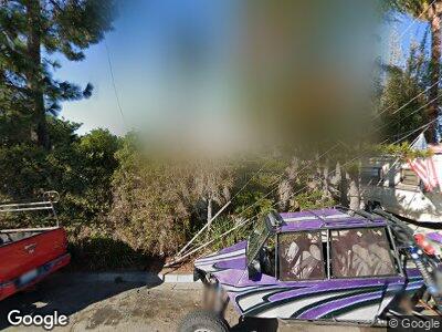
2104 Poplar Rd Oceanside, CA 92058
East Side Capistrano NeighborhoodEstimated Value: $564,000 - $703,088
1
Bed
1
Bath
600
Sq Ft
$1,077/Sq Ft
Est. Value
About This Home
This home is located at 2104 Poplar Rd, Oceanside, CA 92058 and is currently estimated at $646,022, approximately $1,076 per square foot. 2104 Poplar Rd is a home located in San Diego County with nearby schools including Mission Elementary School, Oceanside High School, and St. Mary Star Of The Sea Elementary School.
Ownership History
Date
Name
Owned For
Owner Type
Purchase Details
Closed on
Sep 26, 2024
Sold by
Carriger Mary Danielle
Bought by
Norris Family Trust and Norris
Current Estimated Value
Home Financials for this Owner
Home Financials are based on the most recent Mortgage that was taken out on this home.
Original Mortgage
$300,000
Outstanding Balance
$298,213
Interest Rate
6.08%
Mortgage Type
Seller Take Back
Estimated Equity
$349,215
Purchase Details
Closed on
May 27, 1983
Bought by
Wiederhold William B
Create a Home Valuation Report for This Property
The Home Valuation Report is an in-depth analysis detailing your home's value as well as a comparison with similar homes in the area
Home Values in the Area
Average Home Value in this Area
Purchase History
| Date | Buyer | Sale Price | Title Company |
|---|---|---|---|
| Norris Family Trust | $650,000 | Chicago Title | |
| Wiederhold William B | $44,000 | -- |
Source: Public Records
Mortgage History
| Date | Status | Borrower | Loan Amount |
|---|---|---|---|
| Open | Norris Family Trust | $300,000 |
Source: Public Records
Tax History Compared to Growth
Tax History
| Year | Tax Paid | Tax Assessment Tax Assessment Total Assessment is a certain percentage of the fair market value that is determined by local assessors to be the total taxable value of land and additions on the property. | Land | Improvement |
|---|---|---|---|---|
| 2024 | $4,535 | $408,000 | $377,400 | $30,600 |
| 2023 | $953 | $88,770 | $69,677 | $19,093 |
| 2022 | $937 | $87,030 | $68,311 | $18,719 |
| 2021 | $939 | $85,324 | $66,972 | $18,352 |
| 2020 | $911 | $84,450 | $66,286 | $18,164 |
| 2019 | $884 | $82,795 | $64,987 | $17,808 |
| 2018 | $873 | $81,172 | $63,713 | $17,459 |
| 2017 | $856 | $79,581 | $62,464 | $17,117 |
| 2016 | $826 | $78,022 | $61,240 | $16,782 |
| 2015 | $802 | $76,851 | $60,321 | $16,530 |
| 2014 | $772 | $75,347 | $59,140 | $16,207 |
Source: Public Records
Map
Nearby Homes
- 0 Poplar Rd
- 000 Poplar Rd
- 585 Lands End Way Unit 234
- 575 Lands End Way Unit 223
- 555 Lands End Way Unit 213
- 1708 Loretta St
- 2250 Crestline Dr
- 450 Stoney Point Way Unit 135
- 405 Stoney Point Way Unit 90
- 1225 Langford St
- 1408 Papin St
- 320 Isthmus Way Unit 31
- 1408 San Simeon St
- 415 Bush St
- 216 Pajama Dr
- 2845 Cottingham St
- 1320 Higgins St
- 0 Saratoga St
- 2811 Turnbull St
- 2722 Penkea Dr
- 2104 Poplar Rd
- 2055 Poplar Rd
- 2112 Poplar Rd
- 2126 Poplar Rd
- 913 Hillcrest Place
- 921 Hillcrest Place
- 911 Hillcrest Place
- 919 Hillcrest Place
- 901 Hillcrest Place Unit 8
- 901 Hillcrest Place Unit 5
- 901 Hillcrest Place Unit 2
- 901 Hillcrest Place Unit 7
- 901 Hillcrest Place Unit 1
- 2070 Poplar Rd
- 924 Hillcrest Place
- 914 Hillcrest Place
- 810 Acacia Ave
- 916 Hillcrest Place
- 920 Hillcrest Place
- 2217 Poplar Rd
