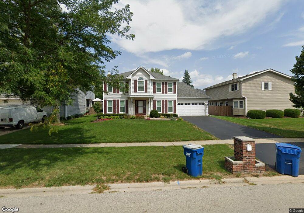
211 Gingerbrook Ln Bartlett, IL 60103
South Tri Village NeighborhoodEstimated Value: $474,207 - $564,000
4
Beds
3
Baths
2,388
Sq Ft
$217/Sq Ft
Est. Value
About This Home
This home is located at 211 Gingerbrook Ln, Bartlett, IL 60103 and is currently estimated at $519,302, approximately $217 per square foot. 211 Gingerbrook Ln is a home located in DuPage County with nearby schools including Centennial School, Eastview Middle School, and Bartlett High School.
Ownership History
Date
Name
Owned For
Owner Type
Purchase Details
Closed on
Apr 10, 2007
Sold by
Wiess Kenneth and Wiess Catherine
Bought by
Johnson Bradley A and Johnson Emily R
Current Estimated Value
Home Financials for this Owner
Home Financials are based on the most recent Mortgage that was taken out on this home.
Original Mortgage
$304,000
Outstanding Balance
$184,311
Interest Rate
6.2%
Mortgage Type
Purchase Money Mortgage
Estimated Equity
$334,991
Purchase Details
Closed on
Jun 10, 2002
Sold by
Abraham Arthur W and Abraham Kathleen D
Bought by
Wiess Kenneth A and Wiess Catherine
Home Financials for this Owner
Home Financials are based on the most recent Mortgage that was taken out on this home.
Original Mortgage
$228,000
Interest Rate
6.87%
Create a Home Valuation Report for This Property
The Home Valuation Report is an in-depth analysis detailing your home's value as well as a comparison with similar homes in the area
Home Values in the Area
Average Home Value in this Area
Purchase History
| Date | Buyer | Sale Price | Title Company |
|---|---|---|---|
| Johnson Bradley A | $380,000 | C T I C Dupage | |
| Wiess Kenneth A | $285,000 | -- |
Source: Public Records
Mortgage History
| Date | Status | Borrower | Loan Amount |
|---|---|---|---|
| Open | Johnson Bradley A | $304,000 | |
| Previous Owner | Wiess Kenneth A | $228,000 |
Source: Public Records
Tax History
| Year | Tax Paid | Tax Assessment Tax Assessment Total Assessment is a certain percentage of the fair market value that is determined by local assessors to be the total taxable value of land and additions on the property. | Land | Improvement |
|---|---|---|---|---|
| 2024 | $10,384 | $136,431 | $33,827 | $102,604 |
| 2023 | $9,542 | $123,780 | $30,690 | $93,090 |
| 2022 | $9,527 | $115,030 | $28,520 | $86,510 |
| 2021 | $9,256 | $109,190 | $27,070 | $82,120 |
| 2020 | $9,033 | $105,920 | $26,260 | $79,660 |
| 2019 | $8,912 | $102,140 | $25,320 | $76,820 |
| 2018 | $8,438 | $94,240 | $24,230 | $70,010 |
| 2017 | $9,258 | $101,420 | $23,260 | $78,160 |
| 2016 | $9,082 | $96,880 | $22,220 | $74,660 |
| 2015 | $9,066 | $91,700 | $21,030 | $70,670 |
| 2014 | $8,434 | $89,380 | $20,500 | $68,880 |
| 2013 | $10,120 | $91,520 | $20,990 | $70,530 |
Source: Public Records
Map
Nearby Homes
- 244 Ewell Ct Unit 2
- 195 E Oak Glen Dr
- 304 Jackson St
- 340 Windsor Dr
- 361 Sundance Dr
- 249 Surrey Rd
- 396 Nantucket Ct
- 644 Cedar Ln
- 318 S Prospect Ave
- 370 Wilmington Dr Unit D2
- 791 Duxbury Ln
- 930 Maple Ct
- 303 Newport Ln Unit D2
- 615 Mallard Ct Unit C2
- 1110 Sausalito Ct
- 1105 Sandpiper Ct
- 701 W Stearns Rd
- 119 E Railroad Ave
- 275 E Railroad Ave Unit 101
- 748 Sterling Ct Unit A2
- 849 Francine Dr
- 844 Faith Ln
- 842 Faith Ln
- 845 Francine Dr
- 840 Faith Ln
- 841 Francine Dr
- 212 Gingerbrook Ln
- 214 Gingerbrook Ln
- 859 Francine Dr
- 843 Faith Ln
- 216 Gingerbrook Ln
- 838 Faith Ln
- 837 Francine Dr
- 841 Faith Ln
- 848 Francine Dr
- 844 Francine Dr
- 4009 Faith Ln
- 4008 Faith Ln
- 4012 Faith Ln
- 4023 Faith Ln
Your Personal Tour Guide
Ask me questions while you tour the home.