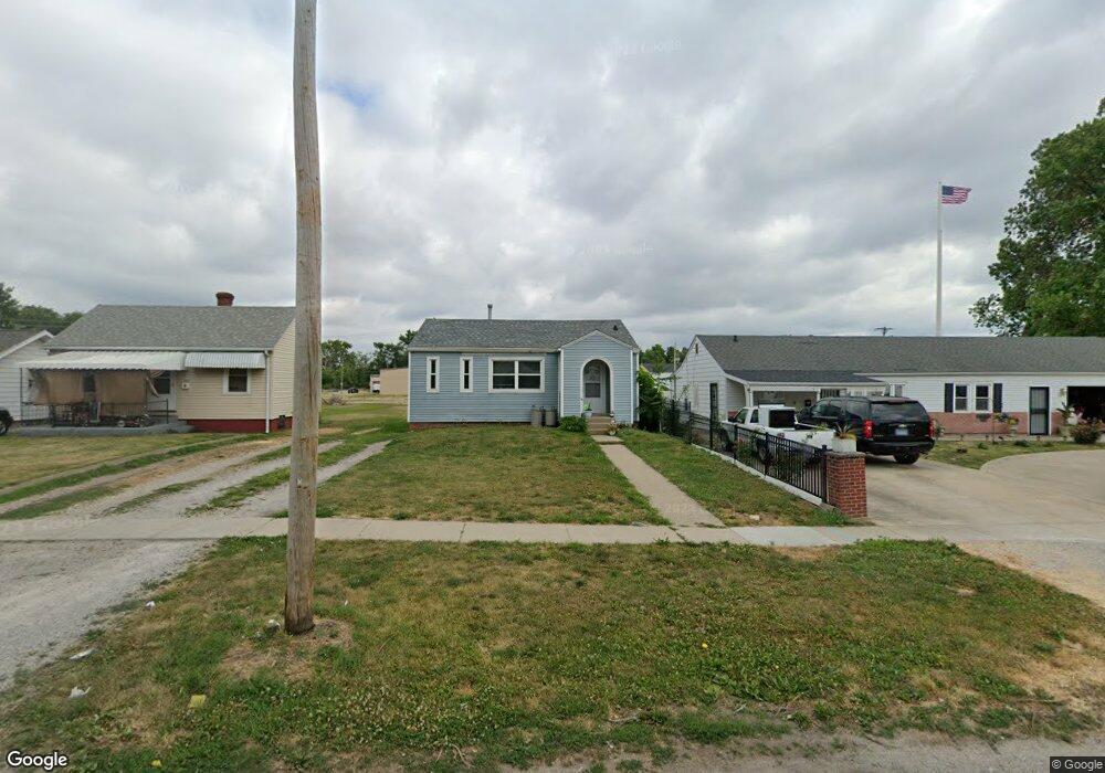
2113 E Adams St Springfield, IL 62703
Estimated Value: $50,991 - $62,000
3
Beds
1
Bath
900
Sq Ft
$63/Sq Ft
Est. Value
About This Home
This home is located at 2113 E Adams St, Springfield, IL 62703 and is currently estimated at $56,498, approximately $62 per square foot. 2113 E Adams St is a home located in Sangamon County with nearby schools including Matheny-Withrow Elementary School, Washington Middle School, and Lanphier High School.
Ownership History
Date
Name
Owned For
Owner Type
Purchase Details
Closed on
Jan 7, 2020
Sold by
Terrence Lawson
Bought by
Tdl Properties One Llc
Current Estimated Value
Purchase Details
Closed on
Sep 21, 2018
Sold by
Grider Larry D
Bought by
Lawson Terrence D
Home Financials for this Owner
Home Financials are based on the most recent Mortgage that was taken out on this home.
Original Mortgage
$65,000
Interest Rate
5.75%
Mortgage Type
New Conventional
Purchase Details
Closed on
Oct 4, 2006
Purchase Details
Closed on
Jul 17, 1998
Purchase Details
Closed on
Jun 18, 1993
Create a Home Valuation Report for This Property
The Home Valuation Report is an in-depth analysis detailing your home's value as well as a comparison with similar homes in the area
Purchase History
| Date | Buyer | Sale Price | Title Company |
|---|---|---|---|
| Tdl Properties One Llc | -- | Tdl Properties One Llc | |
| Lawson Terrence D | $60,000 | Prairie Land Title | |
| -- | $12,600 | -- | |
| -- | $18,000 | -- | |
| -- | -- | -- |
Source: Public Records
Mortgage History
| Date | Status | Borrower | Loan Amount |
|---|---|---|---|
| Previous Owner | Lawson Terrence D | $65,000 |
Source: Public Records
Tax History
| Year | Tax Paid | Tax Assessment Tax Assessment Total Assessment is a certain percentage of the fair market value that is determined by local assessors to be the total taxable value of land and additions on the property. | Land | Improvement |
|---|---|---|---|---|
| 2024 | $648 | $7,711 | $1,811 | $5,900 |
| 2023 | $623 | $7,043 | $1,654 | $5,389 |
| 2022 | $599 | $6,681 | $1,569 | $5,112 |
| 2021 | $579 | $6,431 | $1,510 | $4,921 |
| 2020 | $567 | $6,440 | $1,512 | $4,928 |
| 2019 | $557 | $6,418 | $1,507 | $4,911 |
| 2018 | $358 | $4,239 | $1,499 | $2,740 |
| 2017 | $351 | $4,185 | $1,480 | $2,705 |
| 2016 | $344 | $4,124 | $1,458 | $2,666 |
| 2015 | $341 | $4,075 | $1,441 | $2,634 |
| 2014 | $370 | $4,049 | $1,432 | $2,617 |
| 2013 | $362 | $4,464 | $1,432 | $3,032 |
Source: Public Records
Map
Nearby Homes
- 2236 E Adams St
- 2128 E Capitol Ave
- 222 S David St
- 1529 E Edwards St
- 1415 E Jefferson St
- 1405 E Edwards St
- 2238 E Stuart St
- 1617 E Matheny Ave
- 1521 E Matheny Ave
- 516 N Milton Ave Unit 1
- 905 N Wesley St Unit 1
- 1105 Knoll Pointe Place
- 1123 E Miller St
- 1037 N Wesley St Unit 1
- 1050 N 19th St
- 1111 N Albany St Unit 1
- 2267 Cincinnati Ave
- 1909 E Cedar St
- 29 Melody Ln
- 2325 E Spruce St
- 2109 E Adams St
- 2117 E Adams St
- 2105 E Adams St
- 2125 E Adams St
- 2129 E Adams St
- 130 S Wheeler Ave
- 2108 E Adams St
- 2104 E Adams St
- 2112 E Adams St
- 2100 E Adams St
- 2116 E Adams St
- 153 S Wheeler Ave
- 2135 E Adams St
- 2124 E Adams St
- 2056 E Adams St
- 2128 E Adams St
- 2139 E Adams St
- 149 S Wheeler Ave
- 2052 E Adams St
- 2132 E Adams St
Your Personal Tour Guide
Ask me questions while you tour the home.