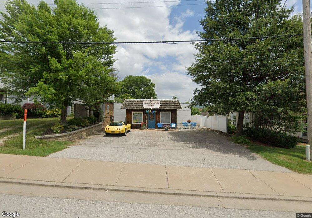
212 N Central Ave Eureka, MO 63025
Estimated Value: $247,000
1
Bed
--
Bath
1,516
Sq Ft
$163/Sq Ft
Est. Value
About This Home
This home is located at 212 N Central Ave, Eureka, MO 63025 and is currently estimated at $247,000, approximately $162 per square foot. 212 N Central Ave is a home located in St. Louis County with nearby schools including Eureka Elementary School, Lasalle Springs Middle School, and Eureka Senior High School.
Ownership History
Date
Name
Owned For
Owner Type
Purchase Details
Closed on
Dec 2, 2013
Sold by
Jefferson Bank & Trust Company
Bought by
Tha Properties Llc
Current Estimated Value
Home Financials for this Owner
Home Financials are based on the most recent Mortgage that was taken out on this home.
Original Mortgage
$84,000
Outstanding Balance
$62,685
Interest Rate
4.17%
Mortgage Type
Commercial
Estimated Equity
$184,315
Purchase Details
Closed on
Sep 13, 2013
Sold by
M & J Realty Group
Bought by
Jefferson Bank & Trust Company
Purchase Details
Closed on
Dec 15, 2004
Sold by
Kaeding Samuel H
Bought by
J & J Realty Group Llc
Create a Home Valuation Report for This Property
The Home Valuation Report is an in-depth analysis detailing your home's value as well as a comparison with similar homes in the area
Home Values in the Area
Average Home Value in this Area
Purchase History
| Date | Buyer | Sale Price | Title Company |
|---|---|---|---|
| Tha Properties Llc | $105,000 | Investors Title Co Clayton | |
| Jefferson Bank & Trust Company | $115,000 | None Available | |
| J & J Realty Group Llc | -- | -- |
Source: Public Records
Mortgage History
| Date | Status | Borrower | Loan Amount |
|---|---|---|---|
| Open | Tha Properties Llc | $84,000 |
Source: Public Records
Tax History
| Year | Tax Paid | Tax Assessment Tax Assessment Total Assessment is a certain percentage of the fair market value that is determined by local assessors to be the total taxable value of land and additions on the property. | Land | Improvement |
|---|---|---|---|---|
| 2025 | $2,682 | $32,230 | $12,690 | $19,540 |
| 2024 | $2,682 | $31,080 | $13,630 | $17,450 |
| 2023 | $2,683 | $31,080 | $13,630 | $17,450 |
| 2022 | $2,806 | $30,680 | $13,630 | $17,050 |
| 2021 | $2,800 | $30,680 | $13,630 | $17,050 |
| 2020 | $2,467 | $26,470 | $9,090 | $17,380 |
| 2019 | $2,477 | $26,470 | $9,090 | $17,380 |
| 2018 | $2,424 | $24,560 | $9,090 | $15,470 |
Source: Public Records
Map
Nearby Homes
- 637 N Virginia Ave
- 16805 Enderbush Ln
- 318 Kevin Jon Ct
- 329 Kevin Jon Ct
- 1 Fairway Estates Ct
- 126 Shaw Dr
- 15 Rockwood Place Ct
- 369 Cerny Ave
- 944 Emerald Oaks Ct
- 362 Cerny Ave
- 917 Emerald Oaks Ct
- 826 Lower Field Ln
- 75 Old Farmhouse Way
- 830 Lower Field Ln
- 83 Old Farmhouse Way
- 808 Lower Field Ln
- 402 Wallach Dr
- 345 Palisades Ridge Ct
- 17114 Elm Trail Dr
- 814 Eureka Rd
- 216 N Central Ave
- 224 N Central Ave
- 201 Beverly St
- 0TBB Ashton Woods 1 2 Story Homes
- 0TBB Aspen Lot 1&2 Lower Byrnesmill
- 211 Beverly St
- 789456 E Second Ct
- 120 N Central Ave
- 116 N Central Ave
- 0TBB 2 Sty@ashton Woods
- 223 Beverly St
- 8 E 2nd St
- 12 E 2nd St
- 16 E 2nd St
- 119 N Central Ave Unit 1
- 119 N Central Ave
- 301 N Central Ave
- 218 Beverly St
- 302 N Central Ave
- 21 E 3rd St
Your Personal Tour Guide
Ask me questions while you tour the home.