Estimated Value: $429,000 - $450,000
4
Beds
3
Baths
2,333
Sq Ft
$188/Sq Ft
Est. Value
About This Home
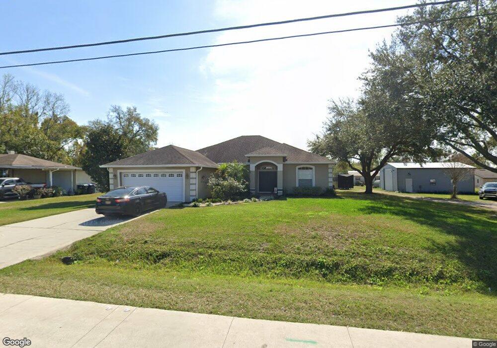
This home is located at 213 Wurst Rd, Ocoee, FL 34761 and is currently estimated at $438,349, approximately $187 per square foot. 213 Wurst Rd is a home located in Orange County with nearby schools including Spring Lake Elementary School, Ocoee Middle School, and Ocoee High School.
Ownership History
Date
Name
Owned For
Owner Type
Purchase Details
Closed on
Mar 25, 2005
Sold by
Brimer Betty Jean
Bought by
Hall Stephen and Hall Krista
Current Estimated Value
Purchase Details
Closed on
Sep 15, 2004
Sold by
Brimer Betty J
Bought by
Williams Mark A and Williams Amanda R
Create a Home Valuation Report for This Property
The Home Valuation Report is an in-depth analysis detailing your home's value as well as a comparison with similar homes in the area
Home Values in the Area
Average Home Value in this Area
Purchase History
| Date | Buyer | Sale Price | Title Company |
|---|---|---|---|
| Hall Stephen | -- | -- | |
| Williams Mark A | -- | -- |
Source: Public Records
Tax History
| Year | Tax Paid | Tax Assessment Tax Assessment Total Assessment is a certain percentage of the fair market value that is determined by local assessors to be the total taxable value of land and additions on the property. | Land | Improvement |
|---|---|---|---|---|
| 2025 | $2,863 | $199,151 | -- | -- |
| 2024 | $2,500 | $193,538 | -- | -- |
| 2023 | $2,500 | $182,606 | $0 | $0 |
| 2022 | $2,397 | $177,287 | $0 | $0 |
| 2021 | $2,350 | $172,123 | $0 | $0 |
| 2020 | $2,233 | $169,747 | $0 | $0 |
| 2019 | $2,287 | $165,931 | $0 | $0 |
| 2018 | $2,264 | $162,837 | $0 | $0 |
| 2017 | $2,224 | $249,921 | $27,000 | $222,921 |
| 2016 | $2,196 | $165,354 | $18,000 | $147,354 |
| 2015 | $2,232 | $155,122 | $18,000 | $137,122 |
| 2014 | $2,309 | $160,909 | $18,000 | $142,909 |
Source: Public Records
Map
Nearby Homes
- 314 15th Ave
- 314 Wurst Rd
- 1079 N Lakewood Ave
- 1500 Adair St
- 1102 Bellini Ln
- 1737 N Lakewood Ave
- 1236 Russell Dr
- 601 Catwood Dr
- 1602 Starfire Ln
- 632 Cardinal St
- 905 Spring Creek Dr
- 2009 Adair St
- 28 Rewis St
- 600 Hill Ave
- 1938 N Lakewood Ave
- 1614 Maureen Ave Unit 4
- 1514 Lady Ave
- 702 Carmen Dr
- 20 Rewis St
- 1817 Demastus Ln
Your Personal Tour Guide
Ask me questions while you tour the home.