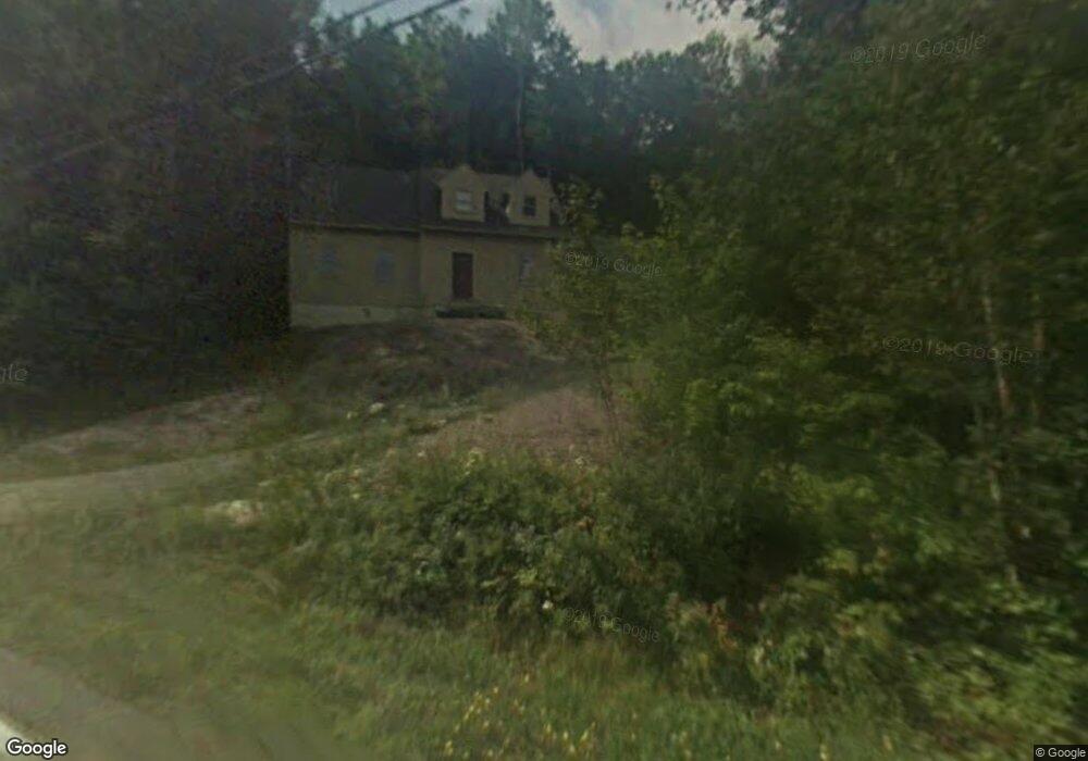
22 Cove Dr Grantham, NH 03753
Estimated Value: $574,044 - $624,000
3
Beds
3
Baths
2,293
Sq Ft
$261/Sq Ft
Est. Value
About This Home
This home is located at 22 Cove Dr, Grantham, NH 03753 and is currently estimated at $598,511, approximately $261 per square foot. 22 Cove Dr is a home with nearby schools including Grantham Village School and Lebanon High School.
Ownership History
Date
Name
Owned For
Owner Type
Purchase Details
Closed on
Apr 10, 2018
Sold by
Bergman Louis and Bergman Mindy
Bought by
Strombom Carl V and Stephen-Strombom Sandra G
Current Estimated Value
Purchase Details
Closed on
Feb 2, 2017
Sold by
Mcgrath Glenn R and Mcgrath Melissa
Bought by
Berman Louis and German Mindy
Home Financials for this Owner
Home Financials are based on the most recent Mortgage that was taken out on this home.
Original Mortgage
$215,523
Interest Rate
4.3%
Mortgage Type
FHA
Purchase Details
Closed on
Mar 25, 2010
Sold by
Sugar River Bank
Bought by
Mcgrath Glenn R and Mcgrath Melissa
Home Financials for this Owner
Home Financials are based on the most recent Mortgage that was taken out on this home.
Original Mortgage
$85,500
Interest Rate
5.02%
Mortgage Type
Purchase Money Mortgage
Purchase Details
Closed on
May 29, 2009
Sold by
Ashbury Properties Ltd
Bought by
Sugar River Bk
Purchase Details
Closed on
Apr 13, 1999
Sold by
Mclaughry Robert D and Mclaughry Ann D
Bought by
Ashbury Props Ltd
Create a Home Valuation Report for This Property
The Home Valuation Report is an in-depth analysis detailing your home's value as well as a comparison with similar homes in the area
Home Values in the Area
Average Home Value in this Area
Purchase History
| Date | Buyer | Sale Price | Title Company |
|---|---|---|---|
| Strombom Carl V | $241,000 | -- | |
| Berman Louis | $219,533 | -- | |
| Mcgrath Glenn R | $95,000 | -- | |
| Sugar River Bk | $110,000 | -- | |
| Ashbury Props Ltd | $5,000 | -- |
Source: Public Records
Mortgage History
| Date | Status | Borrower | Loan Amount |
|---|---|---|---|
| Previous Owner | Berman Louis | $215,523 | |
| Previous Owner | Ashbury Props Ltd | $100,000 | |
| Previous Owner | Ashbury Props Ltd | $85,500 |
Source: Public Records
Tax History Compared to Growth
Tax History
| Year | Tax Paid | Tax Assessment Tax Assessment Total Assessment is a certain percentage of the fair market value that is determined by local assessors to be the total taxable value of land and additions on the property. | Land | Improvement |
|---|---|---|---|---|
| 2024 | $8,346 | $384,100 | $38,600 | $345,500 |
| 2023 | $7,356 | $375,700 | $38,600 | $337,100 |
| 2022 | $6,826 | $375,700 | $38,600 | $337,100 |
| 2021 | $6,709 | $267,700 | $45,400 | $222,300 |
| 2020 | $6,749 | $267,700 | $45,400 | $222,300 |
| 2019 | $6,672 | $242,000 | $43,700 | $198,300 |
| 2018 | $6,725 | $242,000 | $43,700 | $198,300 |
| 2017 | $6,130 | $242,000 | $43,700 | $198,300 |
| 2016 | $5,769 | $242,000 | $43,700 | $198,300 |
| 2015 | $5,837 | $242,000 | $43,700 | $198,300 |
| 2014 | $5,603 | $251,600 | $57,800 | $193,800 |
| 2013 | $5,394 | $251,600 | $57,800 | $193,800 |
Source: Public Records
Map
Nearby Homes
- 8 Old Spring Dr
- 637 Marmot Ln Unit 37
- 3 Water View
- 6 Anderson Pond Rd
- 49 Old Beach Cir
- 38 Terrace View
- 23 High Pond Rd
- 1284 Route 10 N
- 00 Route 10 N
- 8 Sandy Brae
- 21 Shore Rd
- 64 High Pond Rd
- 3 Trillium Ln
- 12 Cherry Ln
- 303 Road Round the Rd
- 16 Summit Dr
- 54 Black Duck Spur
- 45 Bright Slope Way
- 295 Frye Ln
- 442 Olde Farms Rd
- 1 Old Spring Dr
- 3 Old Spring Dr
- 45 Terrace
- 803 Covered Bridge Ln
- 803 Covered Bridge Ln Unit 813
- 803 Covered Bridge Ln
- 810 Covered Bridge Ln Unit 810
- 805 Covered Bridge Ln Unit 805
- 809 Covered Bridge Ln Unit 609
- 809 Covered Bridge Ln
- 812 Covered Bridge Ln
- 811 Covered Bridge Ln
- 811 Covered Bridge Ln Unit 811
- 814 Covered Bridge Ln Unit 814
- 814 Covered Bridge Ln
- 4 Old Spring Dr
- 7 Old Spring Dr
- 18 Bobbin Hill
- 816 Covered Bridge Ln Unit 816
- 816 Covered Bridge Ln Unit C16