
Seller's Agent in 2025
Dianne Garcia
ICON Real Estate Group
(541) 337-9246
11 in this area
84 Total Sales
Estimated Value: $450,000 - $477,000
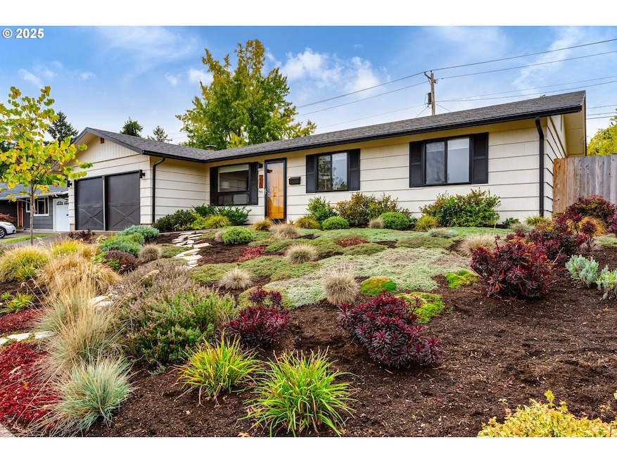
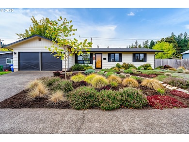
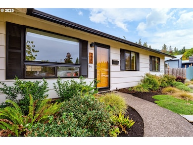
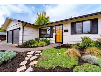
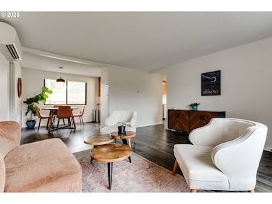
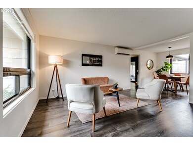
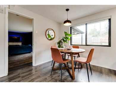
Welcome to this beautifully updated, extremely well-maintained home nestled in fabulous SE Eugene. Attractive luxury vinyl plank flooring throughout. Kitchen with stainless steel appliances. This home has both a living room and a family room creating ample space to relax as well as entertain. Large backyard with covered patio and 3-person jacuzzi. Newer interior/exterior paint. New ductless heat pump and electrical panel in 2021. Near ridgeline hiking trail system and fantastic schools. You won't want to miss this one!
Last Agent to Sell the Property
ICON Real Estate Group Brokerage Email: ICON@TheICONREGroup.com License #201221710 Listed on: 10/21/2025
| Date | Buyer | Sale Price | Title Company |
|---|---|---|---|
| Levey Alice C | $469,000 | Cascade Title | |
| Russell Justin | $385,000 | Cascade Title Co | |
| Cockum Darlene | -- | None Available |
| Date | Status | Borrower | Loan Amount |
|---|---|---|---|
| Previous Owner | Russell Justin | $337,998 |
| Date | Event | Price | List to Sale | Price per Sq Ft |
|---|---|---|---|---|
| 11/12/2025 11/12/25 | Sold | $469,000 | +2.0% | $410 / Sq Ft |
| 10/26/2025 10/26/25 | Pending | -- | -- | -- |
| 10/21/2025 10/21/25 | For Sale | $460,000 | -- | $402 / Sq Ft |
| Year | Tax Paid | Tax Assessment Tax Assessment Total Assessment is a certain percentage of the fair market value that is determined by local assessors to be the total taxable value of land and additions on the property. | Land | Improvement |
|---|---|---|---|---|
| 2025 | $3,905 | $200,429 | -- | -- |
| 2024 | $3,857 | $194,592 | -- | -- |
| 2023 | $3,857 | $188,925 | $0 | $0 |
| 2022 | $3,613 | $183,423 | $0 | $0 |
| 2021 | $3,393 | $178,081 | $0 | $0 |
| 2020 | $3,405 | $172,895 | $0 | $0 |
| 2019 | $3,289 | $167,860 | $0 | $0 |
| 2018 | $3,096 | $158,224 | $0 | $0 |
| 2017 | $2,957 | $158,224 | $0 | $0 |
| 2016 | $2,884 | $153,616 | $0 | $0 |
| 2015 | $2,801 | $149,142 | $0 | $0 |
| 2014 | $2,745 | $144,798 | $0 | $0 |
Seller's Agent in 2025
Dianne Garcia
ICON Real Estate Group
(541) 337-9246
11 in this area
84 Total Sales
Buyer's Agent in 2025
Kim Hyland
Windermere RE Lane County
(541) 513-4884
8 in this area
99 Total Sales
Source: Regional Multiple Listing Service (RMLS)
MLS Number: 768285403
APN: 0683183
Disclaimer: Certain information contained herein is derived from information provided by parties other than Homes.com. All information provided is deemed reliable, but is not guaranteed to be accurate and should be independently verified.
![]() The content relating to real estate for sale on this web site comes in part from the IDX program of the RMLS™ of Portland, Oregon. Real estate listings held by brokerage firms other than Ten-X are marked with the RMLS™ logo, and detailed information about these properties includes the names of the listing brokers. Listing content is copyright © 2026 RMLS™, Portland, Oregon. Some properties which appear for sale on this web site may subsequently have sold or may no longer be available. All information provided is deemed reliable but is not guaranteed and should be independently verified.
The content relating to real estate for sale on this web site comes in part from the IDX program of the RMLS™ of Portland, Oregon. Real estate listings held by brokerage firms other than Ten-X are marked with the RMLS™ logo, and detailed information about these properties includes the names of the listing brokers. Listing content is copyright © 2026 RMLS™, Portland, Oregon. Some properties which appear for sale on this web site may subsequently have sold or may no longer be available. All information provided is deemed reliable but is not guaranteed and should be independently verified.
Ask me questions while you tour the home.