


2210 Power Dr Unit 2302 Bellevue, NE 68005
About This Home
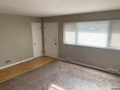
This home is located at 2210 Power Dr Unit 2302, Bellevue, NE 68005 and is currently priced at $1,500. This property was built in 1960. 2210 Power Dr Unit 2302 is a home located in Sarpy County with nearby schools including Avery Elementary School, Logan Fontenelle Middle School, and Bellevue East High School.
Listing Agent
Action Management & Leasing Co License #0980321 Listed on: 12/09/2025
Property Details
Home Type
- Multi-Family
Year Built
- Built in 1960
Home Design
- Duplex
- Ranch Style House
Interior Spaces
- 900 Sq Ft Home
- Partially Finished Basement
- Natural lighting in basement
Kitchen
- Oven or Range
- Microwave
- Dishwasher
Bedrooms and Bathrooms
- 3 Bedrooms
- 2 Bathrooms
Schools
- Central Park Elementary School
- Lewis And Clark Middle School
- Bellevue East High School
Utilities
- Central Air
- Heating System Uses Natural Gas
Community Details
- Avery Heights Subdivision
Listing and Financial Details
- Property Available on 12/9/25
- Assessor Parcel Number 010426000
Map
Property History
| Date | Event | Price | List to Sale | Price per Sq Ft |
|---|---|---|---|---|
| 12/09/2025 12/09/25 | For Rent | $1,500 | -- | -- |
Source: Great Plains Regional MLS
MLS Number: 22534566
APN: 010426000
Disclaimer: Certain information contained herein is derived from information provided by parties other than Homes.com. All information provided is deemed reliable, but is not guaranteed to be accurate and should be independently verified.
![]() Listing information is provided by Participants of the Great Plains Regional Multiple Listing Service Inc.
Listing information is provided by Participants of the Great Plains Regional Multiple Listing Service Inc.
IDX information is provided exclusively for personal, non-commercial use, and may not be used for any purpose other than to identify prospective properties consumers may be interested in purchasing.
Information is deemed reliable but not guaranteed.
Copyright 2025, Great Plains Regional MLS LLC
- 105 Chevro Ln
- 9903 S 10th St
- 202 Caldor Dr
- 1104 Thurston Ave
- 102 Hillcrest Ave
- 1803 Brenda Dr
- 10106 S 13th St
- 1307 Terry Dr
- 1511 Lorraine Ave
- 1406 Sunshine Blvd
- 1505 Mildred Ave
- 502 N 3rd St
- 418 Bellevue Blvd N
- 2303 Lloyd St
- 1403 Saint Raphael St
- 612 Nob Hill Terrace
- 517 Bellevue Blvd N
- 2103 Virginia Ave
- 2303 Victoria Ave
- 2006 Pleasantview Ln
- 302-518 Chateau Dr
- 401 Chateau Dr
- 1201 Fort Crook Rd S Unit N
- 1015 Fairfax Rd
- 2002 Gregg Rd
- 1103 Tanglewood Ct
- 1213 Wilroy Rd
- 10530 S 24th Plaza
- 2103 Fraser Ct
- 1503 Willow Ave
- 2202 Gregg Rd
- 1307 Galvin Rd S
- 210 Bellevue Blvd S
- 845 Hidden Hills Dr
- 46 Martinview Rd
- 1030 O'Malley Cir
- 1704 S Wayne St Unit 7
- 1605 Jefferson Ct
- 401 E 16th St
- 2105 Washington St
