Estimated Value: $413,000 - $429,000
3
Beds
2
Baths
1,456
Sq Ft
$290/Sq Ft
Est. Value
About This Home
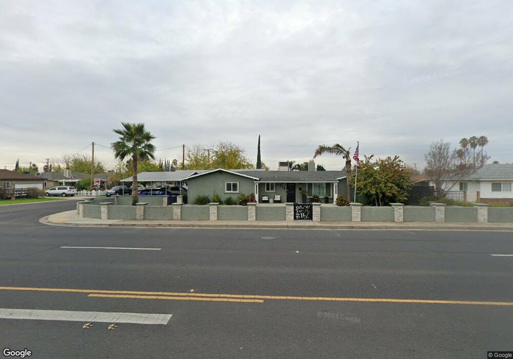
This home is located at 2213 Mitchell Rd, Ceres, CA 95307 and is currently estimated at $422,615, approximately $290 per square foot. 2213 Mitchell Rd is a home located in Stanislaus County with nearby schools including Carroll Fowler Elementary School, Mae Hensley Junior High School, and Ceres High School.
Ownership History
Date
Name
Owned For
Owner Type
Purchase Details
Closed on
Mar 5, 2007
Sold by
Skaggs Willie Mae and Living Revocable Trust Of Will
Bought by
Magana Jose and Magana Martha S
Current Estimated Value
Home Financials for this Owner
Home Financials are based on the most recent Mortgage that was taken out on this home.
Original Mortgage
$114,500
Outstanding Balance
$74,989
Interest Rate
8.2%
Mortgage Type
New Conventional
Estimated Equity
$347,626
Purchase Details
Closed on
Sep 4, 1996
Sold by
Skaggs Willie Mae
Bought by
Skaggs Willie Mae and Living Revocable Tr Of Willie
Create a Home Valuation Report for This Property
The Home Valuation Report is an in-depth analysis detailing your home's value as well as a comparison with similar homes in the area
Purchase History
| Date | Buyer | Sale Price | Title Company |
|---|---|---|---|
| Magana Jose | $269,000 | Alliance Title Company | |
| Skaggs Willie Mae | -- | -- |
Source: Public Records
Mortgage History
| Date | Status | Borrower | Loan Amount |
|---|---|---|---|
| Open | Magana Jose | $114,500 |
Source: Public Records
Tax History
| Year | Tax Paid | Tax Assessment Tax Assessment Total Assessment is a certain percentage of the fair market value that is determined by local assessors to be the total taxable value of land and additions on the property. | Land | Improvement |
|---|---|---|---|---|
| 2025 | $4,167 | $362,967 | $133,969 | $228,998 |
| 2024 | $3,876 | $353,320 | $131,343 | $221,977 |
| 2023 | $3,769 | $346,393 | $128,768 | $217,625 |
| 2022 | $3,737 | $339,602 | $126,244 | $213,358 |
| 2021 | $3,406 | $307,000 | $170,000 | $137,000 |
| 2020 | $3,064 | $282,500 | $140,000 | $142,500 |
| 2019 | $3,105 | $282,500 | $140,000 | $142,500 |
| 2018 | $2,714 | $248,000 | $115,000 | $133,000 |
| 2017 | $2,582 | $233,500 | $75,000 | $158,500 |
| 2016 | $2,438 | $221,000 | $45,000 | $176,000 |
| 2015 | $1,947 | $177,500 | $34,500 | $143,000 |
| 2014 | $1,683 | $154,500 | $30,000 | $124,500 |
Source: Public Records
Map
Nearby Homes
- 3009 Glen Grove Ct
- 3408 Puma Way
- 3432 Vera Way
- 2841 Fowler Rd Unit 33
- 2841 Fowler Rd Unit 89
- 1813 Lupin Ln
- 3613 Southern Oak Dr
- 2812 Roswell Way
- 2708 Oasis Ave
- 2644 Parkway
- 1617 Charlottesville Ln
- 2741 Rosewood Ave
- 3010 Roeding Rd
- 1655 Moffett Rd
- 3550 Mitchell Rd Unit 59
- 3524 Homestead Way Unit 57
- 1536 Vandalay Dr
- 2921 5th St
- 1645 Moffett Rd
- 3786 Waynesboro Dr
Your Personal Tour Guide
Ask me questions while you tour the home.