Estimated Value: $459,000 - $524,000
3
Beds
3
Baths
1,484
Sq Ft
$327/Sq Ft
Est. Value
About This Home
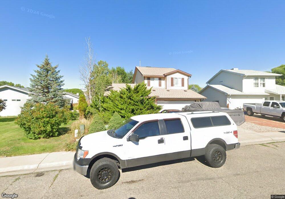
This home is located at 2317 Ute Ave, Rifle, CO 81650 and is currently estimated at $484,671, approximately $326 per square foot. 2317 Ute Ave is a home located in Garfield County with nearby schools including Wamsley Elementary School, Rifle Middle School, and Rifle High School.
Ownership History
Date
Name
Owned For
Owner Type
Purchase Details
Closed on
Oct 25, 2024
Sold by
Olink Michael M
Bought by
Michael M Olink Revocable Trust
Current Estimated Value
Purchase Details
Closed on
Feb 21, 2018
Sold by
Link Michael M O
Bought by
Link Michael M O and O Link Revocable Liv Michael M
Purchase Details
Closed on
Apr 22, 2011
Sold by
The Bank Of New York Mellon
Bought by
Olink Michael M
Purchase Details
Closed on
May 11, 2010
Sold by
Hatch Kenneth J and Hatch Lesa A
Bought by
The Bank Of New York Mellon
Purchase Details
Closed on
Aug 1, 2008
Sold by
Hatch Lesa Ann
Bought by
Hatch Kenneth J
Purchase Details
Closed on
Jan 5, 1999
Purchase Details
Closed on
Jun 18, 1998
Create a Home Valuation Report for This Property
The Home Valuation Report is an in-depth analysis detailing your home's value as well as a comparison with similar homes in the area
Home Values in the Area
Average Home Value in this Area
Purchase History
| Date | Buyer | Sale Price | Title Company |
|---|---|---|---|
| Michael M Olink Revocable Trust | -- | None Listed On Document | |
| Michael M Olink Revocable Trust | -- | None Listed On Document | |
| Link Michael M O | -- | None Available | |
| Olink Michael M | $127,050 | North American Title | |
| The Bank Of New York Mellon | -- | None Available | |
| Hatch Kenneth J | -- | None Available | |
| -- | $139,900 | -- | |
| -- | $18,000 | -- |
Source: Public Records
Tax History Compared to Growth
Tax History
| Year | Tax Paid | Tax Assessment Tax Assessment Total Assessment is a certain percentage of the fair market value that is determined by local assessors to be the total taxable value of land and additions on the property. | Land | Improvement |
|---|---|---|---|---|
| 2024 | $1,286 | $23,560 | $3,480 | $20,080 |
| 2023 | $1,286 | $23,560 | $3,480 | $20,080 |
| 2022 | $1,040 | $21,480 | $3,820 | $17,660 |
| 2021 | $1,766 | $22,090 | $3,930 | $18,160 |
| 2020 | $1,493 | $20,410 | $2,860 | $17,550 |
| 2019 | $1,413 | $20,410 | $2,860 | $17,550 |
| 2018 | $1,134 | $16,020 | $2,660 | $13,360 |
| 2017 | $1,025 | $16,020 | $2,660 | $13,360 |
| 2016 | $757 | $13,390 | $2,550 | $10,840 |
| 2015 | $699 | $13,390 | $2,550 | $10,840 |
| 2014 | -- | $10,770 | $1,750 | $9,020 |
Source: Public Records
Map
Nearby Homes
- 2203 Ute Ave
- 2501 Meadow Cir Unit 1
- 2659 Acacia Ave Unit 2C
- 321 Columbine Dr
- 1783 Anvil View Ave
- 148 W 26th St
- 1760 Anvil View Ave
- 211 W 28th Ct
- 2409 W 24th Place
- 405 W 26th St
- Phase 2 Rifle Creek
- 1663 Walnut
- 1607 Balsam Loop
- 200 W 20th St Unit A142
- 200 W 20th St Unit E5
- 200 W 20th St Unit A24
- 200 W 20th St Unit E6
- 200 W 20th St Unit A128
- 200 W 20th St Unit A145
- 200 W 20th St Unit A139