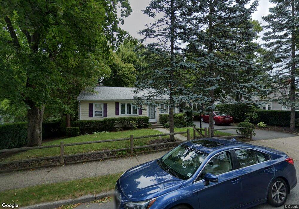
26 Larkin Rd West Newton, MA 02465
West Newton NeighborhoodEstimated Value: $928,000 - $1,185,114
3
Beds
2
Baths
1,267
Sq Ft
$803/Sq Ft
Est. Value
About This Home
This home is located at 26 Larkin Rd, West Newton, MA 02465 and is currently estimated at $1,017,529, approximately $803 per square foot. 26 Larkin Rd is a home located in Middlesex County with nearby schools including C.C. Burr, F.A. Day Middle School, and Newton North High School.
Ownership History
Date
Name
Owned For
Owner Type
Purchase Details
Closed on
Jul 17, 2008
Sold by
Est Polagruto Stella and Polagruto Frank
Bought by
Harris Mitchell A and Harris Shohreh A
Current Estimated Value
Home Financials for this Owner
Home Financials are based on the most recent Mortgage that was taken out on this home.
Original Mortgage
$378,000
Outstanding Balance
$245,092
Interest Rate
6.17%
Mortgage Type
Purchase Money Mortgage
Estimated Equity
$772,437
Create a Home Valuation Report for This Property
The Home Valuation Report is an in-depth analysis detailing your home's value as well as a comparison with similar homes in the area
Home Values in the Area
Average Home Value in this Area
Purchase History
| Date | Buyer | Sale Price | Title Company |
|---|---|---|---|
| Harris Mitchell A | $420,000 | -- |
Source: Public Records
Mortgage History
| Date | Status | Borrower | Loan Amount |
|---|---|---|---|
| Open | Harris Mitchell A | $378,000 |
Source: Public Records
Tax History Compared to Growth
Tax History
| Year | Tax Paid | Tax Assessment Tax Assessment Total Assessment is a certain percentage of the fair market value that is determined by local assessors to be the total taxable value of land and additions on the property. | Land | Improvement |
|---|---|---|---|---|
| 2025 | $8,204 | $837,100 | $787,500 | $49,600 |
| 2024 | $7,932 | $812,700 | $764,600 | $48,100 |
| 2023 | $7,466 | $733,400 | $579,000 | $154,400 |
| 2022 | $7,144 | $679,100 | $536,100 | $143,000 |
| 2021 | $6,894 | $640,700 | $505,800 | $134,900 |
| 2020 | $6,689 | $640,700 | $505,800 | $134,900 |
| 2019 | $6,500 | $622,000 | $491,100 | $130,900 |
| 2018 | $6,197 | $572,700 | $446,300 | $126,400 |
| 2017 | $5,350 | $481,100 | $421,000 | $60,100 |
| 2016 | $5,116 | $449,600 | $393,500 | $56,100 |
| 2015 | $4,879 | $420,200 | $367,800 | $52,400 |
Source: Public Records
Map
Nearby Homes
- 10 Crescent St Unit 1
- 10 Crescent St Unit 2
- 17 Crescent St
- 90 Auburndale Ave
- 160 Pine St Unit 12
- 62-64 Rowe St Unit B
- 42 Evergreen Cir
- 13 Weir St
- 0 Duncan Rd Unit 72925240
- 33 Lill Ave
- 51 Bourne St
- 212 River St Unit 2
- 1488 Washington St Unit 1488
- 2 Elm St Unit 6
- 2 Elm St Unit 8
- 106 River St Unit 18
- 106 River St Unit 2
- 106 River St Unit 14
- 17 Gilbert St
- 371 Cherry St