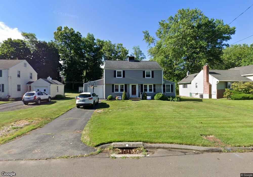
26 Toll Gate Rd Wethersfield, CT 06109
Estimated Value: $398,440 - $443,000
3
Beds
2
Baths
1,491
Sq Ft
$281/Sq Ft
Est. Value
About This Home
This home is located at 26 Toll Gate Rd, Wethersfield, CT 06109 and is currently estimated at $419,360, approximately $281 per square foot. 26 Toll Gate Rd is a home located in Hartford County with nearby schools including Samuel B. Webb Elementary School, Silas Deane Middle School, and Wethersfield High School.
Ownership History
Date
Name
Owned For
Owner Type
Purchase Details
Closed on
Aug 7, 2008
Sold by
Civitello Philip R A and Civitello Leslie M
Bought by
Fletcher Jeffrey A and Fletcher Aimee L
Current Estimated Value
Home Financials for this Owner
Home Financials are based on the most recent Mortgage that was taken out on this home.
Original Mortgage
$236,495
Interest Rate
6.49%
Create a Home Valuation Report for This Property
The Home Valuation Report is an in-depth analysis detailing your home's value as well as a comparison with similar homes in the area
Home Values in the Area
Average Home Value in this Area
Purchase History
| Date | Buyer | Sale Price | Title Company |
|---|---|---|---|
| Fletcher Jeffrey A | $245,000 | -- |
Source: Public Records
Mortgage History
| Date | Status | Borrower | Loan Amount |
|---|---|---|---|
| Open | Fletcher Jeffrey A | $25,000 | |
| Open | Fletcher Jeffrey A | $223,572 | |
| Closed | Fletcher Jeffrey A | $236,495 | |
| Previous Owner | Fletcher Jeffrey A | $115,000 |
Source: Public Records
Tax History Compared to Growth
Tax History
| Year | Tax Paid | Tax Assessment Tax Assessment Total Assessment is a certain percentage of the fair market value that is determined by local assessors to be the total taxable value of land and additions on the property. | Land | Improvement |
|---|---|---|---|---|
| 2025 | $9,517 | $230,880 | $67,770 | $163,110 |
| 2024 | $6,331 | $146,480 | $58,100 | $88,380 |
| 2023 | $6,120 | $146,480 | $58,100 | $88,380 |
| 2022 | $6,017 | $146,480 | $58,100 | $88,380 |
| 2021 | $5,957 | $146,480 | $58,100 | $88,380 |
| 2020 | $5,960 | $146,480 | $58,100 | $88,380 |
| 2019 | $5,968 | $146,480 | $58,100 | $88,380 |
| 2018 | $6,088 | $149,300 | $59,000 | $90,300 |
| 2017 | $5,938 | $149,300 | $59,000 | $90,300 |
| 2016 | $5,754 | $149,300 | $59,000 | $90,300 |
| 2015 | $5,702 | $149,300 | $59,000 | $90,300 |
| 2014 | $5,485 | $149,300 | $59,000 | $90,300 |
Source: Public Records
Map
Nearby Homes
- 358 Ridge Rd
- 69 Concord Cir
- 67 Oakdale St
- 19 Albert Ave
- 481 Ridge Rd
- 80 Spruce St
- 11 Yale St
- 173 Timber Trail
- 80 Cedar St
- 49 Ridge Rd Unit 49
- 55 Rutledge Rd
- 219 Crest St
- 47 Forest Dr
- 615 Ridge Rd
- 136 Amherst St
- 237 Mountain St
- 9 Tanner Crossing Unit 9
- 42 Schoolhouse Crossing
- 208 Mountain St
- 35 Tinsmith Crossing Unit 35
- 20 Toll Gate Rd
- 32 Toll Gate Rd
- 14 Toll Gate Rd
- 40 Toll Gate Rd
- 275 Ridge Rd
- 275 Ridge Rd Unit 109
- 275 Ridge Rd Unit 107
- 275 Ridge Rd Unit 223
- 275 Ridge Rd Unit 215
- 275 Ridge Rd Unit 212
- 275 Ridge Rd Unit 2
- 275 Ridge Rd
- 275 Ridge Rd Unit 218
- 275 Ridge Rd Unit 111
- 275 Ridge Rd Unit 309
- 275 Ridge Rd Unit 203
- 275 Ridge Rd Unit 308
- 275 Ridge Rd Unit 114
- 275 Ridge Rd Unit 103
- 275 Ridge Rd Unit 102