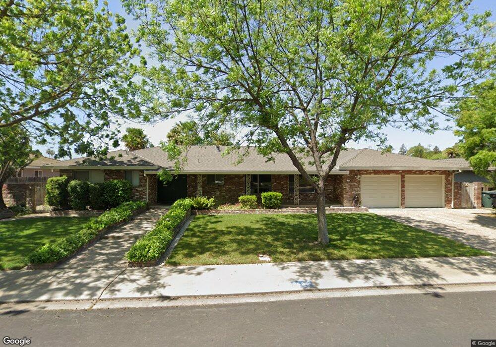
2605 Kathrine Ave Modesto, CA 95350
Central Modesto NeighborhoodEstimated Value: $506,000 - $577,756
3
Beds
3
Baths
1,854
Sq Ft
$289/Sq Ft
Est. Value
About This Home
This home is located at 2605 Kathrine Ave, Modesto, CA 95350 and is currently estimated at $536,189, approximately $289 per square foot. 2605 Kathrine Ave is a home located in Stanislaus County with nearby schools including Woodrow Elementary School, Somerset Middle School, and Grace M. Davis High School.
Ownership History
Date
Name
Owned For
Owner Type
Purchase Details
Closed on
May 11, 2016
Sold by
Gillette Dianne M
Bought by
Yunt Daniel C and Daniel C Yunt Trust
Current Estimated Value
Purchase Details
Closed on
Apr 19, 2010
Sold by
Yunt Daniel C and Blanche Yunt Trust
Bought by
Yunt Daniel C and Daniel C Yunt Trust
Purchase Details
Closed on
Feb 26, 2008
Sold by
Yunt Blanche S
Bought by
Yunt Daniel C and Blanche Yunt Trust
Create a Home Valuation Report for This Property
The Home Valuation Report is an in-depth analysis detailing your home's value as well as a comparison with similar homes in the area
Home Values in the Area
Average Home Value in this Area
Purchase History
| Date | Buyer | Sale Price | Title Company |
|---|---|---|---|
| Yunt Daniel C | $148,500 | None Available | |
| Yunt Daniel C | -- | None Available | |
| Yunt Daniel C | -- | None Available |
Source: Public Records
Tax History
| Year | Tax Paid | Tax Assessment Tax Assessment Total Assessment is a certain percentage of the fair market value that is determined by local assessors to be the total taxable value of land and additions on the property. | Land | Improvement |
|---|---|---|---|---|
| 2025 | $3,532 | $319,666 | $139,926 | $179,740 |
| 2024 | $3,469 | $313,399 | $137,183 | $176,216 |
| 2023 | $3,403 | $307,255 | $134,494 | $172,761 |
| 2022 | $3,265 | $301,231 | $131,857 | $169,374 |
| 2021 | $3,208 | $295,325 | $129,272 | $166,053 |
| 2020 | $3,161 | $292,298 | $127,947 | $164,351 |
| 2019 | $3,104 | $286,568 | $125,439 | $161,129 |
| 2018 | $3,043 | $280,950 | $122,980 | $157,970 |
| 2017 | $2,970 | $275,442 | $120,569 | $154,873 |
| 2016 | $2,538 | $232,056 | $71,394 | $160,662 |
| 2015 | $2,424 | $228,571 | $70,322 | $158,249 |
| 2014 | -- | $224,095 | $68,945 | $155,150 |
Source: Public Records
Map
Nearby Homes
- 909 Mount Vernon Dr
- 2768 Sherwood Ave Unit B
- 2410 Sherwood Ave
- 2840 Sherwood Ave Unit A
- 365 Birchwood Ct
- 230 W Rumble Rd Unit C
- 230 W Rumble Rd Unit B
- 2001 Enslen Ave
- 917 Woodrow Ave
- 2840 Levon Ave
- 2013 Sherwood Ave
- 1921 Sherwood Ave
- 3312 Whitehorse Ave
- 920 Kevin Ct
- 3313 Colonial Dr
- 3025 Tully Rd
- 1306 Joni Ave
- 820 Hawthorne Ave
- 1329 Schulenberg Ave
- 617 W Granger Ave Unit 66
- 2601 Kathrine Ave
- 912 Northfield Ct
- 904 Leveland Ln
- 908 Leveland Ln
- 2604 Kathrine Ave
- 2608 Kathrine Ave
- 2600 Kathrine Ave
- 916 Northfield Ct
- 901 Durant St
- 905 Durant St
- 913 Northfield Ct
- 911 Durant St
- 2510 Kathrine Ave
- 909 Leveland Ln
- 920 Northfield Ct
- 912 Leveland Ln
- 917 Durant St
- 2502 Kathrine Ave
- 1001 Northfield Ct
- 2605 Fremont Ave
Your Personal Tour Guide
Ask me questions while you tour the home.