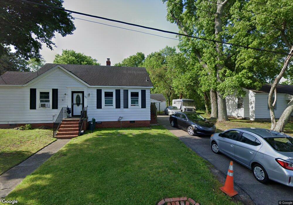
2700 Neal St Hampton, VA 23661
Wythe NeighborhoodEstimated Value: $234,000 - $251,000
3
Beds
2
Baths
1,706
Sq Ft
$144/Sq Ft
Est. Value
About This Home
This home is located at 2700 Neal St, Hampton, VA 23661 and is currently estimated at $245,055, approximately $143 per square foot. 2700 Neal St is a home located in Hampton City with nearby schools including Hunter B. Andrews PK-8 School, C. Alton Lindsay Middle School, and Hampton High School.
Ownership History
Date
Name
Owned For
Owner Type
Purchase Details
Closed on
Mar 18, 2014
Sold by
Federal Home Loan Mortgage Corporation
Bought by
Minns-Tucker Jill W
Current Estimated Value
Home Financials for this Owner
Home Financials are based on the most recent Mortgage that was taken out on this home.
Original Mortgage
$117,472
Outstanding Balance
$88,802
Interest Rate
4.27%
Mortgage Type
VA
Estimated Equity
$156,253
Purchase Details
Closed on
Jul 10, 2013
Sold by
Samuel I White Pc Sub Tr
Bought by
Federal Home Loan Mortgage Corporation
Create a Home Valuation Report for This Property
The Home Valuation Report is an in-depth analysis detailing your home's value as well as a comparison with similar homes in the area
Home Values in the Area
Average Home Value in this Area
Purchase History
| Date | Buyer | Sale Price | Title Company |
|---|---|---|---|
| Minns-Tucker Jill W | $115,000 | -- | |
| Federal Home Loan Mortgage Corporation | $120,934 | -- |
Source: Public Records
Mortgage History
| Date | Status | Borrower | Loan Amount |
|---|---|---|---|
| Open | Minns-Tucker Jill W | $117,472 |
Source: Public Records
Tax History Compared to Growth
Tax History
| Year | Tax Paid | Tax Assessment Tax Assessment Total Assessment is a certain percentage of the fair market value that is determined by local assessors to be the total taxable value of land and additions on the property. | Land | Improvement |
|---|---|---|---|---|
| 2025 | $2,357 | $198,100 | $68,200 | $129,900 |
| 2024 | $2,160 | $187,800 | $68,200 | $119,600 |
| 2023 | $2,021 | $174,200 | $66,000 | $108,200 |
| 2022 | $2,000 | $169,500 | $63,800 | $105,700 |
| 2021 | $2,021 | $152,500 | $55,000 | $97,500 |
| 2020 | $1,838 | $148,200 | $52,800 | $95,400 |
| 2019 | $1,802 | $145,300 | $52,800 | $92,500 |
| 2018 | $1,837 | $140,600 | $56,300 | $84,300 |
| 2017 | $1,837 | $0 | $0 | $0 |
| 2016 | $1,837 | $140,600 | $0 | $0 |
| 2015 | $1,837 | $0 | $0 | $0 |
| 2014 | $1,827 | $140,600 | $56,300 | $84,300 |
Source: Public Records
Map
Nearby Homes
- 2609 Victoria Blvd
- 140 Powhatan Pkwy
- 216 Manteo Ave
- 620 Celey St
- 605 Pocahontas Place
- 628 Celey St
- 114 Pochin Place
- 627 Rolfe St
- 409 Glendale Rd
- 701 Pocahontas Place
- 2201 Laguard Dr
- 421 Glendale Rd
- 218 Alleghany Rd
- 94 Hampton Roads Ave
- 704 Maryland Ave
- 804 Teach St
- 705 Maryland Ave
- 2711 Shell Rd
- 32 Manteo Ave
- 3300 Kecoughtan Rd
- 2702 Neal St
- 2698 Neal St
- 2698 Neal St Unit St
- 2704 Neal St
- 2703 Neal St
- 2701 Neal St
- 2705 Neal St
- 2632 Victoria Blvd
- 2706 Neal St
- 2707 Neal St
- 2701 Verell St
- 2703 Verell St
- 2708 Neal St
- 2709 Neal St
- 2707 Verell St
- 2710 Victoria Blvd
- 2709 Verell St
- 326 Pochin Place
- 266 Pochin Place
- 271 Little Farms Ave