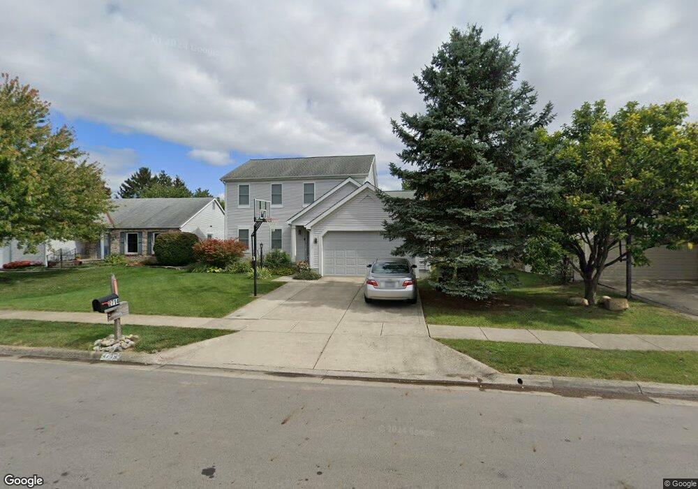
2714 Field Post Ct Hilliard, OH 43026
Cross Creek NeighborhoodEstimated Value: $414,646 - $461,000
4
Beds
3
Baths
2,084
Sq Ft
$209/Sq Ft
Est. Value
About This Home
This home is located at 2714 Field Post Ct, Hilliard, OH 43026 and is currently estimated at $434,912, approximately $208 per square foot. 2714 Field Post Ct is a home located in Franklin County with nearby schools including Scioto Darby Elementary School, Hilliard Station Sixth Grade Elementary School, and Hilliard Heritage Middle School.
Ownership History
Date
Name
Owned For
Owner Type
Purchase Details
Closed on
Jul 30, 1997
Sold by
Bragg B David and Bragg Lori L
Bought by
Beard Andy and Pomarico Lisa
Current Estimated Value
Home Financials for this Owner
Home Financials are based on the most recent Mortgage that was taken out on this home.
Original Mortgage
$128,800
Outstanding Balance
$19,544
Interest Rate
7.68%
Estimated Equity
$415,368
Purchase Details
Closed on
Oct 21, 1996
Sold by
Wholesale Homes Inc
Bought by
Bragg B David and Bragg Lori L
Purchase Details
Closed on
Jan 3, 1990
Create a Home Valuation Report for This Property
The Home Valuation Report is an in-depth analysis detailing your home's value as well as a comparison with similar homes in the area
Home Values in the Area
Average Home Value in this Area
Purchase History
| Date | Buyer | Sale Price | Title Company |
|---|---|---|---|
| Beard Andy | $161,000 | Ohio Bar Title Agency | |
| Bragg B David | $40,000 | -- | |
| -- | $124,400 | -- |
Source: Public Records
Mortgage History
| Date | Status | Borrower | Loan Amount |
|---|---|---|---|
| Open | Beard Andy | $128,800 |
Source: Public Records
Tax History
| Year | Tax Paid | Tax Assessment Tax Assessment Total Assessment is a certain percentage of the fair market value that is determined by local assessors to be the total taxable value of land and additions on the property. | Land | Improvement |
|---|---|---|---|---|
| 2025 | $8,208 | $122,540 | $33,810 | $88,730 |
| 2024 | $8,208 | $122,540 | $33,810 | $88,730 |
| 2023 | $6,683 | $122,540 | $33,810 | $88,730 |
| 2022 | $6,153 | $89,780 | $15,370 | $74,410 |
| 2021 | $6,149 | $89,780 | $15,370 | $74,410 |
| 2020 | $6,133 | $89,780 | $15,370 | $74,410 |
| 2019 | $5,717 | $71,230 | $12,290 | $58,940 |
| 2018 | $5,560 | $71,230 | $12,290 | $58,940 |
| 2017 | $5,719 | $71,230 | $12,290 | $58,940 |
| 2016 | $5,742 | $66,470 | $13,340 | $53,130 |
| 2015 | $5,423 | $66,470 | $13,340 | $53,130 |
| 2014 | $5,432 | $66,470 | $13,340 | $53,130 |
| 2013 | $2,626 | $63,315 | $12,705 | $50,610 |
Source: Public Records
Map
Nearby Homes
- 5570 Oldwynne Rd
- 2600 Pennbrook Ct
- 2571 Rustling Oak Blvd
- 5483 Thorney Dr
- 2592 Cowall Dr
- 5358 Beringer Dr
- 5521 Mirage Dr
- 2921 Mondavi Ln
- 2967 Brookmont Ct
- 3045 Bohlen Dr
- 5288 Hyde Park Dr
- 2772 Quailview Ln
- 4559 Addison Ln N
- 5380 Carjan Way
- 5176 Skytrail Dr
- 5887 Alturas Way
- 2859 Lake Hollow Rd
- 3150 Hilliard Rome Rd
- 2477 Crystal Springs Dr
- 0 Hilliard Rome Rd Unit 225040295
- 2706 Field Post Ct
- 2724 Field Post Ct
- 2721 Oakside Ct
- 2715 Oakside Ct
- 2730 Field Post Ct
- 5596 Oldwynne Rd
- 2729 Oakside Ct
- 2707 Field Post Ct
- 5586 Oldwynne Rd
- 2710 Oakside Ct
- 2733 Field Post Ct
- 2725 Field Post Ct
- 2737 Oakside Ct
- 2695 Field Post Ct
- 5578 Oldwynne Rd
- 2731 Field Post Ct
- 2745 Oakside Ct
- 5636 Oldwynne Rd
- 2716 Oakside Ct
- 2720 Oakside Ct
Your Personal Tour Guide
Ask me questions while you tour the home.