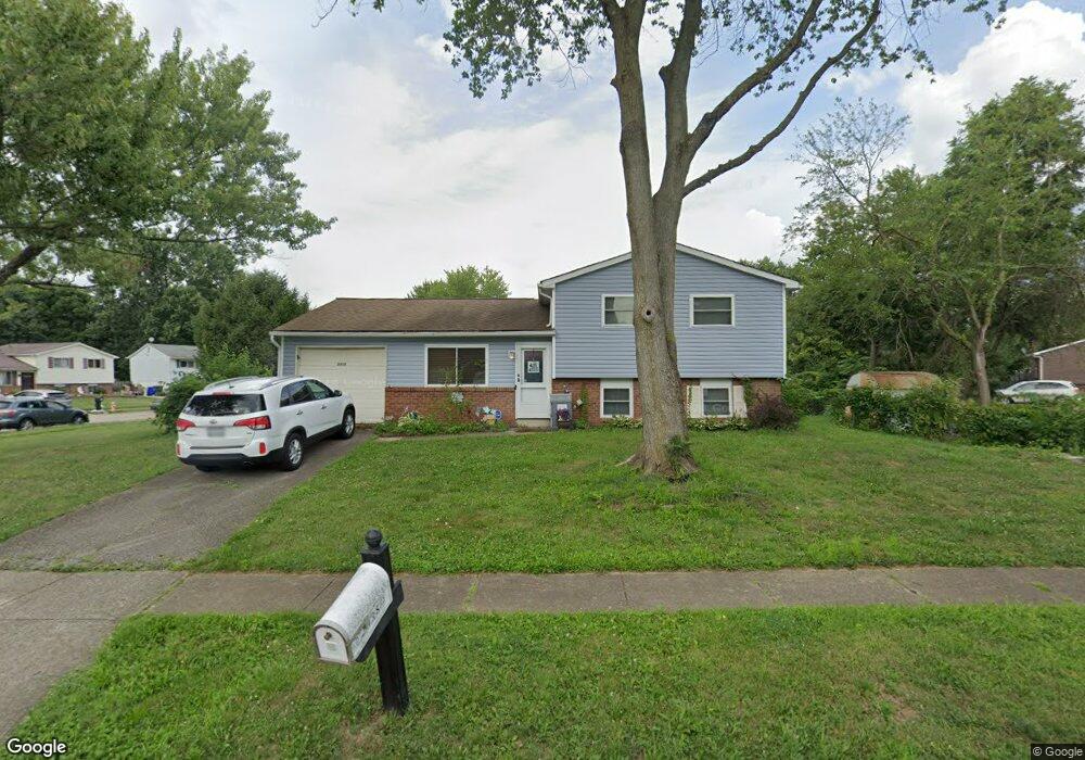
2938 Thornell Way Columbus, OH 43232
Walnut Heights NeighborhoodEstimated Value: $188,197 - $235,000
3
Beds
2
Baths
930
Sq Ft
$227/Sq Ft
Est. Value
About This Home
This home is located at 2938 Thornell Way, Columbus, OH 43232 and is currently estimated at $211,049, approximately $226 per square foot. 2938 Thornell Way is a home located in Franklin County with nearby schools including Liberty Elementary School, Yorktown Middle School, and Independence High School.
Ownership History
Date
Name
Owned For
Owner Type
Purchase Details
Closed on
Jul 7, 2000
Sold by
Rose David L and Rose Melinda J
Bought by
Mayberry Cheryl
Current Estimated Value
Home Financials for this Owner
Home Financials are based on the most recent Mortgage that was taken out on this home.
Original Mortgage
$84,350
Outstanding Balance
$30,867
Interest Rate
8.55%
Mortgage Type
FHA
Estimated Equity
$180,182
Purchase Details
Closed on
Oct 2, 1992
Purchase Details
Closed on
May 13, 1988
Create a Home Valuation Report for This Property
The Home Valuation Report is an in-depth analysis detailing your home's value as well as a comparison with similar homes in the area
Home Values in the Area
Average Home Value in this Area
Purchase History
| Date | Buyer | Sale Price | Title Company |
|---|---|---|---|
| Mayberry Cheryl | $86,900 | Title First Agency Inc | |
| -- | $60,000 | -- | |
| -- | -- | -- |
Source: Public Records
Mortgage History
| Date | Status | Borrower | Loan Amount |
|---|---|---|---|
| Open | Mayberry Cheryl | $84,350 |
Source: Public Records
Tax History Compared to Growth
Tax History
| Year | Tax Paid | Tax Assessment Tax Assessment Total Assessment is a certain percentage of the fair market value that is determined by local assessors to be the total taxable value of land and additions on the property. | Land | Improvement |
|---|---|---|---|---|
| 2024 | $2,762 | $61,540 | $18,450 | $43,090 |
| 2023 | $2,727 | $61,530 | $18,445 | $43,085 |
| 2022 | $1,870 | $36,060 | $7,530 | $28,530 |
| 2021 | $1,874 | $36,060 | $7,530 | $28,530 |
| 2020 | $1,947 | $36,060 | $7,530 | $28,530 |
| 2019 | $1,852 | $30,530 | $6,270 | $24,260 |
| 2018 | $1,289 | $30,530 | $6,270 | $24,260 |
| 2017 | $1,327 | $30,530 | $6,270 | $24,260 |
| 2016 | $803 | $12,120 | $6,130 | $5,990 |
| 2015 | $729 | $12,120 | $6,130 | $5,990 |
| 2014 | $731 | $12,120 | $6,130 | $5,990 |
| 2013 | $400 | $13,440 | $6,790 | $6,650 |
Source: Public Records
Map
Nearby Homes
- 5377 Bleaker Ave
- 5401 Spire Ln
- 5278 Glenbriar Ct
- 5373 Spire Ln
- 2730 Raphael Dr
- 2744 Barrows Rd
- 2736 Barrows Rd
- 2998 Osgood Rd E
- 2991 Blue Moon Dr
- 5137 Holbrook Dr
- 2651 Brownfield Rd
- 3148 Aldgate St
- 3198 Gallant Dr
- 5268 Carbondale Dr
- 5011 Refugee Rd
- 5125 Upton Rd N
- 5882 Abernathy Ln Unit 5882F
- 3057 Lamptonridge Dr
- 3289 Kady Ln
- 5936 Abernathy Ln
- 5351 Adderley Ave
- 2950 Thornell Way
- 5359 Adderley Ave
- 5362 Bleaker Ave
- 5367 Adderley Ave
- 2947 Thornell Way
- 2955 Thornell Way
- 2941 Thornell Way
- 2950 Bleaker Ave
- 5342 Adderley Ave
- 5334 Adderley Ave
- 5375 Adderley Ave
- 5370 Bleaker Ave
- 5350 Adderley Ave
- 2925 Thornell Way
- 5358 Adderley Ave
- 2933 Thornell Way
- 5326 Adderley Ave
- 2967 Thornell Way
- 5366 Adderley Ave