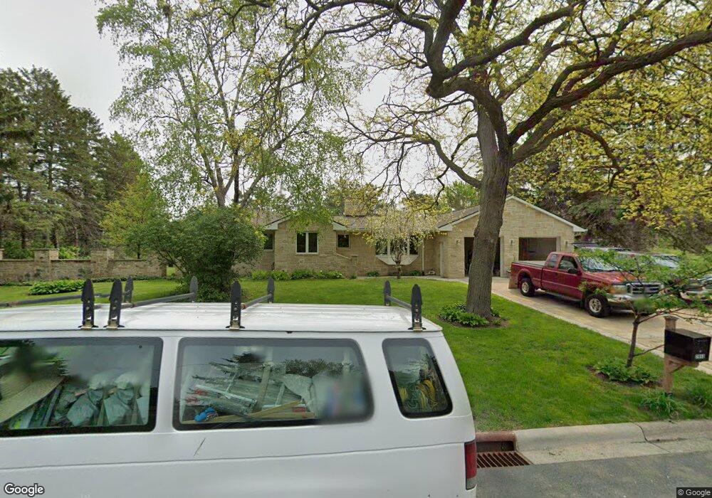
2950 Burnside Ave Saint Paul, MN 55121
Estimated Value: $425,000 - $500,000
3
Beds
1
Bath
2,160
Sq Ft
$213/Sq Ft
Est. Value
About This Home
This home is located at 2950 Burnside Ave, Saint Paul, MN 55121 and is currently estimated at $460,483, approximately $213 per square foot. 2950 Burnside Ave is a home located in Dakota County with nearby schools including Pilot Knob STEM Magnet School, Friendly Hills Middle School, and Two Rivers High School.
Ownership History
Date
Name
Owned For
Owner Type
Purchase Details
Closed on
Aug 18, 2004
Sold by
Marcel Duc
Bought by
Rozumny Gina and Rozumny Dion
Current Estimated Value
Purchase Details
Closed on
Feb 2, 2000
Sold by
Mundstock James and Mundstock Lar
Bought by
Nguyen Duc Marcel
Create a Home Valuation Report for This Property
The Home Valuation Report is an in-depth analysis detailing your home's value as well as a comparison with similar homes in the area
Home Values in the Area
Average Home Value in this Area
Purchase History
| Date | Buyer | Sale Price | Title Company |
|---|---|---|---|
| Rozumny Gina | $212,000 | -- | |
| Nguyen Duc Marcel | $113,000 | -- |
Source: Public Records
Tax History Compared to Growth
Tax History
| Year | Tax Paid | Tax Assessment Tax Assessment Total Assessment is a certain percentage of the fair market value that is determined by local assessors to be the total taxable value of land and additions on the property. | Land | Improvement |
|---|---|---|---|---|
| 2024 | $4,130 | $449,500 | $90,500 | $359,000 |
| 2023 | $3,812 | $462,500 | $90,800 | $371,700 |
| 2022 | $3,560 | $451,100 | $90,600 | $360,500 |
| 2021 | $3,376 | $372,400 | $78,700 | $293,700 |
| 2020 | $3,224 | $341,600 | $75,000 | $266,600 |
| 2019 | $4,255 | $315,400 | $71,400 | $244,000 |
| 2018 | $4,311 | $399,600 | $68,000 | $331,600 |
| 2017 | $4,168 | $350,200 | $64,800 | $285,400 |
| 2016 | $3,720 | $324,300 | $61,700 | $262,600 |
| 2015 | $3,800 | $299,788 | $59,822 | $239,966 |
| 2014 | -- | $298,262 | $58,141 | $240,121 |
| 2013 | -- | $288,452 | $52,613 | $235,839 |
Source: Public Records
Map
Nearby Homes
- 1360 Lone Oak Rd
- 2865 Pilot Knob Rd
- 3050 Shields Dr Unit 103
- 3063 Timberwood Trail Unit 41
- 3082 Timberwood Trail Unit 34
- 3158 Quarry Ct
- 2850 Bridgeview Terrace
- 1076 Mckee St
- 1700 Four Oaks Rd Unit 118
- 1700 Four Oaks Rd Unit 314B
- 1603 Raindrop Dr
- 3243 Evergreen Dr
- 3259 Valley Ridge Dr Unit 10
- 3268 Valley Ridge Dr Unit 37
- 3296 Hill Ridge Dr Unit 58
- 3419 Highlander Dr
- 1481 Woodview Ave E
- 1544 Greenwood Ct N
- 3470 Greenwood Ct S
- 1654 Hunt Dr
- 2930 Burnside Ave
- 2970 Burnside Ave
- 2909 Egan Ave
- 2910 Burnside Ave
- 2950 Egan Ave
- 2899 Fairlawn Place
- 2945 Egan Ave
- 2976 Burnside Ave
- 2969 Burnside Ave
- 2960 Egan Ave
- 2960 Inland Rd
- 2940 Inland Rd
- 2905 Egan Ave
- 2893 Fairlawn Place
- 2970 Egan Ave
- 2894 Fairlawn Place
- 2975 Egan Ave
- 2984 Burnside Ave
- 2898 Egan Ave
- 1383 Rainier Ln