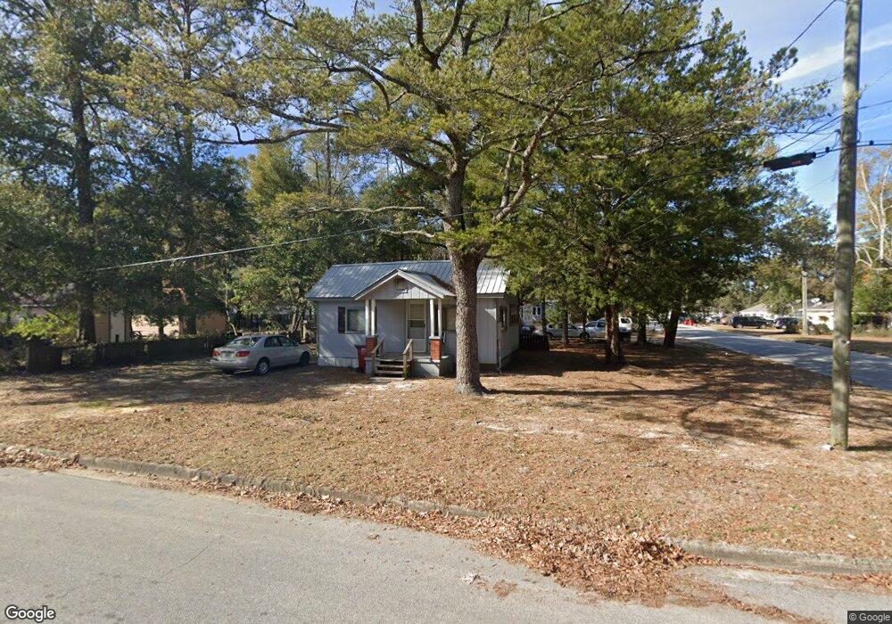
298 E Cobb Ave Crestview, FL 32539
Estimated Value: $64,162 - $92,000
1
Bed
1
Bath
576
Sq Ft
$135/Sq Ft
Est. Value
About This Home
This home is located at 298 E Cobb Ave, Crestview, FL 32539 and is currently estimated at $78,041, approximately $135 per square foot. 298 E Cobb Ave is a home located in Okaloosa County with nearby schools including Riverside Elementary School, Shoal River Middle School, and Crestview High School.
Ownership History
Date
Name
Owned For
Owner Type
Purchase Details
Closed on
Feb 6, 2024
Sold by
Cotton Patricia Ann
Bought by
Cotton Patricia Ann and Pigott Terese
Current Estimated Value
Purchase Details
Closed on
Nov 25, 2002
Sold by
Webb Brenda K
Bought by
Cotton A W
Purchase Details
Closed on
Mar 23, 2002
Sold by
Webb William P
Bought by
Webb Brenda K
Purchase Details
Closed on
Feb 11, 2002
Sold by
Wilkinson Charles E
Bought by
Webb William R
Purchase Details
Closed on
Feb 7, 2001
Sold by
Etheridge Helen C
Bought by
Wilkinson Charles E
Create a Home Valuation Report for This Property
The Home Valuation Report is an in-depth analysis detailing your home's value as well as a comparison with similar homes in the area
Home Values in the Area
Average Home Value in this Area
Purchase History
| Date | Buyer | Sale Price | Title Company |
|---|---|---|---|
| Cotton Patricia Ann | -- | None Listed On Document | |
| Cotton A W | $6,000 | -- | |
| Webb Brenda K | -- | -- | |
| Webb William R | $9,000 | -- | |
| Wilkinson Charles E | -- | -- | |
| Wilkinson Charles E | -- | -- |
Source: Public Records
Tax History
| Year | Tax Paid | Tax Assessment Tax Assessment Total Assessment is a certain percentage of the fair market value that is determined by local assessors to be the total taxable value of land and additions on the property. | Land | Improvement |
|---|---|---|---|---|
| 2025 | $534 | $34,540 | $10,836 | $23,704 |
| 2024 | $472 | $30,646 | $7,578 | $23,068 |
| 2023 | $472 | $32,639 | $7,082 | $25,557 |
| 2022 | $438 | $30,696 | $6,618 | $24,078 |
| 2021 | $385 | $23,540 | $6,300 | $17,240 |
| 2020 | $364 | $23,438 | $7,700 | $15,738 |
| 2019 | $318 | $18,706 | $4,860 | $13,846 |
| 2018 | $306 | $17,803 | $0 | $0 |
| 2017 | $293 | $16,814 | $0 | $0 |
| 2016 | $297 | $17,193 | $0 | $0 |
| 2015 | $275 | $15,568 | $0 | $0 |
| 2014 | $265 | $15,820 | $0 | $0 |
Source: Public Records
Map
Nearby Homes
- 406 E Griffith Ave
- 625 E Chestnut Ave
- 327 E Railroad Ave
- 751 E Chestnut Ave
- 1359 E Chestnut Ave
- 749 Amos St
- 296 S Wilson St
- 451 E Cane Ave
- 873 S Brett St
- 450 S Savage St
- 544 Purl Adams Ave
- 503 Tall Pines St
- 191.95 Ac Highway 90
- 981 E Chestnut Ave
- 228 Cross Dr
- TBD E James Lee Blvd
- 860 S Rayburn St
- 401-409 Brock Ave
- 658 W Griffith Ave
- 556 Lee Ave
- 246 E Cobb Ave
- 491 S Brett St
- 249 E Cobb Ave
- 241 E Cobb Ave
- 501 Brett St
- 211 E Griffith Ave
- 501 S Brett St
- 209 E Griffith Ave
- 332 E Cobb Ave
- 207 E Griffith Ave
- 535 S Ferdon Blvd Unit B
- 535 S Ferdon Blvd Unit A
- 303 E Cobb Ave
- 205 E Griffith Ave
- 403 S Brett St
- 591 S Brett St
- 491 S Ferdon Blvd
- 335 E Griffith Ave
- 396 E Cobb Ave
- 537 S Ferdon Blvd
Your Personal Tour Guide
Ask me questions while you tour the home.