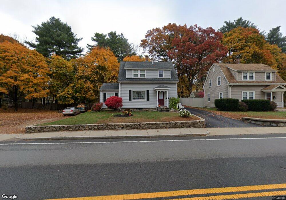
299 W Central St Franklin, MA 02038
Downtown Franklin NeighborhoodEstimated Value: $522,619 - $566,000
3
Beds
2
Baths
1,397
Sq Ft
$393/Sq Ft
Est. Value
About This Home
This home is located at 299 W Central St, Franklin, MA 02038 and is currently estimated at $549,655, approximately $393 per square foot. 299 W Central St is a home located in Norfolk County with nearby schools including Helen Keller Elementary School, Annie Sullivan Middle School, and Franklin High School.
Ownership History
Date
Name
Owned For
Owner Type
Purchase Details
Closed on
Nov 17, 2019
Sold by
Matto Kerry F and Matto Laurie A
Bought by
Matto Courtney M and Matto Paul H
Current Estimated Value
Purchase Details
Closed on
Dec 8, 1994
Sold by
Plausse Carol
Bought by
Matto Kerry F and Matto Laurie A
Home Financials for this Owner
Home Financials are based on the most recent Mortgage that was taken out on this home.
Original Mortgage
$35,000
Interest Rate
9%
Mortgage Type
Purchase Money Mortgage
Create a Home Valuation Report for This Property
The Home Valuation Report is an in-depth analysis detailing your home's value as well as a comparison with similar homes in the area
Home Values in the Area
Average Home Value in this Area
Purchase History
| Date | Buyer | Sale Price | Title Company |
|---|---|---|---|
| Matto Courtney M | -- | -- | |
| Matto Kerry F | $125,000 | -- |
Source: Public Records
Mortgage History
| Date | Status | Borrower | Loan Amount |
|---|---|---|---|
| Previous Owner | Matto Kerry F | $35,000 |
Source: Public Records
Tax History
| Year | Tax Paid | Tax Assessment Tax Assessment Total Assessment is a certain percentage of the fair market value that is determined by local assessors to be the total taxable value of land and additions on the property. | Land | Improvement |
|---|---|---|---|---|
| 2025 | $5,141 | $442,400 | $234,200 | $208,200 |
| 2024 | $4,974 | $421,900 | $234,200 | $187,700 |
| 2023 | $5,280 | $419,700 | $255,700 | $164,000 |
| 2022 | $4,934 | $351,200 | $195,200 | $156,000 |
| 2021 | $4,805 | $328,000 | $203,200 | $124,800 |
| 2020 | $4,691 | $323,300 | $205,000 | $118,300 |
| 2019 | $4,370 | $298,100 | $179,800 | $118,300 |
| 2018 | $4,228 | $288,600 | $183,400 | $105,200 |
| 2017 | $4,155 | $285,000 | $179,800 | $105,200 |
| 2016 | $4,056 | $279,700 | $186,900 | $92,800 |
| 2015 | $3,884 | $261,700 | $168,900 | $92,800 |
| 2014 | $3,711 | $256,800 | $164,000 | $92,800 |
Source: Public Records
Map
Nearby Homes
- 163 W Central St
- 120 Union St Unit 1
- 78 Highwood Dr
- 14 Pleasant St Unit B
- 88 Crescent St
- 6 Pine Knoll Rd
- 602 Franklin Crossing Rd Unit 602
- 1801 Franklin Crossing Rd Unit 1801
- 17 Longhill Rd
- 374-378 Union St
- 6 Lydia Ln
- 3 Washington St
- 1 Washington St
- 404 Oak St
- 99 Summer St
- 37 Cross St
- 204 Lincoln St
- 25 Brookview Rd
- 30 Longobardi Dr Unit 30
- 834-836 W Central St
- 295 W Central St
- 5 Buena Vista Dr
- 7 Buena Vista Dr
- 7 Buena Vista Dr Unit 7
- 306 W Central St
- 309 W Central St
- 11 Buena Vista Dr
- 9 Buena Vista Dr
- 9 Buena Vista Dr Unit 9
- 285 W Central St
- 1 Buena Vista Dr
- 3 Buena Vista Dr
- 290 W Central St
- 286 W Central St Unit 1
- 286 W Central St
- 2 Buena Vista Dr Unit 2
- 2 Buena Vista Dr Unit 5a
- 4 Buena Vista Dr
- 2 Buena Vista Dr
- 4 Buena Vista Dr Unit 4
Your Personal Tour Guide
Ask me questions while you tour the home.