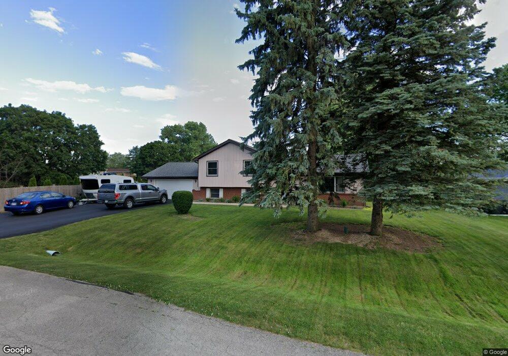
29W303 Staffeldt Dr Naperville, IL 60564
Wheatland South NeighborhoodEstimated Value: $412,420 - $509,000
--
Bed
--
Bath
1,385
Sq Ft
$343/Sq Ft
Est. Value
About This Home
This home is located at 29W303 Staffeldt Dr, Naperville, IL 60564 and is currently estimated at $475,605, approximately $343 per square foot. 29W303 Staffeldt Dr is a home with nearby schools including Ellsworth Elementary School, Clifford Crone Middle School, and Neuqua Valley High School.
Ownership History
Date
Name
Owned For
Owner Type
Purchase Details
Closed on
Feb 9, 2022
Sold by
Wilson Gregory Scott and Wilson Linda Carol
Bought by
Wilson Gregory Scott and Wilson Linda Carol
Current Estimated Value
Purchase Details
Closed on
Dec 31, 1996
Sold by
Crotteau Richard E and Crotteau Patricia J
Bought by
Wilson Gregory S and Wilson Linda C
Home Financials for this Owner
Home Financials are based on the most recent Mortgage that was taken out on this home.
Original Mortgage
$134,400
Interest Rate
7.6%
Create a Home Valuation Report for This Property
The Home Valuation Report is an in-depth analysis detailing your home's value as well as a comparison with similar homes in the area
Home Values in the Area
Average Home Value in this Area
Purchase History
| Date | Buyer | Sale Price | Title Company |
|---|---|---|---|
| Wilson Gregory Scott | -- | None Listed On Document | |
| Wilson Gregory S | $168,000 | Law Title Pick Up |
Source: Public Records
Mortgage History
| Date | Status | Borrower | Loan Amount |
|---|---|---|---|
| Previous Owner | Wilson Gregory S | $134,400 |
Source: Public Records
Tax History Compared to Growth
Tax History
| Year | Tax Paid | Tax Assessment Tax Assessment Total Assessment is a certain percentage of the fair market value that is determined by local assessors to be the total taxable value of land and additions on the property. | Land | Improvement |
|---|---|---|---|---|
| 2024 | $6,880 | $131,066 | $25,941 | $105,125 |
| 2023 | $6,880 | $115,783 | $22,916 | $92,867 |
| 2022 | $5,872 | $99,782 | $21,679 | $78,103 |
| 2021 | $5,568 | $95,031 | $20,647 | $74,384 |
| 2020 | $5,458 | $93,525 | $20,320 | $73,205 |
| 2019 | $5,351 | $90,889 | $19,747 | $71,142 |
| 2018 | $4,906 | $82,736 | $19,312 | $63,424 |
| 2017 | $4,827 | $80,600 | $18,813 | $61,787 |
| 2016 | $4,804 | $78,865 | $18,408 | $60,457 |
| 2015 | $4,583 | $75,832 | $17,700 | $58,132 |
| 2014 | $4,583 | $66,310 | $17,700 | $48,610 |
| 2013 | $4,583 | $66,310 | $17,700 | $48,610 |
Source: Public Records
Map
Nearby Homes
- 29W316 Andermann Dr
- 4007 Heron Ct Unit 1
- 2255 Wendt Cir
- 3707 Junebreeze Ln
- 3105 Saganashkee Ln
- 3616 Eliot Ln
- 1804 Princess Cir
- 1736 Robert Ln
- 2207 Sisters Ave
- 2949 Brossman St
- 2866 Stonewater Dr Unit 102
- 3432 Caine Dr
- 3004 Bennett Dr
- 3003 Kingbird Ct Unit IV
- 2736 Bluewater Cir
- 1112 Saratoga Ct
- 3432 Redwing Dr Unit 2
- 3349 Rosecroft Ln Unit 2
- 3816 Rosada Dr
- 2636 Salix Cir
- 29W317 Staffeldt Dr
- 11S514 Webster Ln
- 29W304 Staffeldt Dr
- 29W331 Staffeldt Dr
- 11S530 Webster Ln
- 29W278 Staffeldt Dr
- 29 Staffeldt Dr Unit 278
- 29 Staffeldt Dr
- 29W318 Staffeldt Dr
- 29W345 Staffeldt Dr
- 29W304 Hartman Dr
- 11S481 Mcgrath Ln
- 29W280 Hartman Dr
- 11S501 Webster Ln
- 29W316 Hartman Dr
- 11S517 Webster Ln
- 29W332 Hartman Dr
- 274 Mcgrath Ln
- 11S471 Webster Ln
- 11S471 Mcgrath Ln