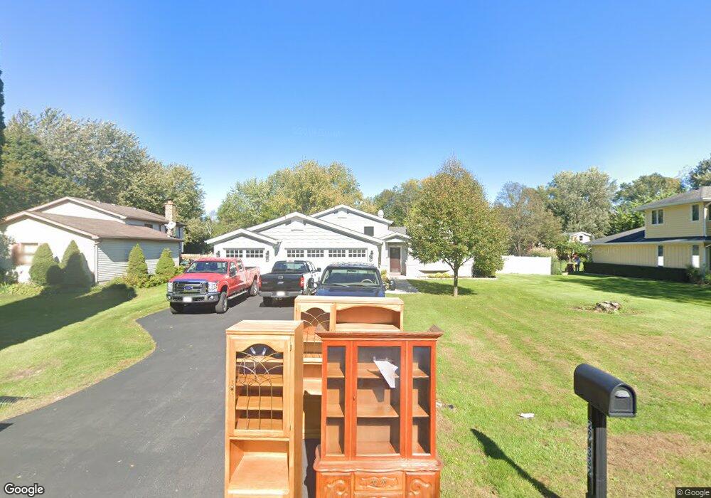
29W332 Hartman Dr Naperville, IL 60564
Wheatland South NeighborhoodEstimated Value: $435,861 - $500,000
--
Bed
--
Bath
1,276
Sq Ft
$369/Sq Ft
Est. Value
About This Home
This home is located at 29W332 Hartman Dr, Naperville, IL 60564 and is currently estimated at $470,965, approximately $369 per square foot. 29W332 Hartman Dr is a home with nearby schools including Ellsworth Elementary School, Clifford Crone Middle School, and Neuqua Valley High School.
Ownership History
Date
Name
Owned For
Owner Type
Purchase Details
Closed on
Sep 27, 1996
Sold by
Cook John W
Bought by
Hanson Rex R and Landorf Judy L
Current Estimated Value
Home Financials for this Owner
Home Financials are based on the most recent Mortgage that was taken out on this home.
Original Mortgage
$153,400
Outstanding Balance
$13,935
Interest Rate
7.97%
Estimated Equity
$457,030
Purchase Details
Closed on
Sep 23, 1993
Sold by
Koth Mary Lee and Cook Mary Lee
Bought by
Cook John W
Create a Home Valuation Report for This Property
The Home Valuation Report is an in-depth analysis detailing your home's value as well as a comparison with similar homes in the area
Home Values in the Area
Average Home Value in this Area
Purchase History
| Date | Buyer | Sale Price | Title Company |
|---|---|---|---|
| Hanson Rex R | $176,000 | -- | |
| Cook John W | -- | -- |
Source: Public Records
Mortgage History
| Date | Status | Borrower | Loan Amount |
|---|---|---|---|
| Open | Hanson Rex R | $153,400 |
Source: Public Records
Tax History Compared to Growth
Tax History
| Year | Tax Paid | Tax Assessment Tax Assessment Total Assessment is a certain percentage of the fair market value that is determined by local assessors to be the total taxable value of land and additions on the property. | Land | Improvement |
|---|---|---|---|---|
| 2024 | $6,937 | $132,023 | $25,941 | $106,082 |
| 2023 | $6,937 | $116,628 | $22,916 | $93,712 |
| 2022 | $5,919 | $100,493 | $21,679 | $78,814 |
| 2021 | $5,944 | $95,708 | $20,647 | $75,061 |
| 2020 | $5,833 | $94,192 | $20,320 | $73,872 |
| 2019 | $5,365 | $91,537 | $19,747 | $71,790 |
| 2018 | $4,742 | $80,784 | $19,312 | $61,472 |
| 2017 | $4,665 | $78,698 | $18,813 | $59,885 |
| 2016 | $4,641 | $77,004 | $18,408 | $58,596 |
| 2015 | -- | $68,598 | $17,700 | $50,898 |
| 2014 | -- | $59,090 | $17,700 | $41,390 |
| 2013 | -- | $59,090 | $17,700 | $41,390 |
Source: Public Records
Map
Nearby Homes
- 29W316 Andermann Dr
- 4007 Heron Ct Unit 1
- 2255 Wendt Cir
- 3707 Junebreeze Ln
- 3105 Saganashkee Ln
- 1804 Princess Cir
- 3616 Eliot Ln
- 1736 Robert Ln
- 2207 Sisters Ave
- 2866 Stonewater Dr Unit 102
- 2949 Brossman St
- 3432 Caine Dr
- 3432 Redwing Dr Unit 2
- 3003 Kingbird Ct Unit IV
- 1112 Saratoga Ct
- 2711 Wait Rd
- 3349 Rosecroft Ln Unit 2
- 2736 Bluewater Cir
- 3420 Sunnyside Ct
- 3816 Rosada Dr
- 29W344 Hartman Dr
- 29W316 Hartman Dr
- 29W331 Hartman Dr
- 29W304 Hartman Dr
- 29W345 Hartman Dr Unit 4
- 29W317 Hartman Dr
- 11S556 Mcgrath Ln
- 29W303 Hartman Dr
- 274 Mcgrath Ln
- 11S584 Mcgrath Ln
- 11S544 Mcgrath Ln
- 29W280 Hartman Dr
- 11S570 Mcgrath Ln
- 29W331 Staffeldt Dr
- 29W345 Staffeldt Dr
- 29W317 Staffeldt Dr
- 11S530 Mcgrath Ln
- 29W281 Hartman Dr
- 11S612 Mcgrath Ln
- lot Mc Grath Ln