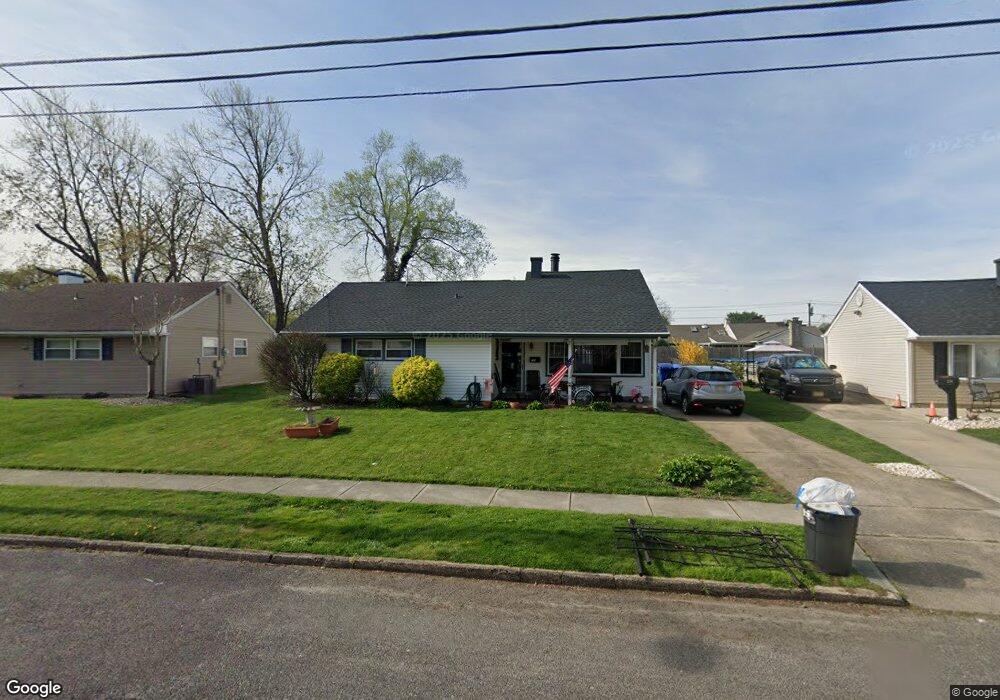
30 Paul Rd Maple Shade, NJ 08052
Estimated Value: $309,338 - $343,000
--
Bed
--
Bath
1,432
Sq Ft
$224/Sq Ft
Est. Value
About This Home
This home is located at 30 Paul Rd, Maple Shade, NJ 08052 and is currently estimated at $321,335, approximately $224 per square foot. 30 Paul Rd is a home located in Burlington County with nearby schools including Maude M. Wilkins Elementary School, Ralph J Steinhauer Elementary School, and Howard R Yocum School.
Ownership History
Date
Name
Owned For
Owner Type
Purchase Details
Closed on
Jul 15, 2002
Sold by
Vallen Kevin
Bought by
Mcclure Dale E and Mcclure Helen A
Current Estimated Value
Home Financials for this Owner
Home Financials are based on the most recent Mortgage that was taken out on this home.
Original Mortgage
$77,000
Outstanding Balance
$32,341
Interest Rate
6.58%
Mortgage Type
Stand Alone First
Estimated Equity
$288,994
Purchase Details
Closed on
Mar 21, 2002
Sold by
Smallman Frank E
Bought by
Vallen Kevin
Home Financials for this Owner
Home Financials are based on the most recent Mortgage that was taken out on this home.
Original Mortgage
$37,000
Interest Rate
6.84%
Create a Home Valuation Report for This Property
The Home Valuation Report is an in-depth analysis detailing your home's value as well as a comparison with similar homes in the area
Home Values in the Area
Average Home Value in this Area
Purchase History
| Date | Buyer | Sale Price | Title Company |
|---|---|---|---|
| Mcclure Dale E | $122,500 | Surety Title Corporation | |
| Vallen Kevin | $82,500 | Members Title Agency |
Source: Public Records
Mortgage History
| Date | Status | Borrower | Loan Amount |
|---|---|---|---|
| Open | Mcclure Dale E | $77,000 | |
| Previous Owner | Vallen Kevin | $37,000 |
Source: Public Records
Tax History Compared to Growth
Tax History
| Year | Tax Paid | Tax Assessment Tax Assessment Total Assessment is a certain percentage of the fair market value that is determined by local assessors to be the total taxable value of land and additions on the property. | Land | Improvement |
|---|---|---|---|---|
| 2025 | $5,736 | $151,100 | $48,900 | $102,200 |
| 2024 | $5,570 | $151,100 | $48,900 | $102,200 |
| 2023 | $5,570 | $151,100 | $48,900 | $102,200 |
| 2022 | $5,483 | $151,100 | $48,900 | $102,200 |
| 2021 | $4,558 | $151,100 | $48,900 | $102,200 |
| 2020 | $5,446 | $151,100 | $48,900 | $102,200 |
| 2019 | $5,246 | $151,100 | $48,900 | $102,200 |
| 2018 | $5,156 | $151,100 | $48,900 | $102,200 |
| 2017 | $4,595 | $151,100 | $48,900 | $102,200 |
| 2016 | $4,520 | $151,100 | $48,900 | $102,200 |
| 2015 | $4,411 | $151,100 | $48,900 | $102,200 |
| 2014 | $4,261 | $151,100 | $48,900 | $102,200 |
Source: Public Records
Map
Nearby Homes
- 5 Paul Rd
- 2 Gainor Ave
- 319 S Coles Ave
- 327 S Coles Ave
- 57 S Terrace Ave
- 480 W Front St
- 8515 Bryn Mawr Ave
- 8275 Maple Ave
- 102 Avignon Way
- 29 W Broadway
- 301 N Coles Ave
- 410 S Forklanding Rd
- 112 S Maple Ave
- 120 E Center Ave
- 22 Theodore Ave
- 111 Chestnut St Unit 208
- 111 Chestnut St Unit 404
- 26 N Poplar Ave
- 50 Mara Ct
- 47 Mara Ct