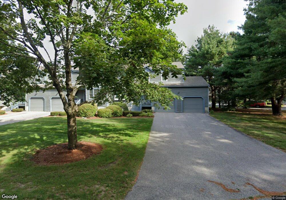
30 Quince Island Rd Franklin, MA 02038
Estimated Value: $571,000 - $598,000
2
Beds
3
Baths
1,900
Sq Ft
$310/Sq Ft
Est. Value
About This Home
This home is located at 30 Quince Island Rd, Franklin, MA 02038 and is currently estimated at $589,016, approximately $310 per square foot. 30 Quince Island Rd is a home located in Norfolk County with nearby schools including Remington Middle School, Franklin High School, and Benjamin Franklin Classical Charter Public School.
Ownership History
Date
Name
Owned For
Owner Type
Purchase Details
Closed on
Feb 27, 2004
Sold by
Hansen Shannon M
Bought by
Shannon M Hansen Lt and Hansen Shannon M
Current Estimated Value
Purchase Details
Closed on
Aug 1, 2003
Sold by
Est Macinnes Evelyn F and Younglacus Patricia A
Bought by
Hansen Shannon M
Home Financials for this Owner
Home Financials are based on the most recent Mortgage that was taken out on this home.
Original Mortgage
$134,900
Interest Rate
5.28%
Mortgage Type
Purchase Money Mortgage
Create a Home Valuation Report for This Property
The Home Valuation Report is an in-depth analysis detailing your home's value as well as a comparison with similar homes in the area
Home Values in the Area
Average Home Value in this Area
Purchase History
| Date | Buyer | Sale Price | Title Company |
|---|---|---|---|
| Shannon M Hansen Lt | -- | -- | |
| Hansen Shannon M | $324,900 | -- |
Source: Public Records
Mortgage History
| Date | Status | Borrower | Loan Amount |
|---|---|---|---|
| Open | Hansen Shannon M | $27,500 | |
| Open | Hansen Shannon M | $163,000 | |
| Previous Owner | Hansen Shannon M | $134,900 | |
| Previous Owner | Hansen Shannon M | $64,500 |
Source: Public Records
Tax History Compared to Growth
Tax History
| Year | Tax Paid | Tax Assessment Tax Assessment Total Assessment is a certain percentage of the fair market value that is determined by local assessors to be the total taxable value of land and additions on the property. | Land | Improvement |
|---|---|---|---|---|
| 2025 | $6,013 | $517,500 | $0 | $517,500 |
| 2024 | $5,889 | $499,500 | $0 | $499,500 |
| 2023 | $5,559 | $441,900 | $0 | $441,900 |
| 2022 | $5,522 | $393,000 | $0 | $393,000 |
| 2021 | $5,264 | $359,300 | $0 | $359,300 |
| 2020 | $4,841 | $333,600 | $0 | $333,600 |
| 2019 | $4,813 | $328,300 | $0 | $328,300 |
| 2018 | $4,420 | $301,700 | $0 | $301,700 |
| 2017 | $4,233 | $290,300 | $0 | $290,300 |
| 2016 | $4,227 | $291,500 | $0 | $291,500 |
| 2015 | $4,226 | $284,800 | $0 | $284,800 |
| 2014 | $3,903 | $270,100 | $0 | $270,100 |
Source: Public Records
Map
Nearby Homes
- 32 Quince Island Rd
- 31 Quince Island Rd
- 29 Quince Island Rd
- 29 Quince Island Rd Unit 4
- 56 Quince Landing
- 55 Quince Landing
- 54 Quince Landing
- 53 Quince Landing
- 53 Quince Landing Unit 53
- 53 Quince Landing Unit 53,14
- 36 Quince Landing
- 35 Quince Landing
- 34 Quince Landing
- 33 Quince Landing
- 34 Quince Landing Unit 34
- 52 Quince Landing
- 51 Quince Landing
- 50 Quince Landing
- 49 Quince Landing
- 12 Spruce Pond Rd