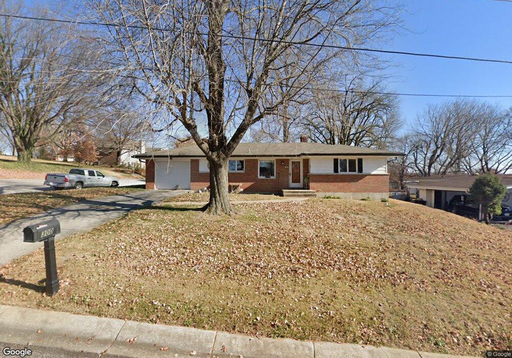
300 Alberta Ln Washington, MO 63090
Estimated Value: $213,000 - $273,000
2
Beds
1
Bath
1,395
Sq Ft
$173/Sq Ft
Est. Value
About This Home
This home is located at 300 Alberta Ln, Washington, MO 63090 and is currently estimated at $241,516, approximately $173 per square foot. 300 Alberta Ln is a home located in Franklin County with nearby schools including Washington High School, Our Lady of Lourdes Catholic School, and St. Francis Borgia Catholic School.
Ownership History
Date
Name
Owned For
Owner Type
Purchase Details
Closed on
May 25, 2018
Sold by
Nunn Shane A
Bought by
Cumberlidge Wendy D and Cumberlidge Kenneth E
Current Estimated Value
Home Financials for this Owner
Home Financials are based on the most recent Mortgage that was taken out on this home.
Original Mortgage
$140,900
Outstanding Balance
$121,340
Interest Rate
4.5%
Mortgage Type
FHA
Estimated Equity
$120,176
Purchase Details
Closed on
Jun 12, 2012
Sold by
Allen Jayandra and Rennick William
Bought by
Nunn Shane A
Home Financials for this Owner
Home Financials are based on the most recent Mortgage that was taken out on this home.
Original Mortgage
$120,000
Interest Rate
3.86%
Mortgage Type
FHA
Create a Home Valuation Report for This Property
The Home Valuation Report is an in-depth analysis detailing your home's value as well as a comparison with similar homes in the area
Home Values in the Area
Average Home Value in this Area
Purchase History
| Date | Buyer | Sale Price | Title Company |
|---|---|---|---|
| Cumberlidge Wendy D | -- | Continental Title | |
| Nunn Shane A | -- | None Available |
Source: Public Records
Mortgage History
| Date | Status | Borrower | Loan Amount |
|---|---|---|---|
| Open | Cumberlidge Wendy D | $140,900 | |
| Previous Owner | Nunn Shane A | $120,000 |
Source: Public Records
Tax History
| Year | Tax Paid | Tax Assessment Tax Assessment Total Assessment is a certain percentage of the fair market value that is determined by local assessors to be the total taxable value of land and additions on the property. | Land | Improvement |
|---|---|---|---|---|
| 2025 | $1,772 | $31,763 | $0 | $0 |
| 2024 | $1,772 | $30,157 | $0 | $0 |
| 2023 | $1,713 | $30,157 | $0 | $0 |
| 2022 | $1,559 | $27,442 | $0 | $0 |
| 2021 | $1,555 | $27,442 | $0 | $0 |
| 2020 | $1,482 | $25,172 | $0 | $0 |
| 2019 | $1,479 | $25,172 | $0 | $0 |
| 2018 | $1,427 | $24,531 | $0 | $0 |
| 2017 | $1,425 | $24,531 | $0 | $0 |
| 2016 | $1,303 | $22,834 | $0 | $0 |
| 2015 | $1,302 | $22,834 | $0 | $0 |
| 2014 | $1,316 | $23,090 | $0 | $0 |
Source: Public Records
Map
Nearby Homes
- 1800 E 9th St
- 1 Riverbend Place
- 1707 E 9th St
- 1423 E 5th St
- 1 Southpoint Place
- 806 Camp St
- 9 Old Highway 100
- 1 Old Highway 100
- 4 Old Highway 100
- 7 Old Highway 100
- 2550 E 5th St
- 1580 Kelly Ct
- 2300 Willows Ct
- 1200 E 8th St
- 106 Tina Dr
- 1015 River Bluff Dr
- 1019 River Bluff Dr
- 1017 River Bluff Dr
- 1205 Caroline Dr
- 1002 Marilyn Ct
Your Personal Tour Guide
Ask me questions while you tour the home.