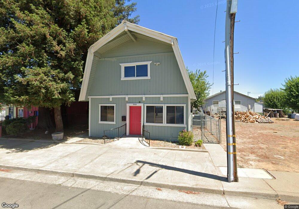
3001 Freeman St Anderson, CA 96007
Riverside Avenue Neighborhood
Studio
--
Bath
--
Sq Ft
6,534
Sq Ft Lot
About This Home
This home is located at 3001 Freeman St, Anderson, CA 96007. 3001 Freeman St is a home located in Shasta County with nearby schools including Meadow Lane Elementary School, Anderson Heights Elementary School, and Anderson Middle School.
Ownership History
Date
Name
Owned For
Owner Type
Purchase Details
Closed on
Dec 18, 2006
Sold by
Goedert Brian
Bought by
Goedert Brian R and Goedert Michele B
Purchase Details
Closed on
Jun 26, 2006
Sold by
Goedert Ralph T and Goedert Betty J
Bought by
Goedert Steven and Goedert Brian
Home Financials for this Owner
Home Financials are based on the most recent Mortgage that was taken out on this home.
Original Mortgage
$161,177
Outstanding Balance
$95,264
Interest Rate
6.57%
Mortgage Type
Seller Take Back
Create a Home Valuation Report for This Property
The Home Valuation Report is an in-depth analysis detailing your home's value as well as a comparison with similar homes in the area
Home Values in the Area
Average Home Value in this Area
Purchase History
| Date | Buyer | Sale Price | Title Company |
|---|---|---|---|
| Goedert Brian R | -- | None Available | |
| Goedert Steven | $175,000 | None Available |
Source: Public Records
Mortgage History
| Date | Status | Borrower | Loan Amount |
|---|---|---|---|
| Open | Goedert Steven | $161,177 |
Source: Public Records
Tax History
| Year | Tax Paid | Tax Assessment Tax Assessment Total Assessment is a certain percentage of the fair market value that is determined by local assessors to be the total taxable value of land and additions on the property. | Land | Improvement |
|---|---|---|---|---|
| 2025 | $2,100 | $165,612 | $18,340 | $147,272 |
| 2024 | $2,207 | $162,366 | $17,981 | $144,385 |
| 2023 | $2,207 | $159,183 | $17,629 | $141,554 |
| 2022 | $2,016 | $156,063 | $17,284 | $138,779 |
| 2021 | $2,124 | $153,004 | $16,946 | $136,058 |
| 2020 | $2,096 | $151,436 | $16,773 | $134,663 |
| 2019 | $2,022 | $148,468 | $16,445 | $132,023 |
| 2018 | $1,994 | $145,558 | $16,123 | $129,435 |
| 2017 | $2,030 | $142,705 | $15,807 | $126,898 |
| 2016 | $1,919 | $139,908 | $15,498 | $124,410 |
| 2015 | $2,087 | $137,808 | $15,266 | $122,542 |
| 2014 | -- | $135,109 | $14,967 | $120,142 |
Source: Public Records
Map
Nearby Homes
- 3065 Silver St
- 3040 Silver St
- 1765 School St
- 3343 Oak St
- 3394 Josh Dr
- 1805 Diamond St
- 2648 Tremonto Rd
- 3473 Nathan Dr
- 3200 Franklin St
- 2616 W Hillside Dr
- 1535 Cordova St
- 2771 North St
- 0 1st St
- 3100 Driftstone Dr
- 3520 Humbug Dr
- 2705 Limestone Ct
- 1481 Diamond St
- 3535 Cazadero Way
- 2863 Sandstone Dr
- 3625 Knight Ln
- 3007 Freeman St
- 2983 Freeman St
- 2930 Freeman St
- 2990 East St
- 1815 North St
- 2970 East St
- 2112 Ferry St
- 2110 Ferry St
- 2110 North St
- 2971 E Center St
- 2965 E Center St
- 2035 North St
- 2959 E Center St
- 3005 E Center St
- 3001 E Center St
- 2941 E Center St
- 2937 E Center St
- 2935 E Center St
- 2910 East St
- 0 Freeman St
Your Personal Tour Guide
Ask me questions while you tour the home.