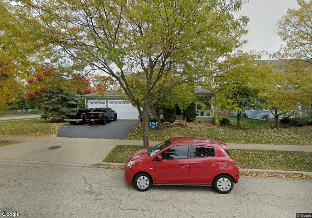
3017 Cranston Ave Elgin, IL 60124
Providence NeighborhoodEstimated Value: $531,000 - $564,000
4
Beds
3
Baths
3,247
Sq Ft
$167/Sq Ft
Est. Value
About This Home
This home is located at 3017 Cranston Ave, Elgin, IL 60124 and is currently estimated at $542,657, approximately $167 per square foot. 3017 Cranston Ave is a home located in Kane County with nearby schools including Country Trails Elementary School, Prairie Knolls Middle School, and Central Middle School.
Ownership History
Date
Name
Owned For
Owner Type
Purchase Details
Closed on
Mar 14, 2005
Sold by
Pinnacle Corp
Bought by
Rodriguez Oscar and Gracia Rodriguez Angelica
Current Estimated Value
Home Financials for this Owner
Home Financials are based on the most recent Mortgage that was taken out on this home.
Original Mortgage
$350,000
Outstanding Balance
$174,612
Interest Rate
5.37%
Mortgage Type
Purchase Money Mortgage
Estimated Equity
$368,045
Create a Home Valuation Report for This Property
The Home Valuation Report is an in-depth analysis detailing your home's value as well as a comparison with similar homes in the area
Home Values in the Area
Average Home Value in this Area
Purchase History
| Date | Buyer | Sale Price | Title Company |
|---|---|---|---|
| Rodriguez Oscar | $399,000 | Chicago Title Insurance Comp |
Source: Public Records
Mortgage History
| Date | Status | Borrower | Loan Amount |
|---|---|---|---|
| Open | Rodriguez Oscar | $350,000 |
Source: Public Records
Tax History
| Year | Tax Paid | Tax Assessment Tax Assessment Total Assessment is a certain percentage of the fair market value that is determined by local assessors to be the total taxable value of land and additions on the property. | Land | Improvement |
|---|---|---|---|---|
| 2024 | $12,454 | $149,826 | $40,572 | $109,254 |
| 2023 | $11,946 | $135,357 | $36,654 | $98,703 |
| 2022 | $11,249 | $123,422 | $33,422 | $90,000 |
| 2021 | $10,881 | $115,391 | $31,247 | $84,144 |
| 2020 | $10,567 | $110,158 | $29,830 | $80,328 |
| 2019 | $10,249 | $104,932 | $28,415 | $76,517 |
| 2018 | $11,330 | $114,170 | $26,769 | $87,401 |
| 2017 | $10,912 | $107,931 | $25,306 | $82,625 |
| 2016 | $10,882 | $100,131 | $23,477 | $76,654 |
| 2015 | -- | $91,779 | $21,519 | $70,260 |
| 2014 | -- | $73,844 | $21,253 | $52,591 |
| 2013 | -- | $75,792 | $21,814 | $53,978 |
Source: Public Records
Map
Nearby Homes
- 2829 Randall Ridge Dr
- 2865 Winchester Dr
- 11N060 Johnstown Rd
- 2705 Colonial Dr
- 3619 Daisy Ln
- 3340 Cameron Dr Unit 176
- 3388 Sanctuary Dr Unit 52
- 3390 Cameron Dr
- 233 Pawtucket Ave
- 1855 Diamond Dr
- 3311 Lafayette St
- 250 Water Lily Ln
- 218 Middleton Ct
- 40 Acres Randall Rd
- 003 South St
- COVENTRY Plan at West Point Gardens
- EMERSON Plan at West Point Gardens
- HENLEY Plan at West Point Gardens
- FAIRFIELD Plan at West Point Gardens
- 613 Lismore Cir
- 3019 Cranston Ave
- 3043 Settlers Pkwy
- 3015 Cranston Ave
- 3021 Cranston Ave
- 3014 Wayland Ave
- 3041 Settlers Pkwy
- 3020 Cranston Ave
- 3013 Cranston Ave
- 3023 Cranston Ave
- 3012 Wayland Ave
- 3018 Cranston Ave
- 3011 Cranston Ave
- 3039 Settlers Pkwy Unit 1
- 3034 Settlers Pkwy
- 3025 Cranston Ave
- 3010 Wayland Ave
- 3016 Cranston Ave
- 3042 Settlers Pkwy
- 3027 Cranston Ave
- 3037 Settlers Pkwy